In 2018 I visited Tasmania to Raft the Frankin River, which was followed by a week of wildlife watching in the Southeast of the island. The itinerary included a return flight to remote Melaleuca to view Orange-bellied Parrots. Melaleuca is the Western Trailhead of the South Coast Track and my curiosity was awakened to the possibility of one day walking the track. See below for an account of that previous visit to Tasmania….
Tasmanian Wildlife – Southeastern Tasmania.
The South Coast Track is an 82km walking trail that traverses Tasmania’s wild Southwest National Park. The Eastern terminus is at Cockle Creek where Tasmania’s road network terminates, while the Western Trailhead is Melaleuca airstrip. Unusually for Australia’s long distance walks these days there is no booking system, and walkers are free to walk in any season in either direction.
The topography of the track varies from beach walks to forested sections as it crests two mountain ranges, numerous inlets and rivers, in addition to muddy poorly-drained moors for which the track is famous. The usual time taken to walk the track is 6-8 days, and all equipment required for the track must be carried, as the basic campsites consist only of cleared areas for tents and pit-toilets.
There are only two means to reach Melaleuca, the first is to walk in, either from Cockle Creek on the South Coast Track or Scotts Peak Dam on the Port Davey Track. The second is to fly into the old tin mining settlement of Melaleuca from the Tasmanian capital Hobart on small aircraft run by local company Par Avion. Wilderness indeed.
Book a flight – Par Avion – exclusive tours of Tasmania by air
In common with most walkers, I had planned to fly into Melaleuca and walk out to Cockle Creek where transport can be arranged to Hobart. The advantage of this plan is due to Southern Tasmania’s unpredictable weather, the walker is not left waiting at Melaleuca airport for a flight that can be cancelled for days.
Friday 26th January 2024
Fast forward to 2024, and finally the dream of walking the South Coast Track was on the cusp of becoming reality. On the January Public Holiday I was at Perth’s Domestic Terminal waiting for a flight to Hobart when my mobile rang……..It was Par Avion calling to inform the flight the following day from Hobart to Melaleuca had been cancelled……shit.
This was not entirely unexpected, as that week I had been tracking the approach of a cold front on the BOM weather app, nevertheless it was a real pain in the ass. In desperation I enquired about flying a day later, but was told that flight was already fully booked. Unsure about how to proceed I asked the advice of the Par Avion employee, who helpfully suggested turning the plan on it’s head and starting the trail at Cockle Creek and flying out of Melaleuca.
In the last few minutes prior to boarding the Hobart flight I madly scrabbled to secure a last minute booking with Tasmanian Wilderness Experiences for a three hour minibus ride from Hobart to Cockle Creek for the cost of $110.
South Coast Track — Tasmanian Wilderness Experiences (twe.travel)
Saturday 27th January – Day 1 – Cockle Creek to South Coast Rivulet 11.4km
There was much to attend to Saturday morning before the 10am departure to Cockle Creek. I reluctantly set an early alarm to separate the gear into what was needed for the South Coast Track, and what would remain in the suitcase for the second week of the holiday post-trail.
The Central Hobart YHA provides secure luggage storage for trail walkers.
Hobart Central YHA – Guest Reservations
Additional early morning tasks included purchasing a raincoat, new walking trousers and T-shirt, fuel for the jetboil and a guidebook (South Coast Track by John and Monica Chapman.) Talk about last minute! This was all possible in a single visit to the excellent Mountain Creek Outdoors store on Bathurst Street. I highly recommend this excellent store.
The minibus arrived early at 9.35am and so I rushed my last minute check of gear, leaving behind my spare camera batteries in the process. I was first in the bus before we picked up three additional walkers exiting Hobart. In addition to myself there was a father and daughter Phillip and Eleanor from Newcastle, NSW, and their friend James hailing from the Southern Highlands of NSW.
The drive to Cockle Creek was through picturesque scenery, rolling hills covered with apple orchards and small villages with cute names like Snug! Travelling further South the settlements decreased and the landscape became heavily forested.
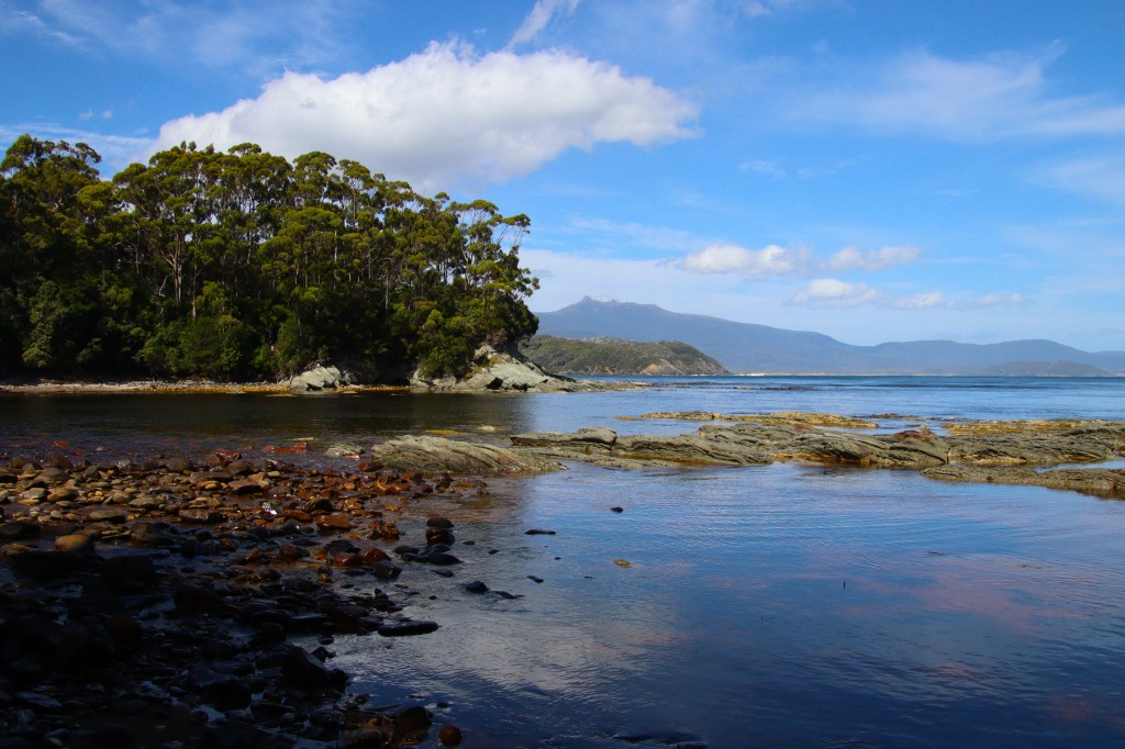
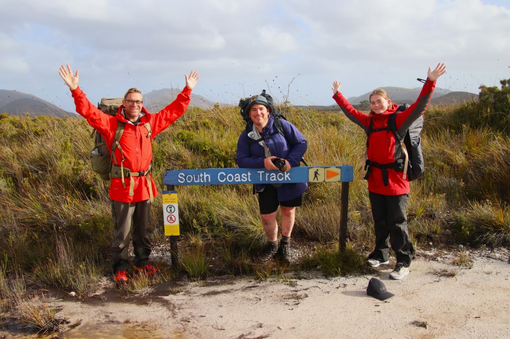
There was rain, but at this stage just light showers dusting the windows of the minibus. We passed numerous coastal campsites where Tasmanian families were making the most of the long weekend. Then after three hours we arrived at Cockle Creek, the Eastern Trailhead of the South Coast Track.
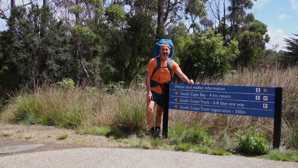
The sun was shining and the temperature could even be described as warm. The initial duty was a photo with the track marker, before heading Westwards into woodland. The first part of the trail is a popular day walk to the coast and there were numerous hikers, some were day trippers and others long distance walkers finishing the trail.
Eastern Trailhead. – Cockle Creek.
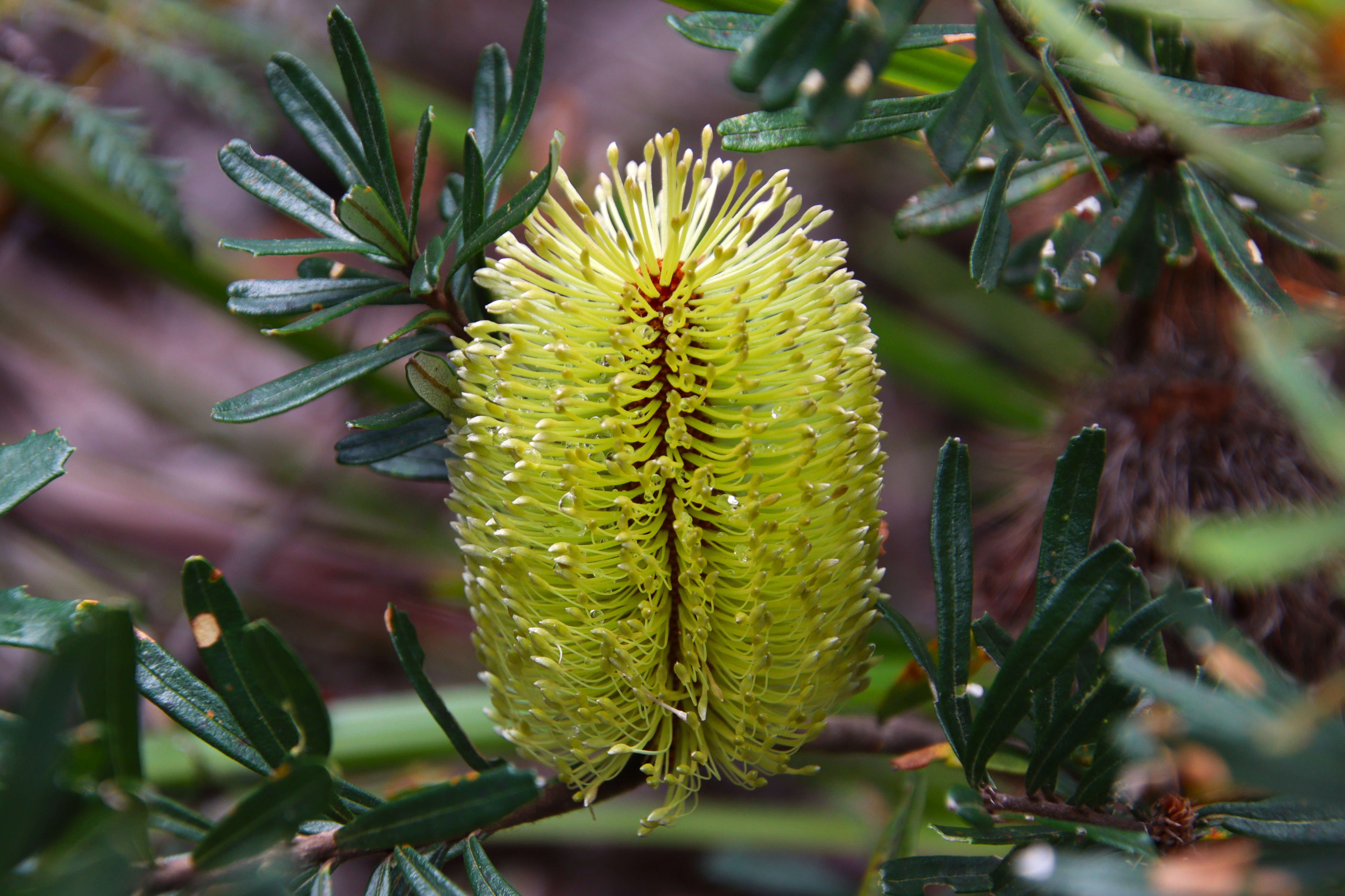
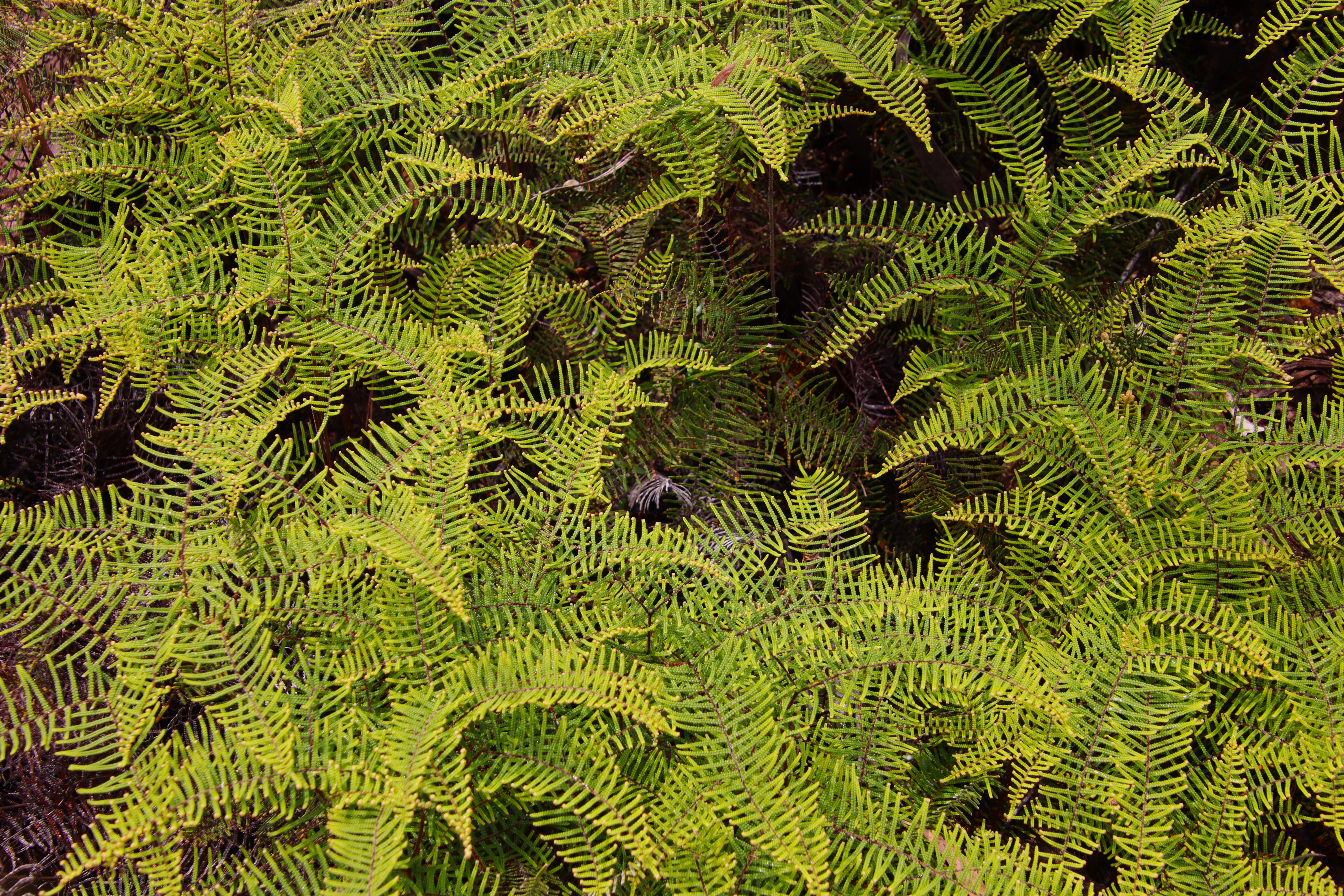
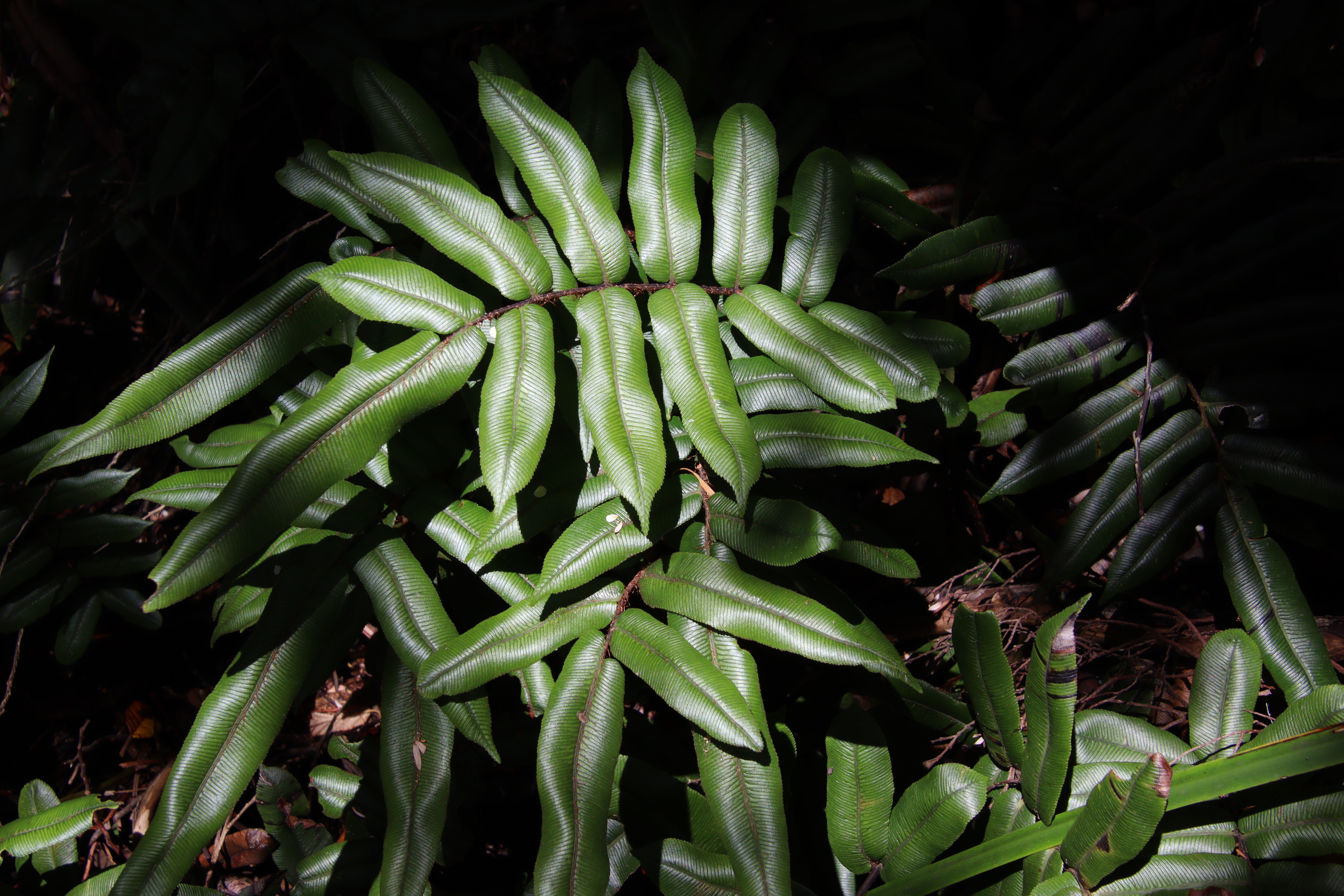
The vegetation was coastal heath and woodland, where there were regular encounters with beautiful Silver Banksia (Banksia marginata.) The sun was shining and there were various fern species in every shade of green imaginable.
There were tiny Coral Ferns (Gleichenia alpina,) shiny Hard-water Ferns (Blechnum wattsii) and of course magnificent Tree Ferns (Dicksonia antarctica) for which Tasmania is famous.
Clockwise:- Silver Banksia, Coral Fern, Hard Water Fern.
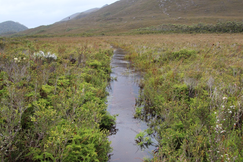
On occasion the track would break out of the woodland onto buttongrass plains. Walking these wooden boardwalks, provided to protect the delicate vegetation below, was the easiest.
As the gently undulating trail descended to the coast, it followed a babbling creek with small waterfalls. The ground became sandier underfoot and the sound of pounding surf from the tempestuous Southern Ocean nearby was clearly audible.
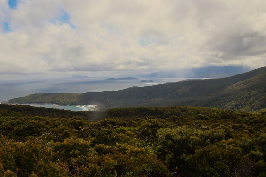
The track broke through a tunnel of vegetation to an open bluff where there magnificent views ahead to the South Cape under the dark shadow of a gathering storm.
The Gathering Storm above the South Cape Range.

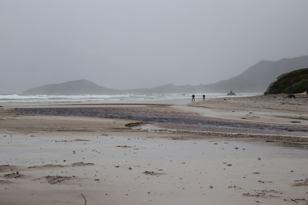
As I stood admiring the view, the first of the flight cancelling rain forced shelter behind a rock. Descending a long set of stairs to beach the downpour truly arrived, and the 600m walk along the beach was into driving rain.
At Lion Rock the trail climbs steeply to sand dunes and re-enteres the forest. It was absolutely tipping down and I briefly considered the meagre shelter of a fallen tree, but pressed on convinced the weather wasn’t going to ease.
The rain intensified walking through clifftop vegetation. There was an amazing lookout on Coal Bluff which had excellent views ahead to the beaches approaching South Cape Rivulet and the South Cape Range, but the rain was too torrential to even attempt a photo.
I decended from the lookout into the tempest with a definite case of camp fever. I should have stopped to put on the raincoat but in my impatience to reach the camp a kilometre away I didn’t. During the 300m beach walk the driving rain was violently wind-tossed, and it was necessary to walk head down.
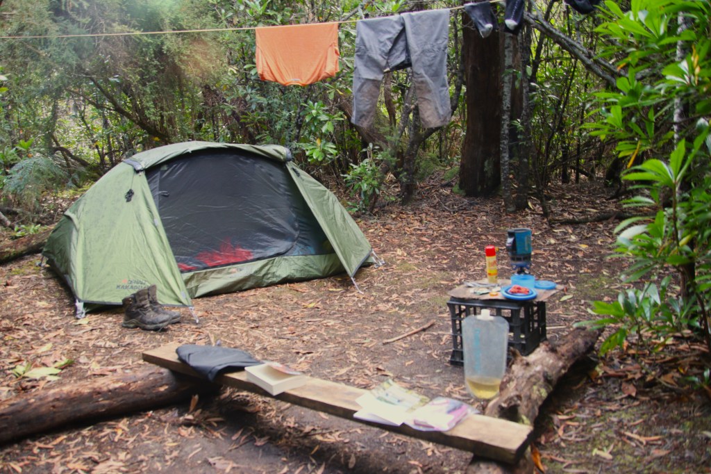
After briefly crossing a low headland, there was a further 600m beachwalk to reach South Rivulet Campsite. I was soaked to the bone on arrival but relieved to reach shelter of sorts at the forested campsite. There were a series of clearings for tents, and one was quickly selected to erect the tent in a brief lull from the heavy rain.
The inside of the tent was mostly dry and the gear was thrown quickly inside. There was no doubt I was mildly hypothermic, explaining my reluctance to dress suitably for the rainy conditions. I was exhausted and struggled out of wet clothes within the confines of the tent.
I donned numerous layers including thermals and a beanie before sliding into the dry sleeping bag. It was late afternoon and I spent the remaining daylight slowly warming up listening to the sounds of a large group camped nearby that had sensible brought tarps for cover.
A couple of leeches climbed the outside tent mesh, and the evening was spent wondering what the hell I had let myself in for. Sleep didn’t come easily.
The rain continued throughout the night while somewhere in the nearby forest a solitary Boobook Owl called.
Sunday 28th January Day 2 – South Coast Rivulet to Surprise Bay 12.2kms
I woke to a still morning, the calm after the storm. The screeching of Sulphur-crested Cockatoos was punctuated by the metallic clink of a Currawong, while Fairy Wrens could be heard moving through the vegetation around the tent. Exploration of the campsite revealed the beautiful location next to South Cape Rivulet. Giant eucalypts lined the rain gorged creek.
South Cape Rivulet.

Life had been somewhat hectic before the trek, both buying a rural property and finishing a long-standing job at a Perth Hospital. I would usually have ordered a guide book long before embarkation, but on this occasion I had been in possession of John and Monica Chapman’s South Coast Track booklet for less then 24 hours.
I would highly recommend researching creek crossings before setting off. I didn’t. After breakfast I donned my pack and set off to cross the creek. The guys from the minibus had sensibly camped on the far bank to avoid the high tide and fast-flowing creek that I now had to content with.
I ditched my pack, stripped down and attempted crossing the creek at the tide line. This is well advised on a low tide, but it quickly became clear the combination of fast flowing water and crashing waves made for a dangerous crossing at high tide. I was going to need a plan B.
I retraced my steps 100m upstream to retry. While the water was deeper, the current strong was not quite so strong and so it was possible to cross with caution.
I retrieved the pack and crossed a second time with the pack balanced on my head. So far so good. I returned for my camera for an ultra cautious third crossing, then finally for my footwear. Apart from a few stubbed toes on submerged rocks and a few close calls losing my balance it was without major incident.
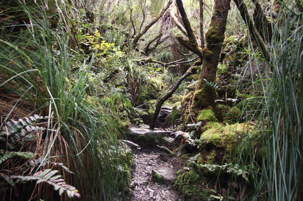
Redressed, I shouldered the pack to set off into the forest. At first it was a gentle climb through open rainforest. There were a few short detours from the track to dramatic lookouts over the nearby sea cliffs.
I disturbed a Pademelon that bounded off into the distance, before encountering a Superb Lyrebird that flew up into a low tree. I attempted a photo but the light was too dark. Lyrebirds are a species introduced to Tasmania along with Sugar Gliders, Kookaburras and a variety of European Bird Species.
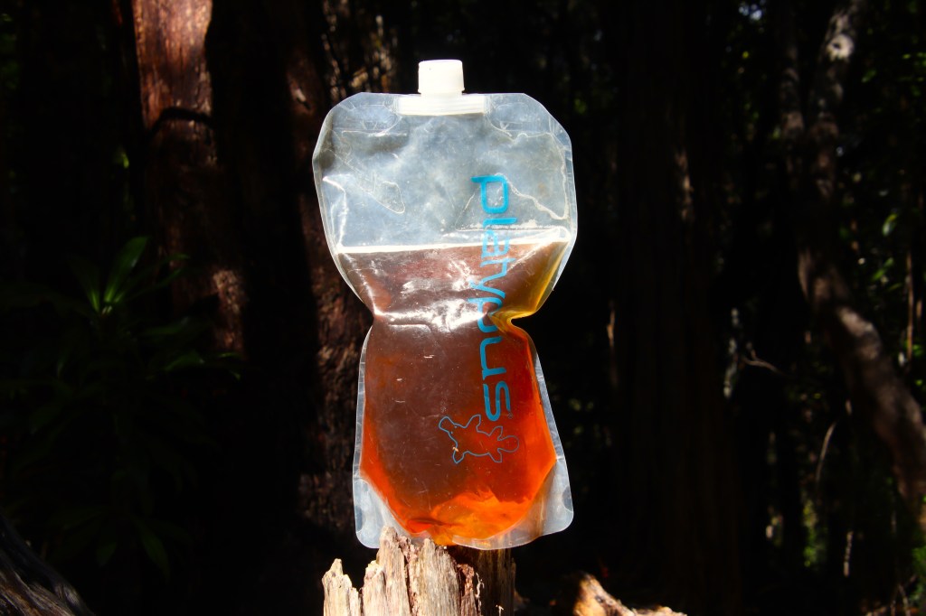
The guidebook advised that crossing the South Cape Range provides few opportunities for water collection, however the recent heavy rains had swollen a small creek on the ascent, so I filled the water bags for the day ahead, South Cape Rivulet had proved too brackish for the task.
Water at the creek was a dirty brown, a result of tannins leaching into the water from the surrounding vegetation. Despite the colour the water was refreshing and tasted just fine. Southwest National Park contains absolutely no livestock to pollute the waterways. I didn’t boil or treat any water on the trail and had no ill effects.
Tannin Stained Creek Water.
The gentle climb at the beginning of the day was a pleasant surprise but it wasn’t to last. A steep climb from the creek and another Pademelon bounded off into the forest. Then the mud started…..
The South Coast Track is famous for mud but thus far despite the rain the track had been fairly firm underfoot. This changed on the South Cape Range. This was the hardest part of the walk. The track constantly ascended and descended over parallel thickly vegetated ridges. Climbs became progessively harder while valleys between the ridges were boggy quagmires, lined with sharp cutting grass.
Boggy Quagmires – South Cape Range.
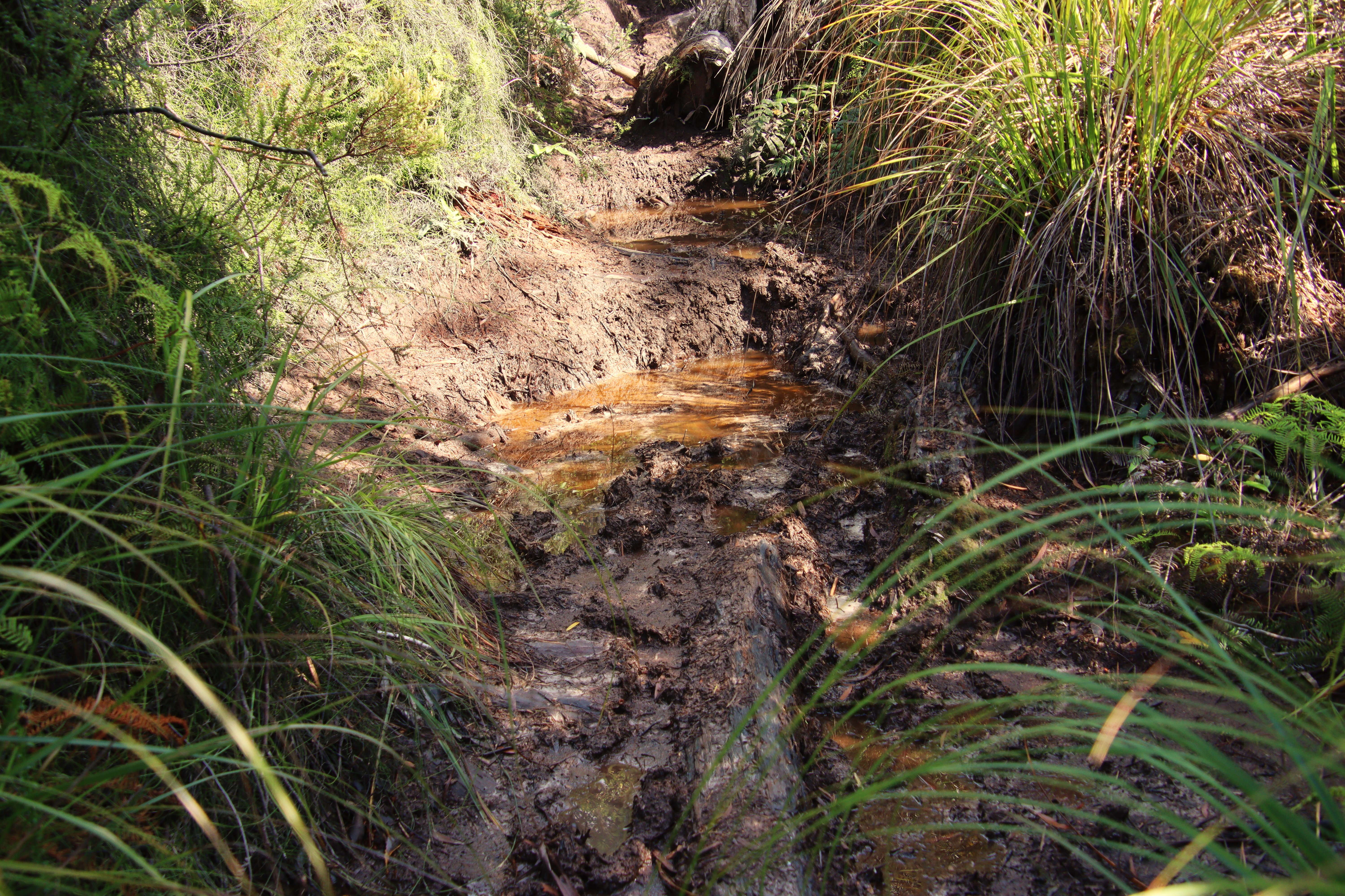

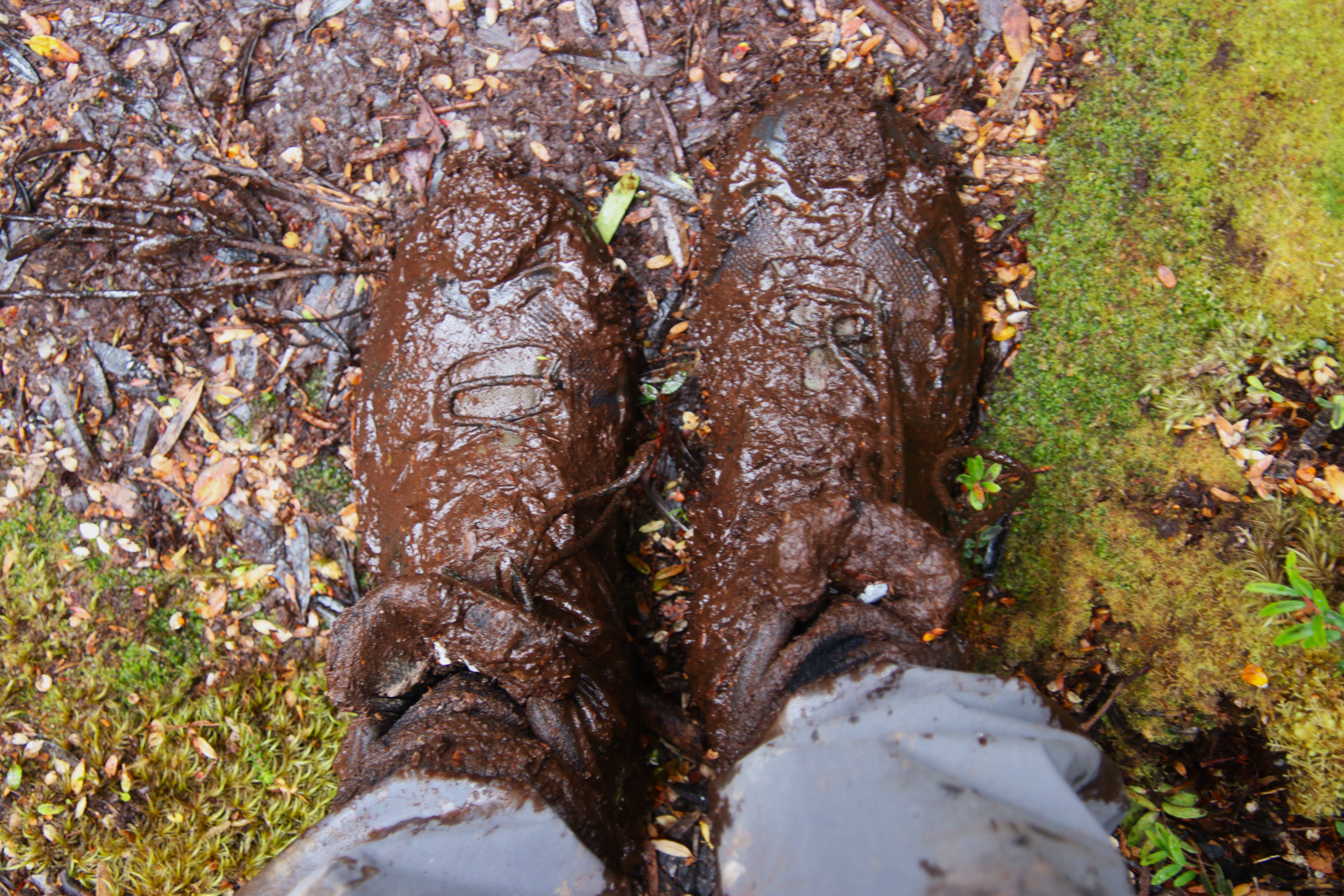
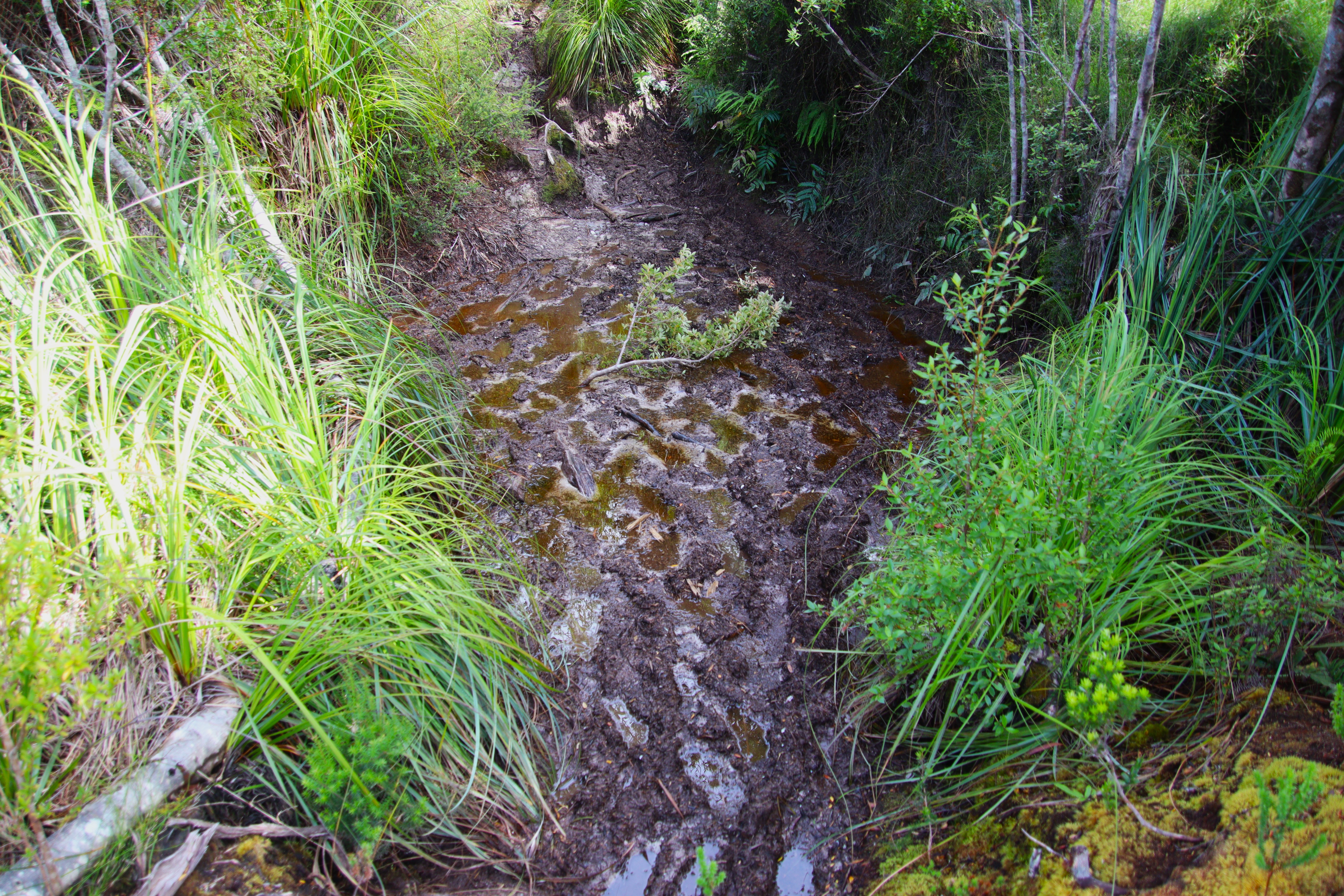
It was completely fruitless expending energy to avoid wet feet, and yet previous irresponsible walkers had tried making long diversions through immaculate vegetation. The deeper mud was tricky to negotiate but slow and steady did the trick, all the while being mindful not to clutch at the cutting grass, that could produce painful lacerations when grasped.
Late morning I met a lovely couple on a particularly steep climb. They had spent the previous night camping on the muddy track after underestimating the time it would take to cross the South Cape Range. It must have been awful.
Perhaps the most debilitating aspect of the day was the lack of a view of any kind. Light showers passed over but fortunately nothing too substantial. After many long hours the track finally emerged onto Black Rock, where there were endless views to the headlands and islands further West, and ultimately the Ironbound Range, although low cloud and showers diminished the excellent vista.
View from Black Rock to the distant Ironbound Range.
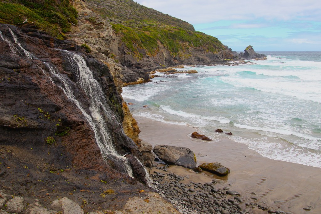
The final descent to the coast was hard on the legs and neverending, but the reward at the end was a beautiful campsite nestled in a grove of tea tree just above the coast. A creek provided an excellent water supply as it tumbled onto the beach below. I was tempted to stay but wanted to push on to Surprise Bay and then Prion Beach, where I had garnered from other walkers there was the chance of encountering Spotted-tailed Quolls.
Sandstone Creek tumbles onto Granite Beach.
It was necessary to exercise care walking the large stones covering Granite Beach. At the Western end the track climbed steeply into forest. The total ascent and descent from Granite Bay Campsite to Surprise Bay is only 180m but I felt every metre of it after the arduous day on the South Cape Range. I would take a few steps and then stop and rest for two minutes, making this final part of the day extremely slow going.
The campsite at Surprise Bay was similar in many respects to Granite Beach Campsite. The ground was sandy, but sprawled spaciously under a thicket of coastal vegetation providing protection from the wind. Best of all I had it completely to myself. I set up the tent and hung the damp clothes to dry, before heading down to a rivulet draining into the ocean for a wash.
Stunning Surprise Bay.
I fired up the stove to cook a quick meal before collapsing in the tent. It had been a hard day and I was truly glad it was over. I was asleep almost immediately to the hypnotic sound of waves crashing on the beach below. Above the moon began it’s long arc through the night sky.
Monday 29th Day 3 – Surprise Bay to Prion Crossing Campsite 9.0kms
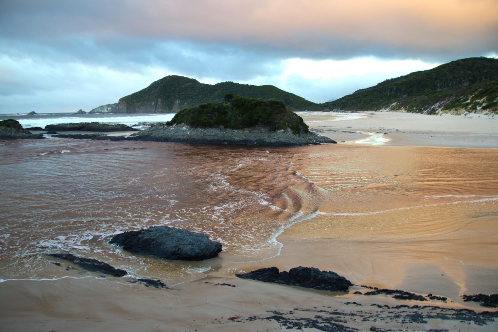
Refreshed after a deep sleep, I roused at first light and carried a coffee down to the deserted beach. The early morning sunlight danced on the cliffs opposite. A light wind rustled through the coastal vegetation, waved crashed and seagull calls echoed along the sands.
Surprise Bay.

I returned to camp ate breakfast, packed and returned to the beach.
The first obstacle of the day was a water crossing of the rivulet. I stripped off to cross, unsure of the depth, but in the event the water reached only thigh deep.
What followed was a delightful beach walk with a pair of Pied Oystercatchers for company. The birds were foraging in the tide and would skittle off on my approach, until eventually I got too close. They would then take off further along the beach, before the process started once again.
Steps climbed from the sand into a lovely rainforest with impressive tree ferns. The walking was pleasant and apart from briefly losing the track, uneventful. Descending the forested ridge back to marshy ground, I passed the side track to Osmiridium Beach disturbing a Button-Grass Parrot in the process.
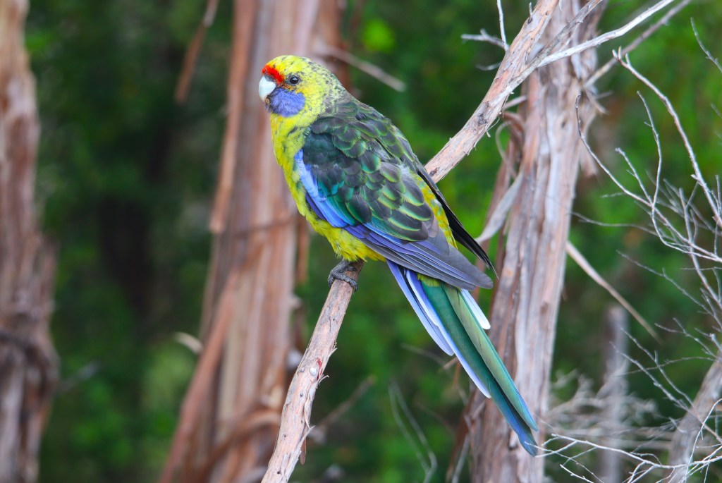
I passed over Tylers Creek, not aware it is the last reliable water for 9km. After passing through further forest where Green Rosellas were common feeding in the canopy, the track emerged at the mouth of New River.
Green Rosella.
I was surprised at how hard I found the 600m section of track that runs parallel to the New River Lagoon after only three hours walking. The track constantly climbed over big dunes, which despite steps was tough going. The warmer weather had brought out a basking White-lipped Snake onto the trail, and I very nearly crushed it underfoot cresting a dune!
According to the guidebook I was in for another river wade, but in recent track upgrades a metal bridge has been placed over Milford Creek. After crossing I scrambled down to the water to top up meagre rations, only to find the water was again too brackish for consumption.
The sand dune scramble continued after the bridge going up and down, up and down but the trail began to flatten on the approach to Prion Beach Campsite.
Track markers approaching Prion Beach Campsite.

I was delighted to find I was the sole hiker at Prion Boast Crossing Campsite that night, and proceeded to collect various pieces of driftwood dotted around to set up camp. The next priority was to attend to the diminushing water supplies. The guidebook mentioned a creek North of the campsite, but after a lengthy traipse through dense bush the creek remained elusive.
I returned to camp by wading through thigh deep water on the margins of the estuary, where I observed pools of water from recent rains had gathered on the mossy ground. Unfortunately, these pools were below the water table and were polluted with salt water from the estuary. However, rainwater being less dense than salt water, meant scooping water from the surface of the pools I could replenish supplies…. just….
Camp at Prion Boat Crossing.
The reason I had elected to camp at Prion Boat Crossing was due to reports from other hikers of Spotted-tailed Quoll sightings. I read for the remainder of the afternoon, always keeping one eye out for those Quolls, but it wasn’t to be. Pademelons however were plentiful, and during the course of the afternoon a large number emerged.
Pademelon.

I wandered down to the estuary at days end, and watched a flock of Black Swans bobbing along on the still waters. To the West the Ironbound Range was silhouetted in the fading light. Tomorrow’s nemesis.
I ate the usual fare of noodles and tuna for dinner as a flock of Green Rosellas settled noisily in the trees above. The light faded and I retired to the tent. It was a beautiful clear night and the stars began to appear in the sky above.
In the last light there was movement on a log about 8m from the tent. I quietly crept out and disturbed a Tasmanian Devil which disppeared into the bush.
I returned to the tent and waited camera in hand…..
I remained stock still in the tent, as quiet as a church mouse, tent fly open. The Devil returned to investigate camp, probably attracted by the smell a now empty can of tuna. I was faced with a dilemma. I could snap a picture, but I instinctively knew the experience would be over and the shy marsupial carnivore would once again disappear into the bush, and so I did what I have never before done.
I put the camera down and watched this amazing Devil for the best part of 10 minutes. Light was poor by this time but the silhouette of the animal was clear, the white chest stripe standing out clearly against the dark fur. It snuffled and sniffed its way around the camp and I sat metres away hardly daring to breathe.
In that moment I understood why I had returned to Tasmania, and why I was enduring the hardships of the South Coast Track. It was utterly magical, every nerve in my body was firing on full and I felt alive in a way that I hadn’t done for years. I could have reached out and touched it.
Eventually the Devil lost interest and wandered away, but I slept with the flysheet open connected to nature in a way I had long forgotten. The moonlight flooded in, and my sleeping form was bathed in a pool of moonlight for the remainder of that special night.
Tuesday 30th Day 4 – Prion Boast Crossing to Little Deadmans Bay 9.4kms
The following morning I stirred and lay quietly in the tent, alone in the wilderness, I thought about the Tasmanian Devil experience the previous evening, which now felt like a dream. A cool, gentle early morning breeze rustled the treetops. It was perfect.
Unfortunately there were tasks that needed attention. After breakfast I packed and bailed the large quantity of rainwater that had accumulated in the row boat, that would be required later that day for the inlet crossing. I read, procrastinated, and procrastinated some more. When I eventually prepared to cross the estuary I heard voices from the camp behind.
Looking ahead to the New River Lagoon Crossing.
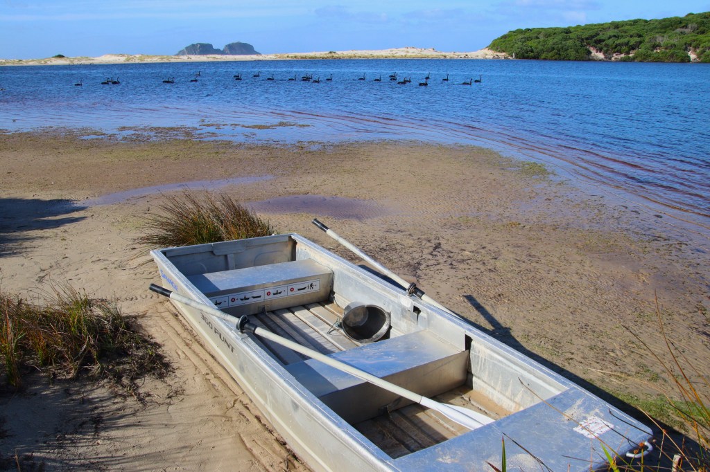
It was Eleanor, Phil and James from the minibus to Cockle Creek. I was glad for assistance with the boat at low tide. Phil and I rowed across the estuary to retrive the second boat and dump the packs. We then picked up Eleanor and James and made the final crossing on what was a beautiful and even hot Tasmanian day. On the far side of the inlet were spectacular views back to Precipitous Bluff.
View Back to Precipitous Bluff and Prion Beach Campsite after the Crossing.
After crossing a large sandbar, boots were removed for a delightful 4km beachwalk. It was the best weather of the entire walk. My feet were eternally grateful to be free of the oppressive boots. It was disappointing to know that had I stayed at Granite Beach instead of Surprise Bay I would have seen a Spotted-tailed Quoll, but even that was not enough to dampen my spirits on this glorious day.
Prion Beach with the Mighty Ironbounds in the distance.
The water situation was desperate, but I counted on Grotto Creek at the far end of Prion Beach providing ample opportunity to replenish supplies. When we arrived fresh water tumbled from the forest down to the beach and I gulped and gulped the heavenly water. It was the best water I had ever tasted and I filled the water bladders to the brim. There was shade from high cliffs and we enjoyed a well deserved rest
The remainder of the walk was sublime, after a short climb into forest the track levelled out. The afternoon consisted of beautiful forest walks punctuated with secret rocky coves, and over beaches adorned with giant kelp. In places the track was quite overgrown and a struggle, but the late afternoon light was ethereal.
Coastal Track on the approach to Deadmans Bay.

After a final haul across a buttongrass plain boardwalk we arrived at the most beautiful campsite, perched on a small cliff above a typically beautiful Tasmanian Cove where a gentle swell washed the rocky shore. The giant eucalypts marched almost to the ocean. Views were superlative and the water inviting. Not so inviting that I swam but many at the campsite did.
The view from Little Deadmans Bay Campsite.
The campsite was spacious enough to spread out. It was at Deadmans Bay Campsite that I first met Guido, a Dutchman who in common with myself had fallen in love with Tasmania many decades before while backpacking Australia.
Guido was well prepared for wilderness hiking and was receiving weather reports from his parents in the Netherlands, and news was not good. Another major front was approaching and while we might have a days reprieve, the impending bad weather was on the way.
Determined not to let the news spoil the balmy Tasmanian evening and beautiful location, we all chatted over dinner enjoying the location. During the night a shower passed through cementing precipitation on every day walking the track.
Wednesday 31st Day 5 – Little Deadmans Bay to Buoy Creek 26.1kms
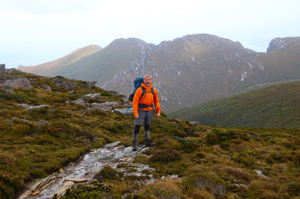
I lay in bed pondering the big day ahead, when the first walkers set off in pitch black past the tent. Today I would cross the Ironbound Range whose elevation is just shy of a kilometre. Shortly after, more footsteps followed until I was the sole walker left in camp.
I ate breakfast, packed and was walking by 6.30am, unaware I would still be walking at 9pm that night, fourteen and a half hours later.
The track was easy going at first, meandering along the coast before switching inland and beginning to climb. Gently at first, but ever steeper. I found Guido sitting beside a small creek after taking a tumble. He was uninjured, but I sat with him awhile anyways.
The climb was through tall eucalypt forest and the track consisted of large muddy sections. It was hard going with hours of just plodding steadily uphill. At higher altitudes the vegetation morphed into rainforest. The track being the lowest point was a continuous stream.
It was exhausting constantly clambering over mossy logs fallen across the track. Lunging under tangles of tree limbs with a heavy pack that would often become snarled, was even worse.
Overgrown South Coast Track on the Ironbounds.
Finally the track emerged into the alpine region where vegetation was low and the first views of the day could be enjoyed. There were no obstacles on the track here, and it was almost easygoing walking the final 800m.
Approaching the high point of the Ironbounds.

The rain held off for now, but overcast and sultry conditions had reduced visibility. Despite this, I was under no illusion that we had been blessed with good conditions for what is considered the most difficult part of the walk.
The boardwalks and gravel underfoot was a pleasure as the track crested the 2km exposed mountain top, but any idea of a meaningful rest were extinguished by the cold wind Southwesterly wind.
On top of the Ironbounds, now for the descent!
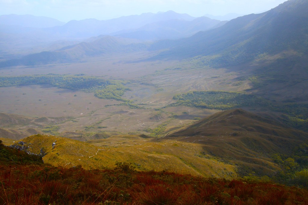
We split and walked seperately for the long hard descent to Louisa River. Despite the hazy conditions there were expansive views ahead to Cox Bight. The track here was mostly gravel and steeper sections had been thoughtfully cut with steps.
The long descent between the spectacular bluffs was hard on the knees, so it was a relief to eventually reach the flat boardwalks across buttongrass plains on the approach into heavily wooded Louisa River Campsite.
View from the Ironbound Descent to Louise Plains.
Good time had been made over the Ironbound Range and during the long descent thoughts had turned to the possibility of walking further that day to beat the impending rain. The track after Louisa River contains three water crossings and it was possible heavy rain could render these rivers and creeks impassable.
I walked through the campsite to check out the Louisa River Crossing and found Guido taking a rest. His plan was to push on to Buoy Creek, and so despite exhaustion setting in a snap decision was made to accompany him to Buoy Creek.
Louisa River Crossing.

The 4km section after Louisa River was delightfully flat, with extended sections of boardwalk. It was uneventful bar a basking Tiger Snake that slithered off the planks into trackside vegetation on approach. After rounding the Spica Hills we finally reached Louisa Creek where we rested for fifteen minutes, the longest break of the entire day.
After navigating Louisa Creek it was a short walk to the final water crossing at Faraway Creek, after which the terrain became hilly. These were not big hills but I was by this time utterly exhausted, and it became a real struggle to keep moving forwards.
Guido crossing the Louisa Plains.

Red Point Hills had been menacing the horizon for a couple of hours, and it was here at the base of the hills I caught up with Guido. It was a respectable 235m climb to the top and by now it was clear Guido’s fitness far surpassed mine, and so he surged ahead for the final 10km to Buoy Creek.
The Red Point Hills came very close to breaking me, but I had no choice but to push on if I didn’t want to be out in the open when the weather front hit. It was bloody hard. I would walk a few steps and rest, a few more steps and rest. It was onerous but eventually I reached the crest. The view that met me wasn’t promising, it was still a considerable haul to the coast.
The descent was just as hard, my feet and knees had already taking a pounding descending the Ironbounds making every step was painful, leg muscles ached and it became impossible to adjust the pack comfortably on my back. At each step down I let out a groan at the effort it took.
What should have been an easy final 7km was anything but. I could have negotiated around creeks but I was just to damn tired, instead ploughing through the water, which felt merciIessly cool on tired feet. Boardwalks were a godsend littered as they were with cubed Wombat Poo. I disturbed three Button Grass Parrots traversing the marshy approaches to Buoy Creek and then finally I arrived.
I must have cut a sorry sight as I stumbled into camp. I had barely enough energy to put up the tent in the failing light before joining Guido for dinner. Removing my boots was heaven. I crawled into the tent vaguely aware of the first falling raindrops.
During the night the predicted front crashed through with torrential rain. The effort had been worth it and the tea tree thicket at Buoy Creek provided excellent shelter from the worst of the wind and rain.
Thursday 1st Day 6 – Buoy Creek to Melaleuca 16.4kms
I slept the sleep of the dead, waking only when Guido knocked on the tent flap to say he was leaving. I was in no rush to vacate the warm tent and went back to much needed sleep. I planned to undertake the final push to Melaleuca later that day when the weather had hopefully eased.
After properly stirring I read for a few hours while rain pounded the tent. When I made the short walk to the edge of the sheltered campsite it was ferocious. A couple of lonely walkers made a pitiful sight stumbling through the storm. We exhanged notes as they wrung out their water soaked socks over a cuppa, and I finally decided it was time to face nature’s wrath.
Cox Bight in a Storm.
I struck camp, rugged up in wet weather gear, but gladly sans boots for the upcoming beach walk. After crossing Buoy Creek near the tideline I walked into the worst of the weather. The wind was howling, driving the rain horizontally. Providing I kept my face down the experience was not actually unpleasant, and the soft sand soothed sore feet.
After a kilometre the walker is faced with Black Bluff, and the choice to either climb a track over the headland or wade through the ocean. I had absolutely no intention of donning my boots yet, and so I took a chance wading the rough ocean. It was perhaps not the better choice in the rough conditions but I didn’t care.
The weather eased slightly for the remaining beachwalk to Point Eric where I encountered three walkers having spent a rough night at the exposed campsite. Sheltered Buoy Creek had been a wise choice.
I crossed the Point Eric Headland on a sandy track, before descending the set of steps back to the Cox Bight Beach for the final 2.3km beachwalk. A lonely Pacific Gull perched on exposed rock eyed me suspiciously while monstrous surf pounded the beach.
I climbed over stones to the timber steps that mark the track to Melaleuca. After passing through coastal tea tree, a boardwalk passes over buttongrass before the track undulates along the side of the New Harbour Range.
Heavy squalls rained down and it was incredibly frustrating to be walking what was a visually impressive section of the track in such miserable conditions. The worst of the showers did finally finish, giving a view across a beautiful valley to the nearby Bathhurst Range.
Bathhurst Range on the approach to Melaleuca.

Although the bulk of the rain was over, the damage was done. The buttongrass plain between the Bathurst and New Harbour Ranges were swollen with floodwater. What should have been an easy finish to the walk was a now a thigh deep wade through rainwater. The boardwalks were unsurprisingly slippery and several times I almost took a tumble in the current.
Flooded Boardwalks on the approach to Melaleuca.
The track climbed to the higher ground of the upper valley and squinting ahead I could make out the white quartz runway of Melaleuca Airstrip. It was almost done. More flooded boardwalks on the approach to Moth Creek, a stumble past the rusting tin mine equipment to reach the airstrip, and then finally the first permanent structure in six days, the walkers huts at Melaleuca.
Walkers Huts Melaleuca.
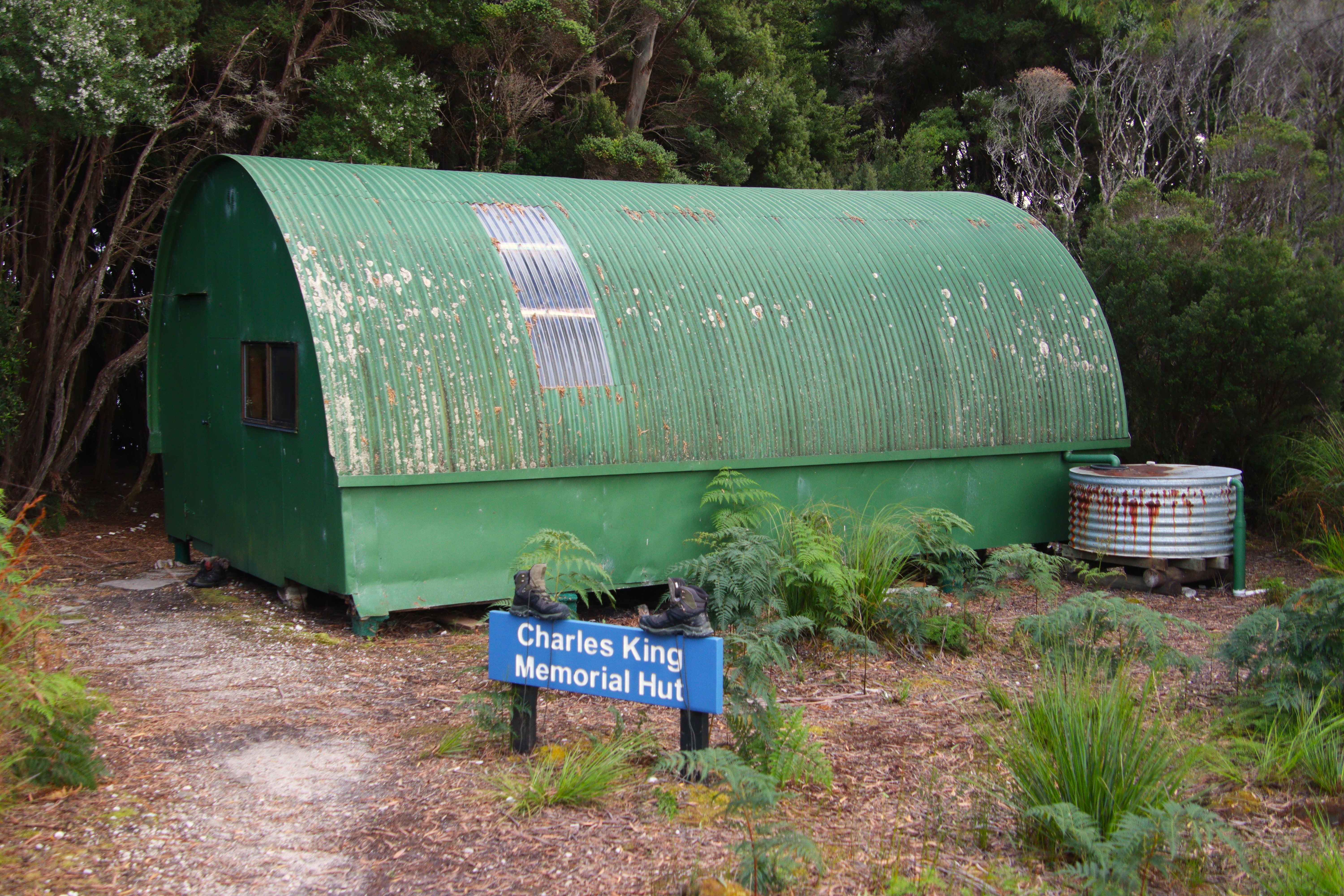

After confirming which of the two Guido had claimed I secured the other, dumped my pack and setting up home for the remaining time at Melaleuca.
The Anderson Walkers Huts were built by long time Melaleuca resident and tin miner Deny King in the 1960’s. It was like stepping back in time with metal bunks, vinyl mattresses and a stone fireplace. It was so good to be out of the elements.
After gratefully removing my walking boots for the last time, I peeled off sodden clothes, had a delicious wet wipe wash, cooked up some hot noodles and crawled into a dry sleeping bag for a well-earned nap. All the while showers drummed on the metal roof of the hut. It was bliss.
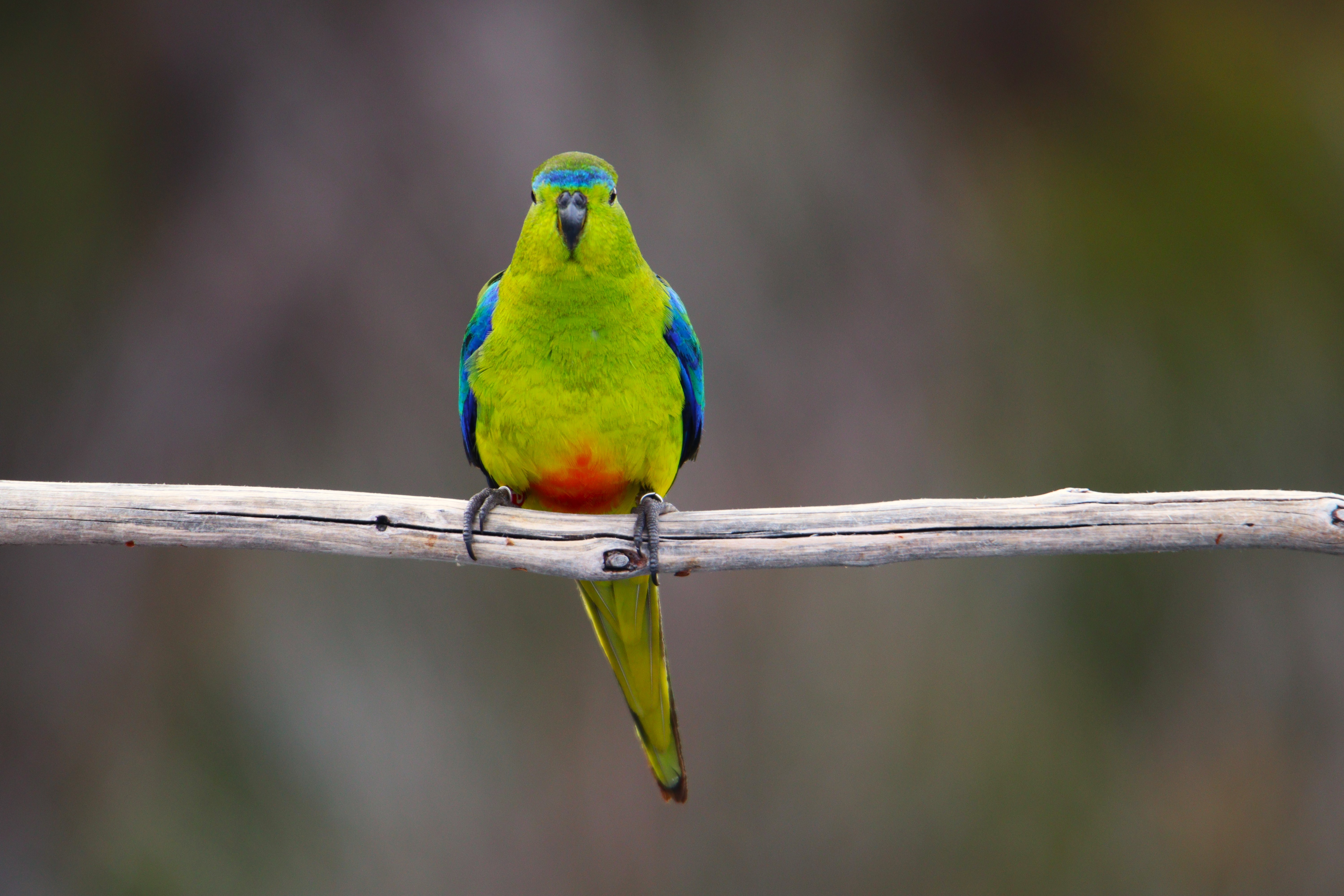
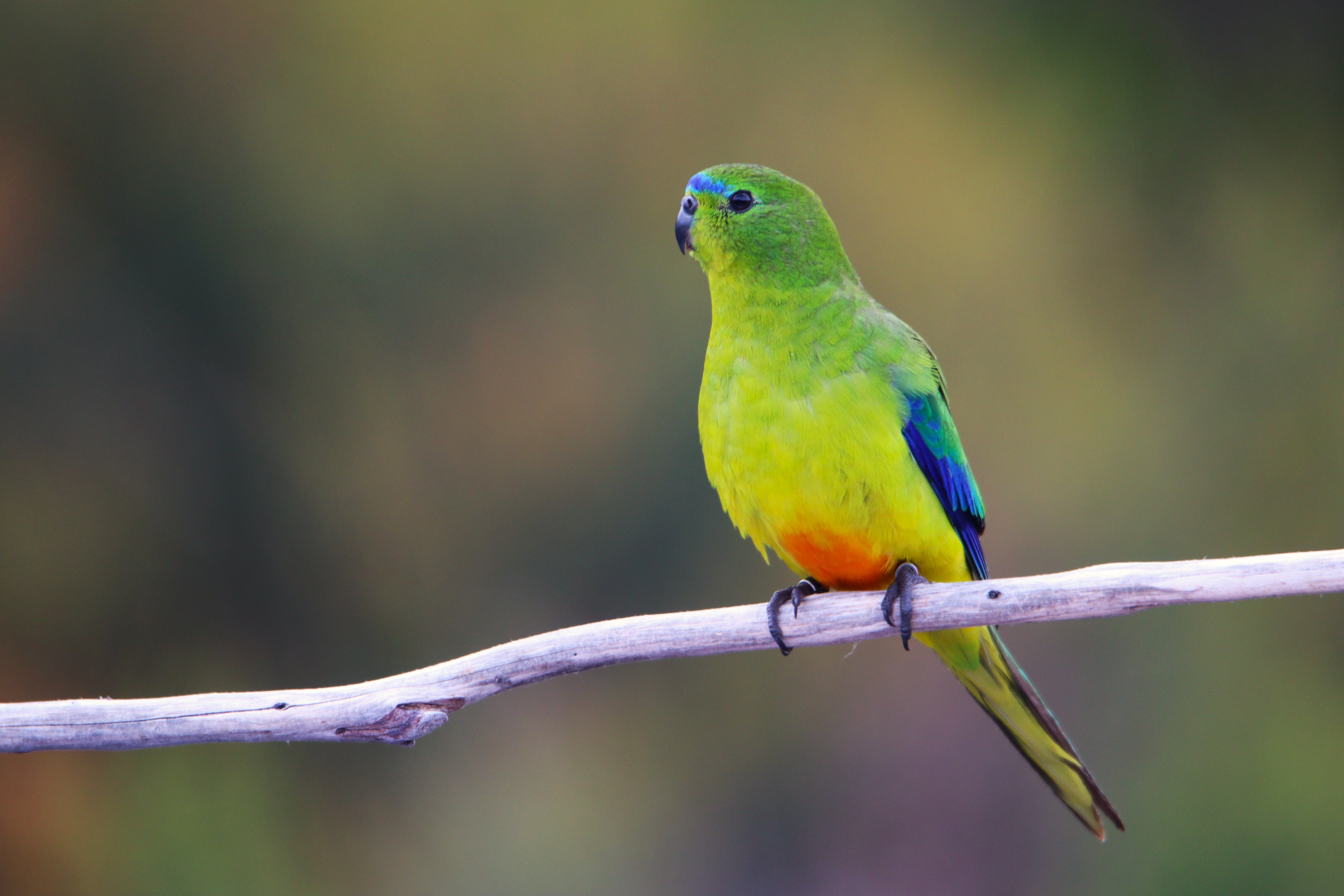
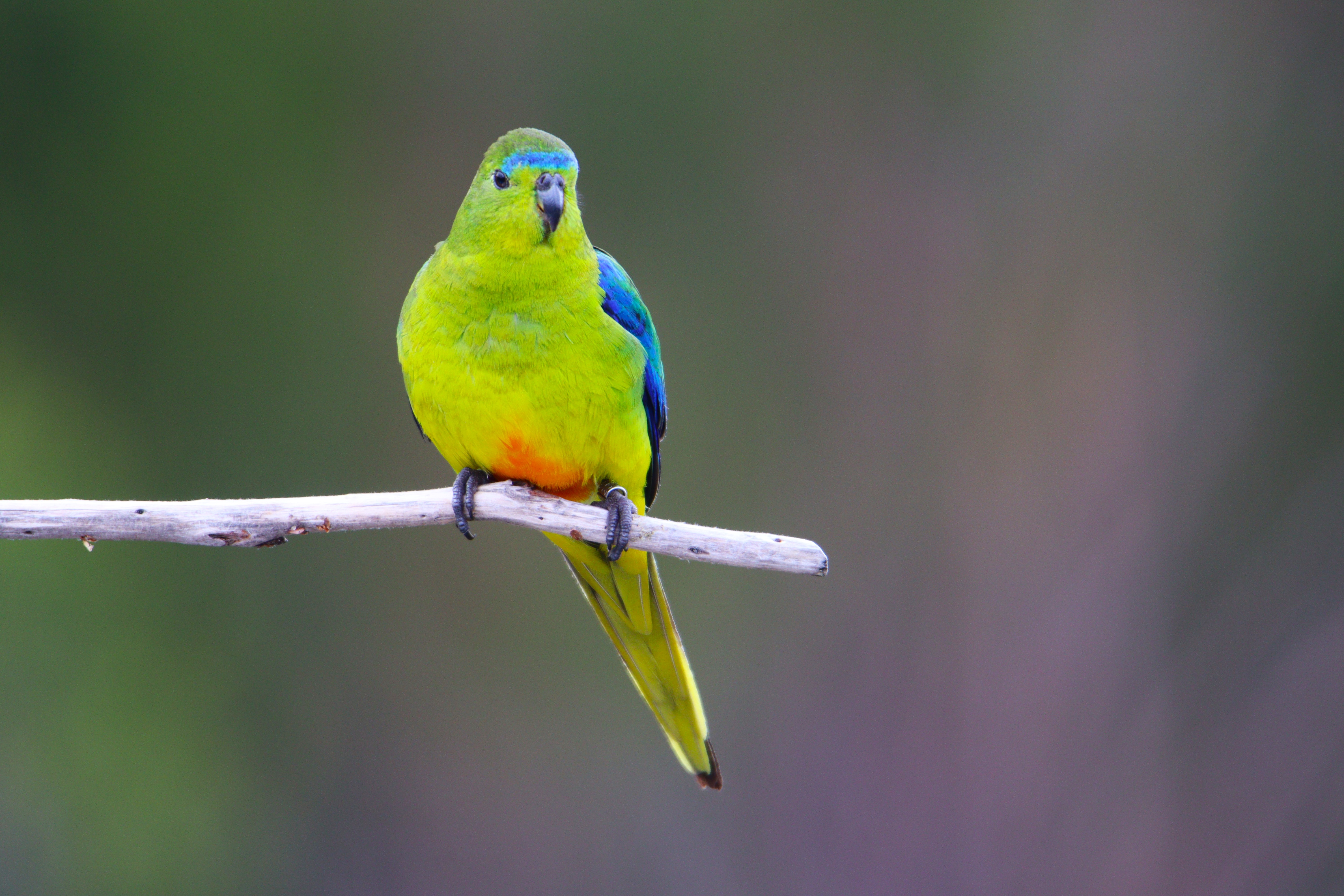
Later that afternoon I visited the nearby Deny King Museum to view Melaleuca’s most famous inhabitants, the Orange-bellied Parrots.
These critically endangered Parrots visit Tasmania from the Australian Mainland over the Summer months (October to Mid-March) to breed. Feeding stations are set up around Melalauca to record population size and for individual bird identification. There is often a Birdlife Volunteer at the musuem happy for company.
The brightly coloured Parrots are diminutive and about the size of a Budgerigar. The sharp tzit tzit of birds in flight is a common sound at Melaleuca. Green Rosellas take advantage of the easy feed are also easily seen at feeding stations.
The Orange-bellied Parrots were having a hard time of it in the gusty squalls that peppered the late afternoon, almost being blown sideways at times!
Stunning Orange-bellied Parrots.
Friday 2th Day 7 – Melaleuca 0.0kms
The following day was a day of rest spent exploring around Melaleuca. There is a lovely boardwalk to Melaleuca Inlet under the imposing shadow of Mt Rugby. Bennetts Wallaby ventured out from the undergrowth to bask in brief sunny periods.
Basking Bennetts Wallaby.

It was delightful to spend the day relaxing in remote Melaleuca, and a real bonus to end of the walk. It was spent chatting with Guido, reading and of course napping, but as the afternoon progressed my thoughts turned to my companions from the minibus James, Eleanor and Phil. I hadn’t seen them since the Ironbounds and I began to wander if their progress had been halted by the rain-swollen rivers and creeks of Louisa Plains.
Finally, late afternoon a trimuvirate of blightly coloured raincoats could be seen plodding up the valley. The hut was busy that night but it was great to have company.
Western Trailhead- South Coast Track.
Saturday 3th Day 8 – Melaleuca 0.0kms.
On that final day as we packed there was much speculation about whether conditions would allow a small Par-Avion plane to return us to Hobart. We went down to the quartz runway at the appointed time and waited…..
Eventually, high above it was possible to make out the drone of a small plane. Woohoo!
Par Avion Plane arrives at Melaleuca.

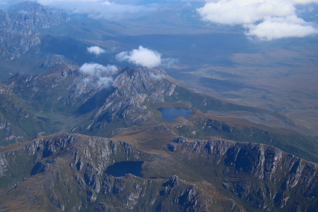
The plane was larger than expected due to a large number of walkers delayed in Hobart for two days awaiting improved weather. We were warned of turbulent flight conditions on the return flight and weren’t disappointed when the plane made a few stomach churning drops over the Western Arthurs.
Flying over the Western Arthurs.
The South Coast Track had lived upto expectations. It is a stunning wilderness walk but not without challenges, foremost of which was the weather.
A final thought about the walk is regarding the mountain ranges. The Ironbounds are considered the biggest challenge of the South Coast Track, but this was not my experience. I found the South Cape Range far more challenging. The Ironbounds are indeed higher, but the muddy conditions and the constant ascent and descent of the South Cape Range proved a greater challenge. I guess it really comes down to the conditions on the day.
As always long distance walks consist of a great experience, with great people but it is great to return to civilisation. Now for the relaxing part of the holiday. A visit to Bruny Island and Mount Field to see if I could find some of Tasmania’s mammals……
#QuollingAround

Fabulous trip! Will read in detail this rainy week!⛈️🌦️😀
LikeLiked by 1 person
My god what a tough hike! I love a good walk but I think this one might be too out of my fitness range. It would be so worth it so see a tassie devil in the wild though! A great write up!
LikeLike
Hey Anna although it was a shorter long distance hike, it was definitely a tougher one due to the Tasmanian weather…and mud. The Tassie Devil absolutely made it all worth it though!
LikeLiked by 1 person
I agree with Anna. I was afraid you might have been swept away as I have heard people crossing mountain streams in NZ and Mossman Gorge have lost their footing to meet dramatic endings. The least scary being submerging your camera! But then you survived to tell the story! I could feel your exhaustion, definitely not for the meek. The cold and the rain must have been well compensated by the wildlife and the scenery not to mention the people you meet along the way. Incredible Jimmy. That feeling you spoke about sleeping in the wild, close to nature was also pretty special.
LikeLiked by 1 person
Thanks Cheryl, it’s an amazing but challanging part of the world. Those moments connected to nature made all the hard walking worth it!
LikeLike
Superbly written Jimmy. You made me feel equally uncomfortable (if not as cold and wet) just reading it! As with all hardships, I’m sure you now view it as a triumph and you should, but it’s a great reminder why I moved to Tassie – so I don’t ever do a big hike without 3 plus days of fine weather forecast!! Congratulations on a huge achievement.
LikeLike