Mirning, Wirangu, Nawu, Banggarla Country
Drving the vast West Australian Wheatbelt in late afternoon Spring sunshine, there was plenty of time to contemplate what lay ahead. A road trip promises release from the monotonous drudgery of daily routine, where almost any hour is predictable. On the road are instant decisions to be made at any number of crossroads, where each outcome can lead to a vastly different scenario. Sometimes better, sometimes worse….
The destination for day one was the town of Norseman, eight hours East of Perth. The town is situated at the Western end of the Eyre Highway, a 1664km (1034 mile) highway linking the states of South Australia and Western Australia via the vast Nullarbor Plain.
It was a 3pm finish to the working day that Friday before I could leave Perth, and Norseman was the absolute limit of what I was prepared to drive that day. To ensure sound sleep a motel had been sensibly pre-booked for the first night.
It was midnight on the nose when I finally pulled into Norseman, which resembled a ghost town at that late hour. When I checked my phone for the e-mail containing the code for the locked motel gate, I found it had been inadvertently deleted. Shit.
There was little choice other than to camp on the outskirts of town. It was a cold and clear night when still cursing I put up the tent in the red dirt, while a chorus of Motorbike Frogs called from a distant waterhole. The stars however were spectacular, and the constellation of Orion was so low in the Southern sky it seemed to topple vicariously on the edge of the continent. So it was I spent the first night of the trip under the stars, in the knowledge of a soft, empty bed with crisp white sheets fully paid for nearby.
The following morning at first light, I stirred bleary-eyed to find a cloud-covered grey sky that held the firm promise of rain. It was going to be another long day of driving, and so after promptly packing up the tent I visited Norseman Roadhouse to fill up with the cheapest fuel for 1000kms.
Nullarbor Road Distances
Perth to Norseman 798 kms
Norseman to Balladonia 191 kms
Balladonia to Caiguna 182 kms
Caiguna to Cocklebiddy 64 kms
Cocklebiddy to Madura 83 kms
Madura to Mundrabilla 115 kms
Mundrabilla to Eucla 66 kms
Eucla to Nullarbor Roadhouse 198 kms
Nullarbor Roadhouse to Ceduna 299 kms
Ceduna to Kimba 339kms
The dreary skies accentuated the russet bark of the Salmon Gums as I drove the 200km through the Great Western Woodlands to Balladonia Roadhouse for a coffee break. The cafe wall at the roadhouse was adorned with a series of clocks indicating an impending time zone change.
Clocks Balladonia Roadhouse.

Shortly after was the official sign heralding the start of the time zone change. Central Western Time is 45 minutes ahead of Western Standard Time (Perth) and 45 minutes behind Central Standard Time (Adelaide.). An indication of the vastness of of Western Australia.
Central Western Time Zone.

Prior to departure, I had read written accounts by previous Nullarbor travellers. Adjectives such as onerous, boring and monotonous were common descriptions, and lack of scenery was a commonplace complaint. My experience was completely different. The unique road signs, quirky roadhouses and vast landscapes made the journey across the Nullarbor incredibly worthwhile.
Further along the highway a road sign advised of Australia’s longest section of straight road, 146.6kms (actually 91.1 miles) of road without the slightest curve. Additional proof of the vast distances involved crossing the Nullarbor. The Eyre Highway linking Western Australia with the Eastern States was a dusty track only sealed in 1976.
90 Mile Straight – Eyre Highway.

At the end of that long, straight stretch of road was Caiguna Roadhouse, which was bypassed in order to press on to Cocklebiddy Roadhouse and the next coffee break. There I paid $5 for a coffee that can best be described as caffeinated dishwater, but at least a humorous sign fronting roadhouse brought a smile to the face.
Cocklebiddy Roadhouse.

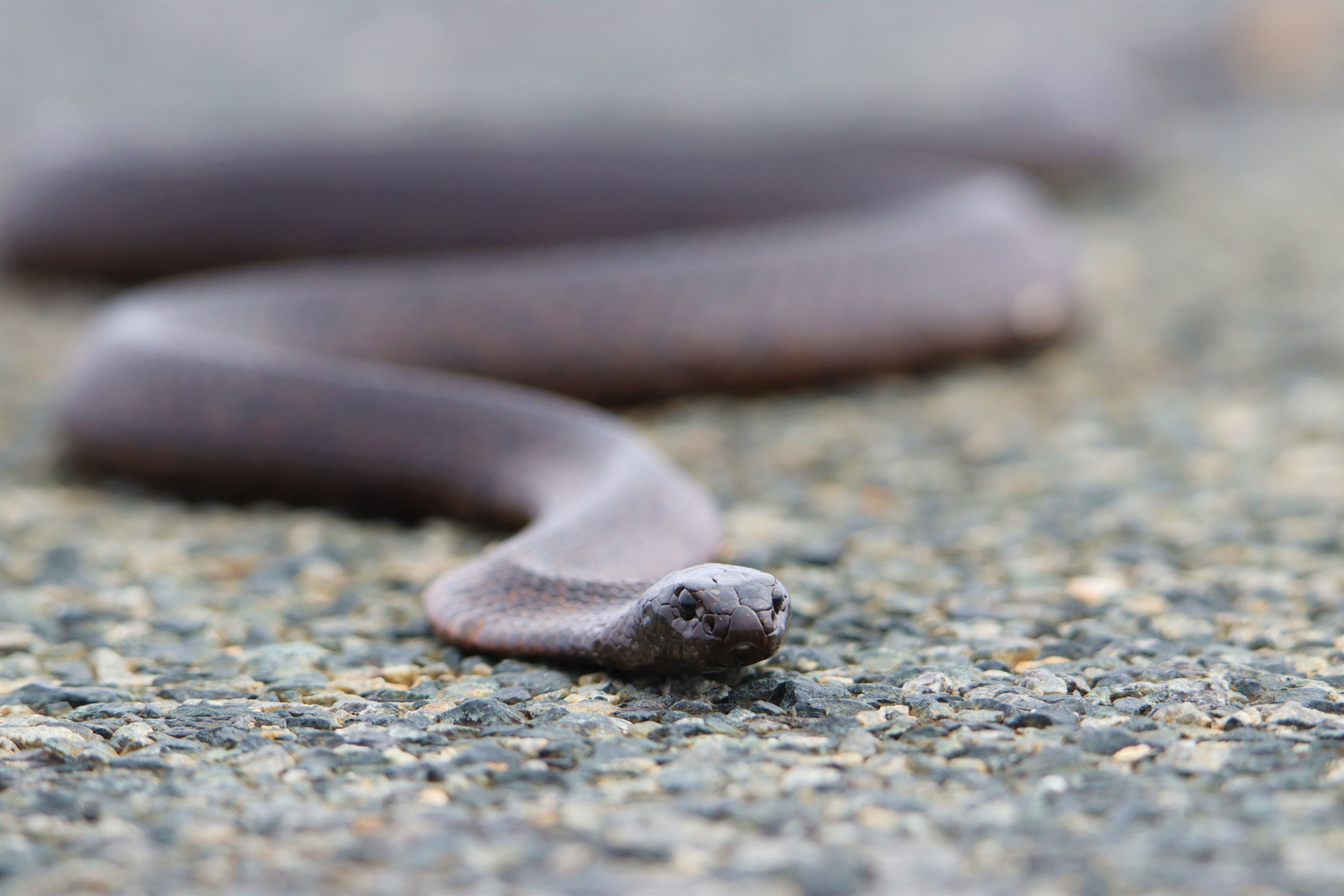
Wildlife was never going to be abundant driving across the Nullarbor during daylight hours, but shortly after Cocklebiddy Roadhouse a beautiful Dugite (Pseudonaja affinis) was basking in the middle of the lane. I desperately lined up the wheels as best I could to avoid a collision.
I turned the Triton around and pulled well off the highway with the intention of moving the snake off the road, but before the chance presented a convoy of four caravans and cars drove over the snake. Unbelievably all four vehicles missed the snake, which disturbed moved to the opposite lane, where a colossal road train then drove over the snake!
Miraculously it was unscathed, this was one seriously lucky snake but I wasn’t taking any chances. Silence once again settled over the highway now void of traffic, so I moved the snake from the road to the roadside from whence it slithered off into the bush, what a great result!
Dugite – Eyre Highway.

The terrain so far had been flat but that all changed on reaching Madura Gap. I pulled over at a viewpoint for commanding views across the Roe Plain all the way to the distant Southern Ocean. It was magnificent.
Madura Gap.
On the approach to Mundrabilla Roadhouse I started to give thought as to where I would sleep that night. Initial thoughts had been to camp inland from Eucla and look for the Southern Hairy-nosed Wombat. This the smallest of Australia’s wombats is the faunal emblem of South Australia and is commonly associated with that state. It’s distribution however does make it across the border into Western Australia.
At Mundrabilla, after I was approached by an extremely paranoid man who I suspect was probably on drugs and possibly on the run from the law, camping in the middle of nowhere near a state border lost it’s appeal. Besides, the rain looked like an ever increasing chance.
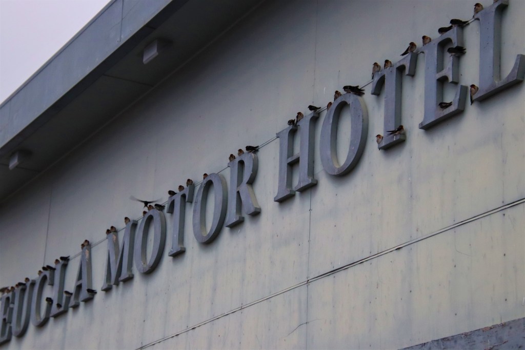
On the final approach into the border town of Eyre, the highway climbs back from the Roe Plain to the Nullarbor Plain proper. Eyre itself consists of only a roadhouse and motel alongside a caravan park. As I parked up a dreary rain started and the local Swallow population had taken up residence on the motel signage, sheltered by the eaves. I counted myself extremely lucky to secure the last room at the motel that night.
Swallows – Eucla Roadhouse.
After the unpacking of essentials, and with time to kill before dinner, I made the short journey down a dusty unsealed road to the coast. There I found the remains of the old Eucla Telegraph Station slowly being swallowed by sand dunes.
There is an 800m walk from the Telegraph Station through the dunes to the ocean. Over the course of the walk I encountered several rabbits. These, or at least their ancestors had brought about the demise of the Telegraph Station. The rabbit introduced by Europeans in the 1800’s and had reached Western Australia in plague proportions by the turn of the century. The local vegetation was decimated, destabilising the soil to ultimately cause a giant dune system that has since swallowed Eucla Telegraph Station.
Map showing location of Eucla Jetty.
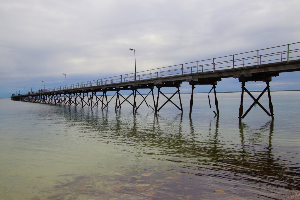
Nearby another derelict structure the Eucla Jetty that once attained a length of 100m, is a shadow of it’s former self. The main purpose of the jetty these days is as a roost for local seabirds. Despite the overcast conditions the aquamarine of the shallows contrasted beautifully with the blue of the deeper ocean, while the timbers of the jetty seemed almost ethereal in the poor late afternoon light.
Eucla Jetty.

In the last hour before dark I did indeed explore inland, and while there were unquestionably wombat burrows they were long uninhabited.
Eucla Roadhouse was certainly a good choice to overnight. The fish dinner was excellent and the although the room was pricey, it was clean and comfortable. Sleep came easily that night, after the two days on the road separated only by five brief hours in the tent the previous night. Overnight I was woken sporadically by the sound of intense rain drumming on the motel roof as heavy showers passed over. Drifting back to sleep in the warm room I was truly grateful to not be camping.
Refreshed after a good sleep I woke at first light and packed the car. A myriad of puddles dotted around the roadhouse suggested there had indeed been substantial rain during the night. The giant whale out the front of the roadhouse was looking decidely soggy in the gloomy, grey early morning light.
The whale reminded me of a decision still to be made, for the coastal cliffs of the Nullarbor are the best place on the Australian Continent to see the Southern Right Whale. The whales travel from Antartica to the South Coast of Australia to calve in the Winter months. July to September being prime season to view these whales.
The indigenous owners charge a fee at the Head of the Bight viewing platform for Southern Right Whales, but I figured I had missed the main window by the first week of October. I called it and made the decision to save the Head of the Bight for a future trip.
Giant Whale – Eucla Roadhouse.

It is only 12 kilometres from Eucla to the South Australian Border, and while there is no quarantine point Eastbound, there is a further time change of 45 minutes. When I checked my phone I was baffled as to why the time was now ONE HOUR and 45 minutes ahead.
South Australian Border.

There was a dogged persistent rain at the border checkpoint, so after a quick photo of the kitsch Kangaroo clasping a jar of vegemite I returned to the dry car.
Aussie Icons – South Australian Border.
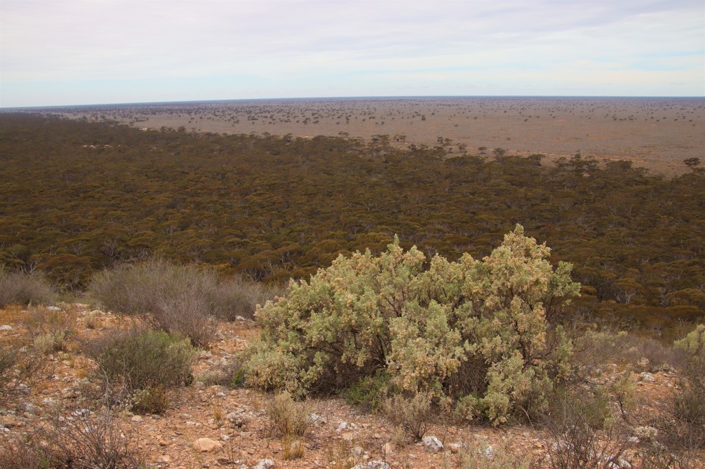
Despite the intermittent showers and gloomy conditions, the beauty of the mallee vegetation covering the vast limestone plain was clear. I used the driving time that morning to put my thinking cap on and solve the mystery of the one hour time discrepancy. The answer was daylight saving that had come into effect the previous night in South Australia, not observed by Western Australia.
There are a series of official lookout points on the Bunda Cliffs (and untold unofficial ones.) Considering the overcast conditions I wasn’t expecting great views but was pleasantly surprised. The cliffs are an impressive geological feature stretching 210 kilometres between Eucla and the Head of the Bight. The cobalt of the ocean contasting with the whites, red and browns of the 100m cliffs, like a series of battlements at permanent war with the might of the Southern Ocean.
Bunda Cliffs.

The mallee vegetation slowly began to thin until nothing but dry, yellow grass stretched to the horizon. This was the characteristic image of the Nullarbor Plain, Nullarbor coming from the latin Null (no) Arbor (trees.) Although the rain had stopped, the grey skies weighed heavily on the landscape. A desolate but strangely beautiful vista.
The Nullarbor Plain.

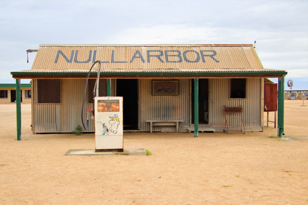
I arrived at Nullarbor Roadhouse to find diesel $3.10 per litre, I had anticipated the steep prices and carried spare fuel in jerry cans. Roadhouses like Nullarbor Roadhouse in remote locations provide an essential service and while I didn’t purchase fuel, I supported the business buying breakfast and coffee. There is a scale model of the original roadhouse in a delightful nod to the past.
The Original Nullarbor Roadhouse.
It was a further 300 kilometres to the town of Ceduna where a quarantine post vets traffic heading East for fruit and veg. It was tempting to stop for the night at Ceduna, but after brief consideration I pushed on after stretching my legs on the foreshore, where the waters of Murat Bay were becalmed ahead of the approaching front. An impressive jetty reached nearly 400m into the bay.
Ceduna Jetty.
After departing Ceduna two things occurred. Firstly I once again entered agricultural country, with wheat clearly the main crop. Secondly the weather improved, now that some distance was placed between myself and the impending front. Sleepy Lizards had come out in force to enjoy the last of the sun before the approaching wet weather, with sadly a great number succumbing to vehicle strike. I counted twenty dead between Ceduna and Kimba, but managed to move four from the road.
The lizard below (Tiliqua rugosa) is referred to as a Bobtail in Western Australia. Australians also know them as the Pinecone Lizard, Stumpy Lizard and Shingleback. However the use of the colloquial South Australian nickname of Sleepy Lizard seems apt while blogging about South Australia, and so I have referred to them as such during over the course of this trip.
Sleepy Lizard.

Kimba is the halfway point when travelling across the Australian Continent, and it had taken two days of solid driving to reach this homely town. Kimba is famous for it’s impressive Silo Art that is illuminated beautifully at night.
Silo Art – Kimba.

At Kimba, I was delighted to find the cozy local pub/motel had excellent food. A steak, beer and soft bed was just what was needed after the momentous drive of the previous three days.
To finally cross the Nullarbor had been an amazing experience despite the inclement weather, and I was looking forward to the return journey at a more leisurely pace three weeks hence.
This part of the trip had been a means to an end. I was almost on the doorstep of a place I had visited only briefly five years prior, The Flinders Ranges. On this trip with my own vehicle and time on my side I couldn’t wait to immerse myself in the abundant wildlife and spectacular scenery of that most ancient of mountain ranges…
Continued in:- South Australia Part 2 of 4 – The Ikara-Flinders Ranges
#QuollingAround
.

Always a good read Jimmy
LikeLike
Thanks Tamara
LikeLike