Minang Country
It had been over 12 months since I had last walked on the Bibbulmun Track, and two and a half years since I had taken those first tentative steps from The Northern Terminus of the track at Kalamunda. It was time to finish what had been started, and so I had booked a week off work to walk the final section of the track from Walpole to Albany.
Continued from Bibbulmun Track Part 3 – Donnelly River – Pemberton – Northcliffe – Walpole – Still Rivers and Giant Karri Country (309.3kms.)
It was a warm Friday afternoon that I left Perth for the four and a half hour drive to Denmark, where I was to overnight at the pub. Indeed, it was relatively warm in Denmark when I arrived just before 9pm although not perhaps “balmy” as I heard one local describe it! After paying my $80 for the room I had a pint, then at a sensible hour turned in for the night.
Day 26,27,28,29,30,31,32. Walpole to Albany Sat 17th – Fri 23rd Nov 2018. 210kms.
I woke early and after a final rearrangement of the backpack, I made the fifty minute drive to Walpole. I left the car at the Walpole Visitor Centre and had breakfast in town before setting off.
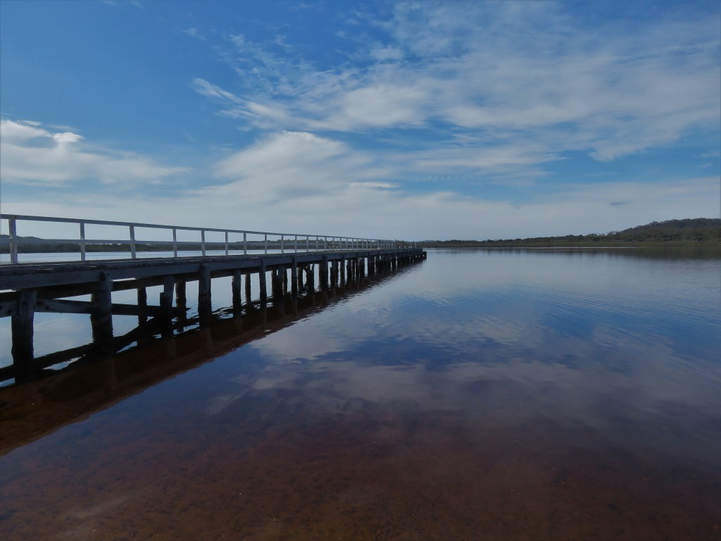
The first part of the walk skirted Walpole Inlet, mostly under the shade of flowering Peppermints, there was also plenty flowering in the undergrowth. The day was predicted to reach a very warm 25C for that part of the world and as such the inlet was like a mill pond.
Walpole Inlet.
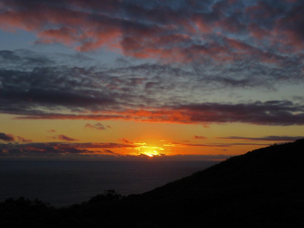
The track then meandered through a swampy area with its own association of plants before skirting Nornalup Inlet and then re-entering Karri and Tingle Forest. The climb up to Hilltop Lookout is a steep one but the views from the lookout over Nornalup Inlet and out to the Southern Ocean are superb. I was less than impressed to find my first blister a mere 10km into the 210kms at this point, but was at least quick to get a band-aid on it to prevent it getting worse.
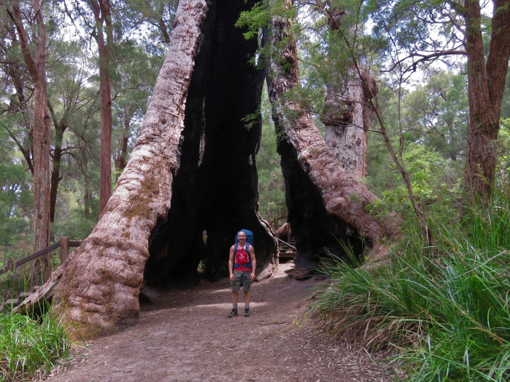
It was great to be back in Karri and Tingle Forest and many times over the course of the morning I stopped in my tracks to look up at the giants surrounding me. I stopped for a well-deserved break at the Giant Tingle Tree and the obligatory picture.
Giant Tingle Tree.
The track continues through excellent forest and the descent along Tingle Drive with views into the Frankland River Valley were a joy to walk. Frankland River Campsite is in a great location next to the Frankland River and after lunch I explored the area around the Campsite. I took an unplanned dip in the Frankland River while trying to negotiate a rock crossing and as a result had wet boots for the next two days.
Karri Forest Wildflowers.

The day had started to cloud over as I left the Frankland River Valley with my entourage of a hundred or so flies. The afternoon’s walk passed first through mixed Jarrah/Marri Forest before re-entering Karri/Tingle Forest. I kept up a good pace because I hoped to arrive at the Tree Top Walk before close at 5pm.
Tassel Plant.

I arrived with 20 minutes to spare and used the time to wander around the Empire Boardwalk, a short 600m boardwalk through giant Tingle Trees, whilst making short work of a guilt free chocolate bar and ginger beer.
On approach to the Tree Top Walk I had passed close to a picnic shelter and knowing that Giants Campsite was going to be busy that night with a school group and many walkers I decided a night of solitude at the Tree Top Walk Picnic Shelter was preferable.
After I had set up my sleeping gear for the night, I had a few hours to enjoy the area around the Tree Top Walk to myself, as dusk fell, I disturbed a number of Quokkas in the understory of Sword Grass, including brief views of one animal as it bolted across the path. It was actually quite a humid night in the stillness of the forest and it took me a long time to fall asleep with a particularly annoying fly buzzing around my head.
The following morning the Kookaburra or bushman’s alarm clock woke me up before 4am, so I packed up and walked the last 2km to Giants Campsite where I filled up on water ready for the mornings walk.
There were yet more impressive trees as I descended out of the Tingle Forest for the last time, and across the South Coast Hwy towards the coast. After following an old rail formation, I ascended to Nut Road Lookout and my first impressive views East along the coast. There were many (as yet) unknown headlands dappled in sunlight and jutting into the Southern Ocean like the battlements of a castle, a wonderful view.
Views to the long walk ahead from Nut Road Lookout.

The next part of the walk was somewhat disappointing and instead of groves of Red-flowering Gum Trees I got scorched earth, after a recent and obviously intense bush fire had passed through the area. There were however signs of the bush recovering, with a Western Grey Kangaroo, the sound of Rattling Froglets coming from numerous watercourses. Twining Fringe Lilies provided a splash of pink alongside the track.
The track passed through heath and stunted Karri Forest approaching the coast and I was fortunate to dodge the first of many showers at the picnic area at Conspicuous Beach Carpark. After morning tea, I had a short beach walk across Conspicuous Beach before climbing a large sand dune that ultimately took me to the impressive Conspicuous Cliffs. This would have been a wonderful place to sit and contemplate the amazing views on a calmer day, but with the weather continuing to deteriorate, I pushed on across the lovely coastal heath to Rame Head Hut and my lunchbreak.
At the hut, I had my first of many encounters with Nick and Murray end to enders from Melbourne and NZ respectively. As I traversed Point Irwin the weather deteriorated sharply with heavy showers driven horizontally by the squally conditions. When I reached Peaceful Bay, I could indeed see why it had been named so, it was an oasis of calm compared to the wild conditions at other bays I had walked past that day, no doubt benefitting from the shelter provided by Point Irwin from the prevailing winds.
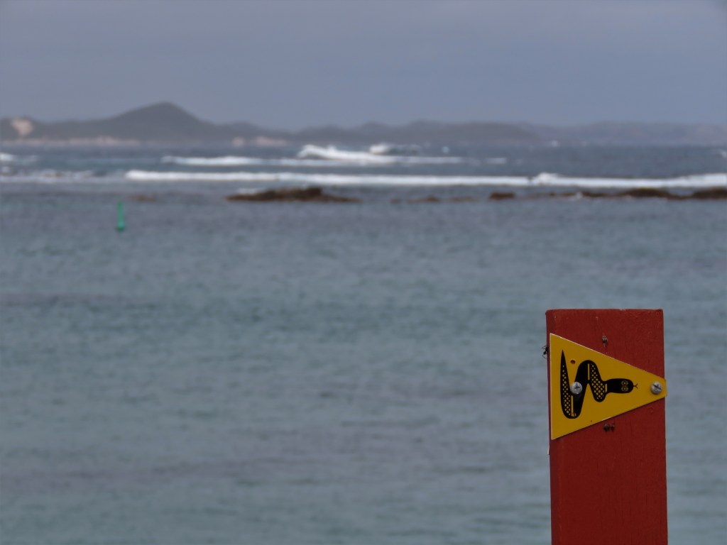
Track Marker – Foul Bay.
I had one thing on my mind when I reached the township of Peaceful Bay, the legendary Fish and Chips at the general store! I made short work of the delicious meal before walking a further ten minutes to the Peaceful Bay Chalets, my accommodation for the night. Whilst I was disappointed not to be able to get the tv working, I was very happy to dry my gear on the heater, and crawl into a comfortable soft bed for an excellent night’s sleep.
Peaceful Bay Fish and Chips!

Early to bed meant early to rise and after a brief breakfast I was on my way by 5.15am for what was to be my biggest day of this walk, an astounding 43 kms to William Bay Hut. I had not even walked 500m when I had to shelter from another shower at the town oval while a number of very large Western Grey Kangaroos considered me.
Fortunately, this was the last of the showers from the system that had passed through the previous day but the day was very windy. This was not a problem for the first 8km of the day as the wind was behind me, but it did become a problem when I had to make the crossing of the Irwin Inlet Channel by canoe.
Irwin Inlet Canoe Crossing.

It wasn’t necessary for me to make the canoe crossing as the sandbar across the Irwin Inlet was closed, but I felt that the canoe crossing was an important part of the Bibbulmun Track that I wanted to experience.
It was as I reached the centre of the 200m wide channel, away from the lee provided by the West bank, that I felt the full force of the wind. The canoe was blown off course, far away from the shed I was aiming for on the opposite bank, and down the channel. I tried my best to fight the wind but the canoe was not very stable. Once I had been blown against the far bank, I faced the canoe into the wind and slowly made progress along the bank until I finally reached the canoe shed. What an effort and to be honest a scary experience.
Now I had to return a canoe from this the shed on the far bank to the previous side of the channel, so that an equal number of canoes remained at each bank. This second crossing was easiest with the wind in my favour. On the third crossing I used the shelter provided by the West bank to paddle up the channel so that when I finally manoeuvred the canoe across the channel the wind assisted me to reach the shed on the far bank. The triumvirate of crossings had taken half an hour of much effort, so I took a short break to gather my breath before continuing.
Immediately after the canoe crossing, I had a hard ascent of steps into the area known as the Showgrounds. The landscape was unique and unlike anything I had previously encountered. There were many Western Grey Kangaroos in this habitat lazing around in the morning sunshine. It was hard going following the track for the next few kilometres because of the sandy terrain and the sharp climbs and descents.
I returned to the coast and Big Quarran Beach and the windy conditions made an impressive vista as the Southern Ocean crashed onto the shore. The beach walk was a short one at 1.5km and was fairly easy because I followed the hard sand of the receding tide. The Bibbulmun Track traverses Quarran Rocks to Middle Quarran Beach on a path and it was here I encountered my first Sticky Tailflower, a white flowering plant endemic to the area.
Big Quarran Beach.

Now that I had passed the headland, I had good views of impressive Pt Hillier ahead, and with the sun breaking through, Middle Quarran Beach with its blue waters and golden sands would have been very inviting had it not been for the pounding surf. It was once again a hard climb into the sand dunes behind Middle Quarran, ultimately resulting in another long hard climb this time up a wooden staircase. The track then followed the clifftops before descending to Boat Harbour Campsite and my lunchbreak for the day. It was during this part of the walk that I disturbed a beautiful small Crowned Snake off the track, unfortunately views were brief.
At Boat Harbour Campsite I once again had the pleasure of the company of Nick and Murray and we duly discussed our snake sightings for the morning. Boat Harbour was a truly beautiful sheltered beach that I wished I had encountered on a day with calmer conditions, because it really would have been a beautiful place to take a dip.
Refreshed from lunch the track once again traversed the impressive clifftop walking of the Southern Coast always with the impressive Cape Hillier looming ahead. The going was hard but the views were astounding and finally the highest point of the day was reached at the trig point at Cape Hillier Ridge with views back along the coast and ahead to Mazzoletti Beach and Edward Point.
After descending to Parry Inlet Campground with its impressive stands of Peppermints it was time for a well-deserved cup of tea before the final push for William Bay Hut.
I was daunted by the prospect of the 7km beach walk along Mazzoletti Beach but I needn’t have been. The sand was very firm for the first half of the beach crossing because of the receding tide coupled with the fact that Point Hillier shelters the Western half of the beach from the prevailing winds.
It was after the halfway point of the beach crossing had passed that conditions became tougher, because of the pounding surf softening the sand, although the wind was at least always behind me. The late afternoon light was epic to encounter as I walked across the beach but the dunes had been washed away at the exit so it was a short sharp climb off the beach.
Mazzoletti Beach.
I love a challenge but the hill up to William Bay Hut was the steepest I could remember, and very hard going, but I was enchanted to encounter a Quenda dart across the track on my ascent. At William Bay Hut, I had the pleasure of the conversation of four other walkers as I ate dinner, before as is tradition on the track we all turned in very early after a hard day’s exertions.
Sleep did not come easily at all that night with mosquitoes in the hut prolific, I tried the picnic bench outside until it rained. Back inside I was once again tormented by the mosquitoes and even a fly! Eventually I decided that rain or no rain outside was best and this is where I eventually dozed off.
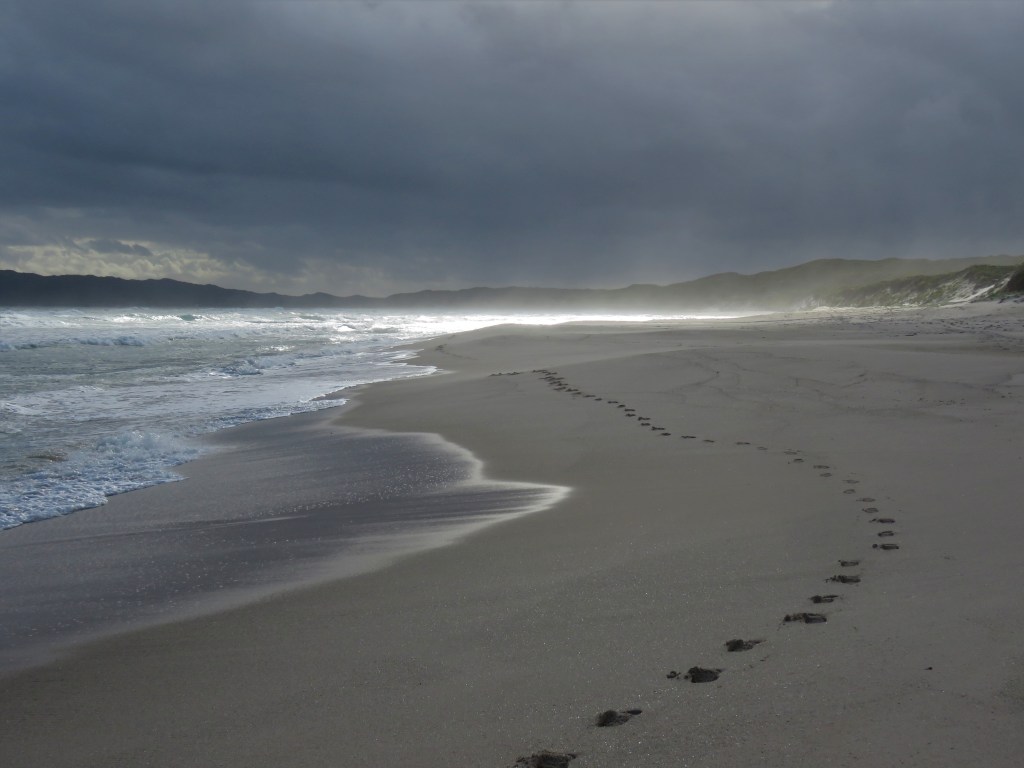
Denmark Ahead…..
Needless to say, I was tired the following morning but at least today was the shortest day walking of the whole week, a mere 20kms to Denmark and a soft bed at the pub. With this in mind I set off early and almost immediately disturbed a Honey Possum of a Bull Banksia flower. Honey Possums are endemic to WA and one of only a few mammals that are entirely nectarivorous, hence they are common, although hard to see, in the flowering heaths of the South Coast where something is always flowering year round. See also post – The Honey Possum and the Banksia
The morning was overcast as I walked the coastal heath down to Lights Beach, from here there were great views West to Cape Hillier that I had walked over only the previous afternoon. At Lights Beach Carpark there were both Carnaby’s Cockatoos and Elegant Parrots feeding on vegetation, which made for a nice break.
Elegant Parrot at Lights Beach Carpark.

Ascending the track from the beach I had views East to the Nullaki Peninsula, that I would be walking the following day, and views North to Mount Hallowell where I was shortly heading. The sun had by now started to break through the clouds and the day began to warm. Ascending Mount Hallowell through the Karri Forest was hard going. At Monkey Rock I hoped to take a breather but the wind was too strong on the exposed granite to make a cup of tea so I continued to climb.
The track became quite hard to follow at the summit as it wound between granite outcrops and I lost the path a couple of times. Descending was much easier although harder on the knees and before long I was in the outer suburbs of Denmark with their beautiful gardens.
The last 6km of the day into Denmark the track was very poorly marked in places, and if I had not had the benefit of google maps on my phone it would have been impossible to follow. Conversations with other walkers later on confirmed I was not the only one to encounter difficulty on this part of the track.
Finally, I reached the trailhead near the river mouth, but it was another 1.5kms to the Denmark Pub, my accommodation for the night. After an amazing pub lunch, shower and sleep in that order I felt like a new man. All I had to do for the rest of the day was to replenish supplies from a box I had left at the pub the previous Friday and relax.
Wednesday morning before setting off, I spent time attending to the increasing number of chafes and bIisters on my feet. I had pre-booked a taxi to take me from Denmark around the Wilson Inlet to the Nullaki Boat Landing on the far side. This was a cheaper option than hiring a boat, although it still cost $66. That said it was a lovely journey with a really nice driver and the distance at 34km was fair for the price.
I had a near emergency when I left the camera in the taxi and had to chase it down the road arms flailing like windmills whilst yelling at the top of my voice. Fortunately, the driver noticed the mad man in the rear-view mirror and stopped. Phew that was close!
It was a lovely still overcast morning as I skirted Wilson Inlet on the track, a bonus was the track was nice and flat making walking easy. Cormorants, Pelicans, Terns and other wading birds took to flight as I passed by energised from the previous night in a soft bed, I was thoroughly enjoying walking as is always the case after the rest provided at a track town.
Waterbirds at Wilson Inlet.

After an easy 10kms, I reached Nullaki Campsite for morning tea. I was glad not to be camping here as this hut is renowned as a mosquito hotspot and this is not surprising with the amount of low-lying swamp around the campsite and hut.
The track ascends to the high sand ridges of the coastal dune system for the first 3km after leaving the hut, and here there are expansive views along the coast in both directions, as well as inland as far North as the Stirling Ranges. What followed was a really enjoyable walk along the coast for the remainder of the day.
There were stands of stunted Bullich, echoeing with the calls of Western Wattlebirds, and plenty of flowering Bull Banksia and Cut-leaf Banksia in the heath.
Cut-leaf Banksia.


I had felt cheated on the coastal parts of the Bibbulmun thus far because of inclement weather, finally I could see why walkers rave about this part of the track. This was especially so as after passing Knapp Head there were amazing views of stunning West Cape Howe. My afternoon cuppa was at the picnic shelter just above Lowlands Beach and like a lady with two small children said “Living the Dream,” even if my legs weren’t entirely in agreement!
Late Afternoon Sun on West Cape Howe.

The last hour to Cape Howe Hut was clifftop walking at it’s best, with views back to Knapp Head and forward to West Cape Howe lit up in the late afternoon sun. Cape Howe Hut was in an impressive location, nested amongst a Peppermint thicket with amazing views from within 50m of the hut. It was from the clifftop that the hut inhabitants gathered for an impressive sunset.
Sunset from West Cape Howe Hut.
The other three walkers at the hut that night Murray, Nick and Richard, I had met previously and so dinner was a fairly relaxed affair. There was a cold wind blowing into the hut that did a wonderful job of keeping mosquitoes away. This night was a full moon and it was wonderful to drift off to sleep while the full moon slowly ascended through one of the open sides of the hut. I slept well.
Approaching Albany….
I woke around 4am as the dawn was beginning to break, and when I finally got out of the sleeping bag, I went to the picnic bench at the front of the hut with a cup of tea to watch the sky redden above West Cape Howe. I thought about all of the huts that I had previously passed through on the track, many of which I had overnighted in. West Cape Howe was top five and in good company along with Maringup, Schafer, Beedalup and Yourdamung.
The early morning walk along the clifftops was brisk for the first couple of hours, but the scenery remained excellent to the sound of the constant calls of Carnaby’s Cockatoos as they fed on the flowering Bull Banksia. Unfortunately, a previous bushfire had passed through the area although the vegetation was well on the road to recovery. I came across a sleepy Bobtail Lizard on the path that disappeared in the vegetation as I circumvented it.
There were a series of deserted beaches on the East side of West Cape Howe, first passed was Shelley Beach but the stand-out was the golden sands and azure waters of Dingo Beach.
The last 4kms to Torbay Hut seemed to take a long time but eventually it appeared. Richard from the previous night was already there and had set up for the night, despite it being lunchtime. I was happy not to be spending the night at this hut because the mosquitoes were bad in the middle of the day. I could only imagine how bad they would be after dark, so lunch was a brief affair.
After lunch, I descended through She-oak to Torbay and relished the 7km beach walk ahead. This time I had promised myself to put my aching feet in the cool Southern Ocean, so I duly spent 15 minutes removing all the bandaging and plasters from my aching feet at Cosy Corner Picnic Area at the Western end of the beach.
It was very overcast by this time and the Western end of the beach was deserted. It felt amazing to have the salt water constantly washing over my sore feet and I thoroughly enjoyed the beach walking. There were a couple of scrambles over small rocky headlands to break up the long stretches over sand.
The sandbar at Torbay Inlet had sealed the ocean off completely in common with all the other inlets between Walpole and Albany during the walk. The Eastern end of the beach showed signs of human activity with the urban centre of Albany nearby. There were a few 4WD’s on the beach and a cluster of four young surfers catching the waves formed by the ocean surging past Muttonbird Island.
After ascending steeply off the beach, I put my boots back on at Muttonbird Carpark ready for the last 4kms of the day. The track again ascends through sandy dunes to reach the clifftops with views of the impressive Grasmere and Albany Windfarms ahead.
The day was cool by now, but the sand on the track obviously remained warm, because I came across two impressive Tiger Snakes basking on the warm sands within 100m of each other. On the final stretch to the hut there was excellent coastal heath with many flowering Bull Banksia.
Tiger Snake enjoying the Warm Sand.

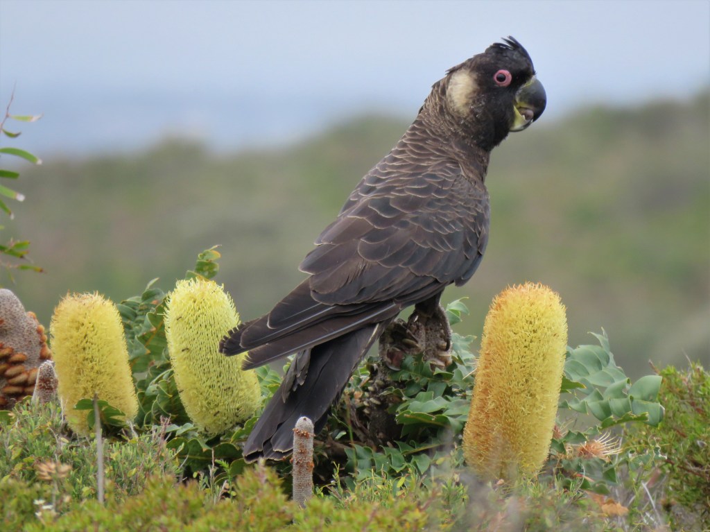
We were five walkers at Muttonbird Hut that night so it was relatively busy. After I had set up and devoured the following mornings breakfast for dinner, I returned along the last 1km of track that passed through the stands of Bull Banksia. Honey Possums were the target but I didn’t see any of this species, I did however see a flock of Carnaby’s Cockatoos and a Kestrel also, no doubt, searching for Honey Possums in the failing light.
Carnaby’s Cockatoo on Bull Banksia.
I was glad that this was my last night on the track, while I had loved walking the track, I despised sleeping in the uncomfortable huts. They are no doubt a feat of engineering dotted at regular intervals all the way along the 1000kms of track but too often they are full of mosquitoes and snorers. My nights in my tent when I had the luxury of carrying it were always better but best of all were nights in a soft bed at track towns!
Day 32 on the track and the final 24kms to Albany and the Southern Terminus of the Bibbulmun Track. I couldn’t wait to get going and was first out of the hut after I had packed up gear, followed by a quick cup of tea. The track was nearer to the cliffs than at any other part of the track due to the presence of the sixteen turbines of the Grasmere and Albany Windfarms. The turbines of the windfarms were impressive and so was the views down from the rugged coastline to the crashing surf 100m below.
The best part of the day was undoubtedly when a diminutive Honey Possum scarpered across the track in front of me into bushes. I dropped my pack and was able to view this amazing marsupial for brief intervals as it climbed through the thick undergrowth eventually disappearing from view. Wow what a final treat from the Bibbulmun!
After Sandpatch Carpark once again the vegetation was burned after a recent fire. Sadly, this fire had resulted in the complete destruction of Sandpatch Hut robbing me of my morning tea break!
An unremarkable sandy 4WD track descended from the cliffs down through Torndirrup NP to Princess Royal Harbour with great views of Albany City during the descent. The track circumnavigated the harbour along a bike/walk track. I took the opportunity of a final cuppa on the track when I passed a shelter and was caught up by Nick and Murray. They were tempted by the Whisky Distillery on the outskirts of Albany but I resisted the urge to join them.
See also accounts of other long distance Australian Walks :-
Trekking Western Australia’s Cape to Cape Track – 31st Oct – 5th Nov 2015 – Reptiles and Beaches.
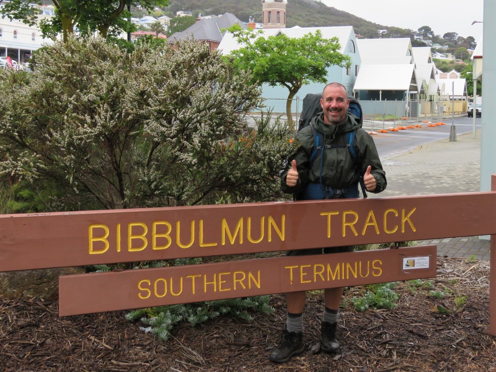
I sheltered under a Peppermint trunk as a heavy shower passed by before the final part of the walk through the suburbs of Albany. Then, there it was, the Southern Terminus outside the old Albany Railway Station. It had taken me 32 walking days over two and a half years to complete the 1005kms from Kalamunda to Albany along the world class Bibbulmun Track. I felt mixed emotion that it was over. After an obligatory picture I walked up York Street the main street of Albany to the recently relocated Visitor Centre.
Southern Terminus on an Overcast and Rainy Day.
The staff there were lovely despite my entourage of flies and brought out the famous bell that I was allowed to ring as an end to end walker. This was the final curtain.
Ringing the famous Bibbulmun Bell!

Accommodation in Albany was sold out because of the fabulous Field of Lights Exhibition at Apex Drive on Mt Clarence so my indignant legs had a further 3km walk to my accommodation for the night at a dodgy motel on the Albany Highway. Fortunately Dome Café was en-route and I indulged in a calamari and chips and coffee before a shower and afternoon nap at the motel.
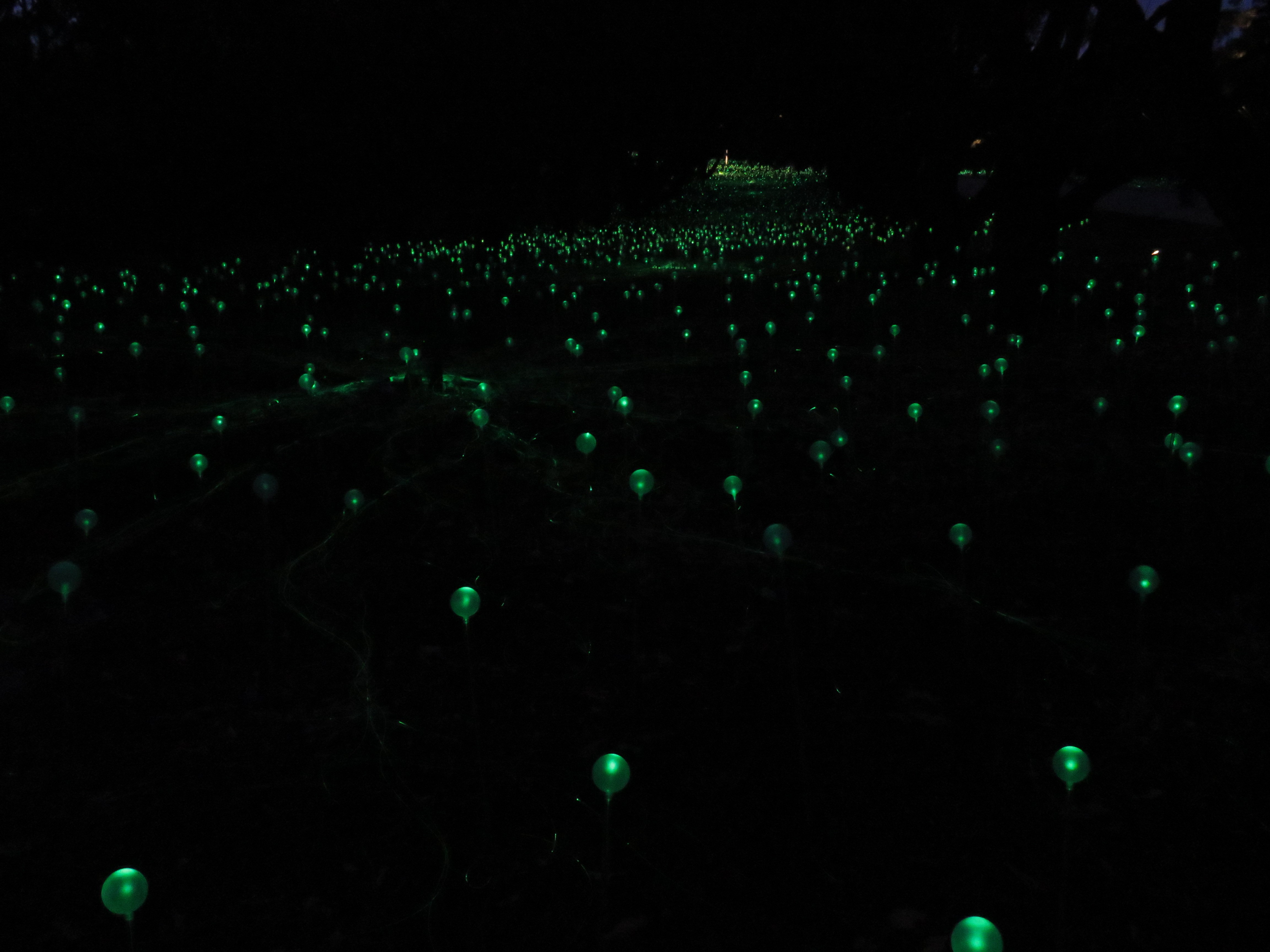

That night I visited the Field of Lights Exhibition which was a fabulous end to an amazing journey. After I had listed my top three experiences of the Northern half of the track, I feel obliged to also mention my top three experiences of the Southern half of the track, and they are as follows, again in no particular order.
-The cathedral-like experience of walking under the giant Karri Trees with their multi-coloured understory of plants and endemic bird calls.
-The incredibly remote swampy Pingerup Plains, an almost alien experience.
-The awe-inspiring vistas of West Cape Howe in bright afternoon sunlight.
I feel very privileged to have walked the Bibbulmun Track end-to-end and am very grateful to the army of volunteers that make this possible. I cannot recommend this experience enough and hope that the four parts of this blog will encourage somebody else to make this incredible journey.
#QuollingAround

One thought on “Bibbulmun Track – Part 4 – Walpole – Denmark – Albany – Honey Possums and Banksias (210.3kms.)”