
Lairmairrener Country
I arrived in Tasmania Saturday 12th August after dark and got a taxi into the city to my pre-track accommodation at the Pickled Frog Backpackers, on Liverpool Street in the city. I had toyed with the idea of luxury accommodation pre-walk but it seemed more sensible to downgrade, as my accommodation on the walk would be basic. That said the Pickled Frog was a friendly place and I was comfortable enough for my stay there.
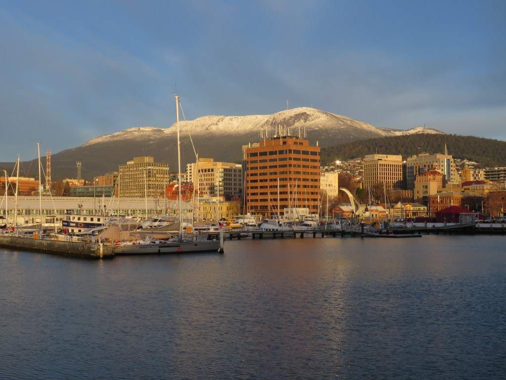
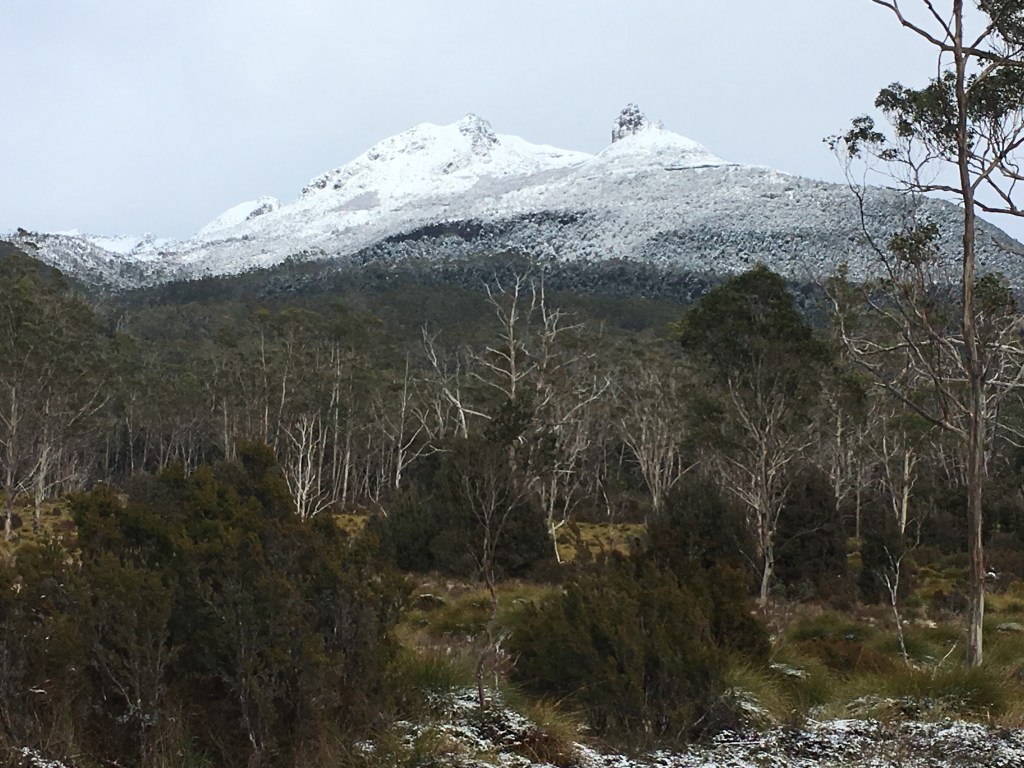
I woke Sunday morning to a “blue bird” winter day in Hobart. I made my way down to the Derwent for fabulous views of Mt Wellington / Kunanyi. The plan for the day was to walk to Waterworks Reserve to view birds but when I arrived the pull of the mountain was too great and I took advice on walking to the top.
Mt Wellington / Kunanyi.
The route I took was the Pipeline Track (via Gentle Annie Falls) to Ferntree (where there are refreshments at the tavern.) I then ascended the Middle Track and Radfords Track to the Springs. Finally, the Pinnacle Track and Zig-Zag Track got me to my destination at the summit (1271m.)
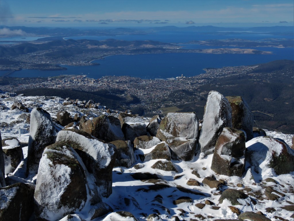
The views at the top were superlative and it was very busy at the summit, because this was the first snowfall on the mountain despite it being so late in the season. The total return journey took me six hours and was a fairly easy walk with the exception of the Middle Track part that was very steep.
Hobart from a snow-covered Mt Wellington.
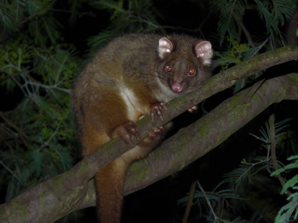
During the three nights I spent in Hobart I spotlighted Waterworks each night in the absence of transport and saw the following wildlife. Brushtail Possums, Pademelons, Bennett’s Wallaby, Tasmanian Bettong (at the usual spot at Picnic Site No 9,) Tawny Frogmouth, Eastern-barred Bandicoot (first dam wall,) and plenty of Ringtail Possums in urban gardens near the Reserve.
Ringtail Possum in suburban garden near Waterworks Reserve.
I used the time in Hobart to make final purchases for the walk, and also to find the Tassielink bus stop that was to be my departure point at 8am Tuesday morning. The Tassielink bus / minibus was my transport from Hobart to Lake St Clair (the start of the Overland Track walking South to North,) and also from my finish point at Cradle Mountain to Launceston to catch my flights back to WA. Tassielink also provide a fabulous service where for $10 they will transport a bag from Hobart to Launceston or vice versa, excess gear for the holiday that I didn’t want to carry with on an 82km trek!
See here for the Tassielink bus services
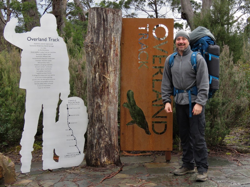
I wanted to walk the track in winter for two reasons. Firstly, I was concerned that with the large numbers of hikers “in season” the wilderness aspect of the walk would be ruined, secondly, I was keen to see if some of Tasmania’s nocturnal animals would become more diurnal during the colder weather. The reason I walked the track in a Northerly direction was simply because I could, as opposed to the season when a strict North to South direction is enforced.
Tuesday 15th August – Day 1 – Lake St Clair to Echo Point Hut
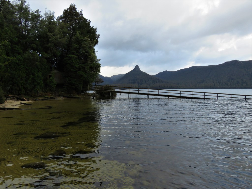
Tuesday the 15th arrived and I caught the bus at the appointed time. The weather for the trip was as to be expected for a Tasmanian winter with plenty of rain and then snow forecast for the duration of the walk. Disembarking at Lake St Clair I sought advice about conditions and purchased my $30 parks pass to cover the trek before the obligatory photos at the Southern Track Marker near the Visitor Centre.
Southern track marker Lake St Clair.
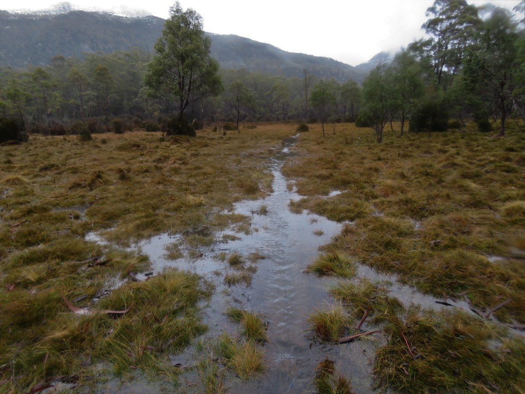
The track leaves the Visitor Centre tracing the shores of Lake St Clair, first passing through dry scherophyll forest. My first wildlife encounter was with a cute Bennett’s Wallaby grazing at the side of the track, and there was lots of Pink Mountain Berry flowering.
Bennett’s Wallaby.

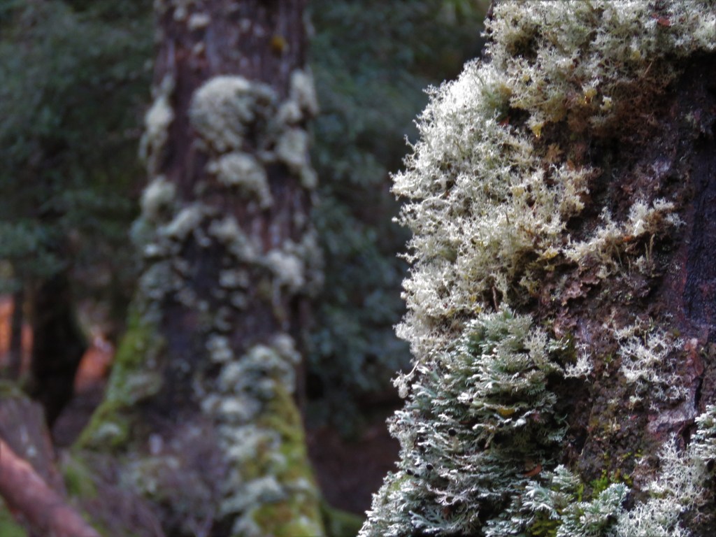
The vegetation quickly transitions to rainforest with its abundance of mosses, litchens and ferns in a myriad of green, even though conditions were overcast. Despite the fact that the track traces the edge of the lake it was surprisingly hard going climbing over fallen trees and descending and ascending creeks that fed into the lake.
Rainforest Lichen.
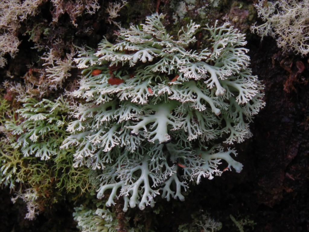
Rainforest Lichen.
I was lucky to have an hour of walking without rain before the looming rainclouds began to unload their burden. The rain was light at first before becoming heavier although to be honest it felt right to be walking through rainforest with the rain coming down. After three hours of walking (16kms) I reached my destination for the night Echo Point Hut.
The view from Echo Point Hut into the pouring rain.

The hut is situated on the edge of Lake St Clair and there is a jetty into the lake, although it was raining far too hard to be doing any exploring when I arrived at the hut. The hut itself was basic with a coal heater and very little light due to the small window and overcast conditions. I unpacked my gear and then heard voices. My companions for the night were Katie and Jim Brisbanites that had relocated to Launceston because of their passion rock climbing.
Echo Point Hut (to the left) and Mt Ida.
There was a bunker out the back of the hut filled with coal though for whatever reason this coal proved hard to light. The resourceful Katie had scrounged some coal from the Visitor Centre which with a bit of kerosene to help it along soon go the fire going, although I could never say it was a roaring blaze giving off copious amounts of heat! I was privileged to spent my first night on the track with such a wonderful couple and the conversation flowed before it was time to turn in for the night.
I wandered out onto the jetty to clean my teeth before bed and at this point there was not a cloud in the sky. The silhouettes of Mt Ida and Mt Olympus were wonderful to behold.
During the night in the nether world between sleeping and waking it was hard to differentiate between the sound of the nearby stream and the fall of rain once again on the roof of the hut.
Wednesday 16th August – Day 2 – Echo Point Hut to Bert Nichols Hut
The following morning as I lay in the sleeping bag listening to the patter of rain on the roof of the hut I made the decision to change my plans. I had planned to spend a night on a side trip to Pine Valley, but there seemed little point to do it with the weather so atrocious. Part of my decision related to the impending snow forecast and I figured it would be handy to have a day up my sleeve in case conditions got really bad.
I was not the only person at the hut to change plans that night, Jim had been suffering with bronchitis which was getting worse so him and Katie made the decision to call off the walk and return to Lake St Clair. As I departed the hut for the days walk Jim said he had hoped that he hadn’t made me ill.
The rain was heavy as I set off on day two of the walk and passed through similar rainforest as the previous days walking. The track was like a river in places and it took a lot of energy and effort to keep my feet dry. The walk through the remainder of the rainforest seemed to drag, probably because I was looking forward to reaching Narcissus Hut and having a cup of tea out of the rain.
A wet Overland Track through the rainforest.
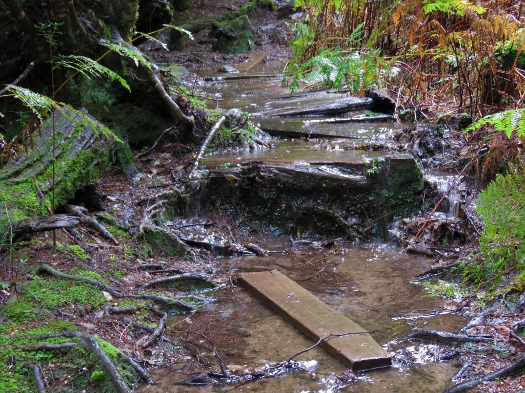
I reached Hamilton Crossing and the scenery changed to button grass moorland. The track changed to a series of planks across the delicate habitat, but the problem was there was so much water that it was flowing over the planks. There was nothing for it but to get my feet wet. As I scurried across the planks the water was knee deep in places and in my haste to get across I slipped and fell sideways onto the plank. Fortunately, I wasn’t injured but as I lay on my side with water up to my right shoulder I was extremely glad to have invested in a pack liner otherwise the walk would have been over.
The flooded boardwalk Hamilton Crossing.
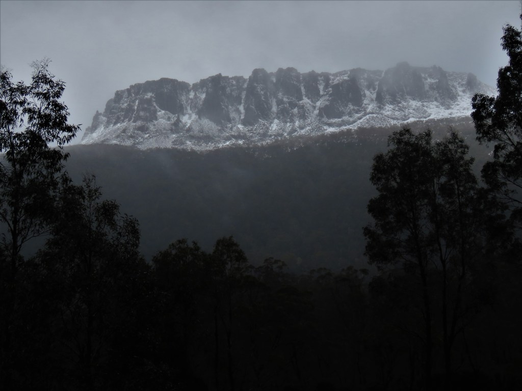
As I walked on towards Narcissus Hut the cloud parted behind me and the menacing peak of Mt Olympus revealed itself looming above and covered with snow.
Mt Olympus.
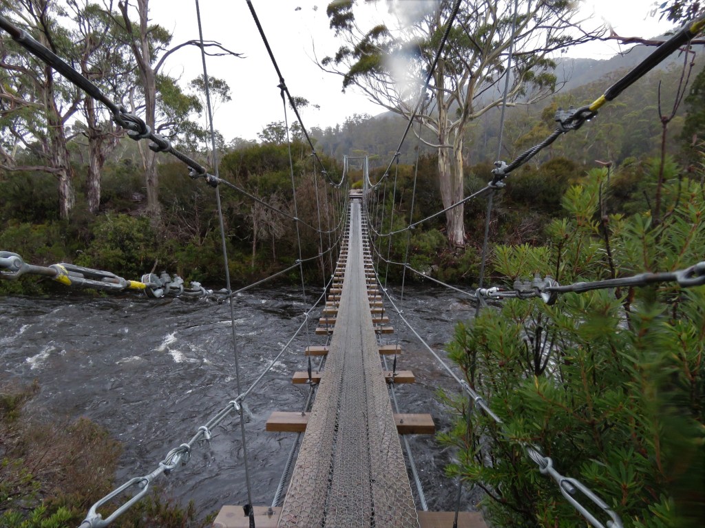
I reached Narcissus Hut and quickly boiled water for a hot cup of tea to warm up, the trouble was as I stood around to drink it I quickly got cold in my wet clothes. The only thing to do was to press on and I was pleased to find the track from Narcissus was much better going than the track through the rainforest plus now my feet were soaking there was no point expending energy trying to keep out of the water. Before long I came to the impressive suspension bridge over the raging torrent that was now the Narcissus River.
Suspension Bridge over the Narcissus River.
Despite the heavy rain I found myself admiring the beautiful vegetation around me as I walked. There were stands of Silver Banksia and wonderful Eucalypt Forest, whilst Pink Mountain Berry provided a splash of colour to the bush.
As the afternoon progressed the non-stop rain turned into heavy showers and I was grateful of the short reprieves from the precipitation. I reached an empty Bert Nichols Hut late afternoon and was delighted to find the heater in good working condition if not a little high on the wall. I decided bed for the night was in front of the heater and got out of my wet clothes and into my hut clothes hanging the wet clothes up on pegs to dry.
As dark descended the weather outside deteriorated even more with high winds gusting and rain lashing the windows of the hut. Boy was I glad to be out of that.
Thursday 17th August – Day 3 – Bert Nichols Hut to Kia Ora Hut
I woke before dawn and when I went outside I could see it was a white winter wonderland. I had been expecting this from weather reports before I set off and was delighted to have snow on the walk, although I did wonder how the going would be up on Du Cane and Pelion Gaps that I was to traverse in the next two days.
I ate a hearty breakfast back inside and with my clothes dried well by the heater I set off early into the snow. It was only really a couple of inches and that path was easy to follow and the snow-covered landscape was a sight to behold. However, as I ascended to Du Cane Gap conditions became tougher as the snow drifts got knee deep and the track disappeared.
In the event I lost the track about four times although it was never for more than a couple of minutes. I guess the good thing about snow is that it makes it very easy to retrace your steps. I just backtracked until the last marker and reassessed where I though the track would be.
Du Cane Gap. Which way now?

I descended into more rainforest and the snow here was less under the tree cover. Today was waterfall day with three falls to visit as side trips. The first waterfall was Hartnett Falls an hour return walk off the main track. It got very old quickly pushing past snow laden branches to have a good dump of snow land on you each time, but the falls were worth it as they thundered into the valley below. From the viewing point it is only possible to see the top of the falls sadly, although I later found out that it is possible to get to the base of the falls.
The second and third waterfalls of the day shared the same path for much of the side trip. The first of the two I visited was D’Alton Falls where the best views of the three were to be had. There sure was a lot of water thundering down the waterfall and the noise provided a stark contrast to the silence of walking through a snow-covered landscape.
Thundering D’Alton Falls.

Fergusson Falls like Hartnett Falls didn’t provide great views.
Back up on the main track the next landmark I passed was the fabulous Du Cane Hut. I couldn’t believe how tough the trappers of old must have been to have lived in this isolation and through such tough weather conditions. I took the opportunity to get out of the snow and take in the atmosphere of this historical place.
Du Cane Hut.

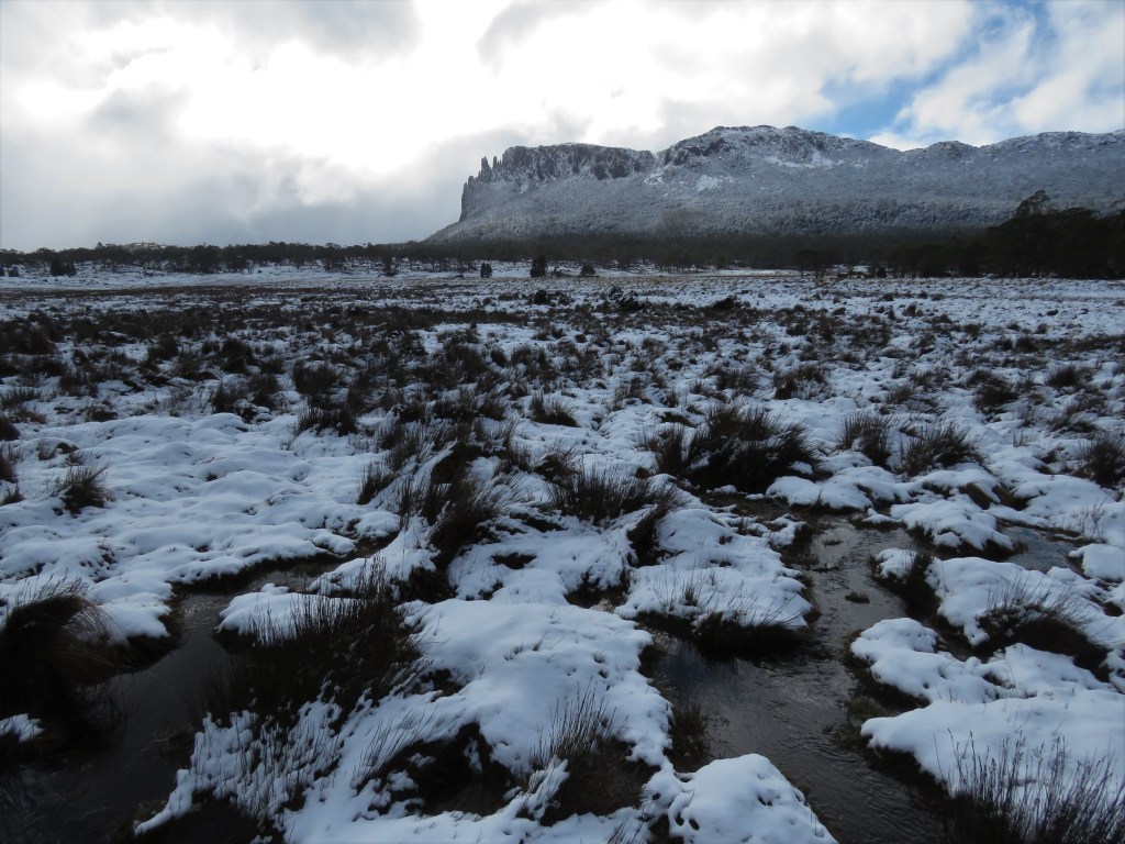
As I returned back into the snow Cathedral Mountain on the opposite side of the valley had revealed itself through the snow clouds. The track was a mere 2kms to Kia Ora Hut the destination for the day. I had arrived mid-afternoon and so had time to explore. The hut was in a fabulous location next to a river in a valley where the mountains slowly started to reveal themselves. In addition to Cathedral Mountain from earlier I could now see Falling Mountain and Mt Massif behind me and to the North the nipple like form of Mt Pelion East.
Before long I was joined by six members of the Hobart Walking Club and over the evening I had a fabulous chat with one of the members, a really kindly older gentleman. One of the ladies was also fun but the other four members were distinctly odd in a serial killer kind of way. I base this in part on the fact they had the social skills of a rock. However, some of the potential serial killers managed to get the heater going a feat I was unable to attain, so at least they were talented serial killers.
The hut heater was a joke though and didn’t give off any heat to speak of during the night and this coupled with the wet clothes I had walked in the previous day after my soaking at Hamilton Crossing was the start of the bronchitis that was to threaten the rest of the trip.
Friday 18th August – Day 4 – Kia Ora Hut to Pelion Hut
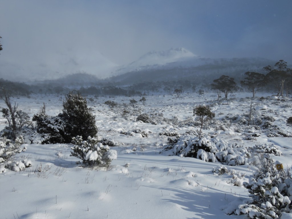
I awoke to find there had been another generous dump of snow during the night, not particularly what I had hoped for to traverse the second highest point of the track. The weather was clear so I didn’t dilly dally and after goodbyes started off into the deep snow.
Setting off from Kia Ora Hut.

The start of the ascent over Pelion Gap was on boardwalk but despite the deep drifts it was mostly easy to follow the track at first. Further on the landscape opened up and the going became much more difficult as the snow drifts deepened and it was impossible to see whether the boardwalk passed to the left or right of the marker poles above the snow.
Open Terrain ascending Pelion Gap.
As I ascended, Mt Doris and the lower part of Mt Ossa, were visible amongst snow flurries to my right and Mt Pelion East was much clearer on the right. If I lost the boardwalk, and I frequently did I would end up waist deep in snow. Many times, I lost balance with the heavy pack on my back, and it took tremendous effort to right myself and get back on the boardwalk. It really was exhausting work and I had to stop to catch my breath every couple of steps, and there is no doubt had the weather been worse there I would have had to turn back.
Impossible to keep on the boardwalk in deep snow – Pelion Gap.

Eventually I reached the saddle and for the first time finishing the walk became a possibility. I took a well-deserved rest on Pelion Gap (1126m) and took in the amazing views and utter isolation of where I was. This was why I was walking the track during August! I watched two Wedgetail Eagles circling the peak of Mt Pelion East as I rested.
Pelion Gap.
The descent to Pelion Hut was easy after traversing the gap, and I passed through forest on my descent getting constantly covered in snow from branches as I passed by. As soon as I saw Pelion Hut I knew this was going to be Ritz of Overland Track huts. Its location was perfect with great views across the Pelion Plains to the imposing Mt Oakleigh and it was surrounded by an impressive balcony. The hut itself was huge and best of all the heater was in great working order.
Mt Oakleigh from Pelion Hut.
I unpacked and placed my wet gear around the heater and warmed up with a cup of tea. I had arrived at lunchtime and so had the afternoon to relax, take photos and read. During the afternoon I was joined by a Danish guy who was extremely grateful to me because he had used my steps through the snow over the previous days on his trek!
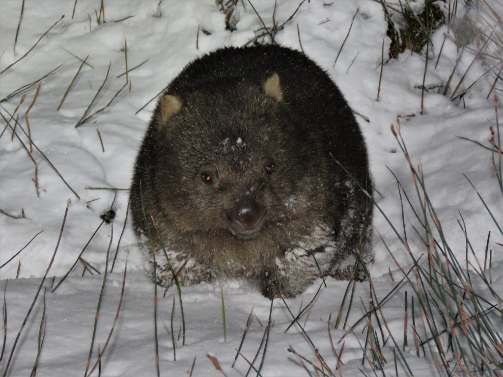
As the day drew to a close we were joined by a group of eight Tasmanian locals who had accessed the hut from the Arm River Track. Late afternoon Tasmanian Pademelons and Bennett’s Wallaby were common around the hut and after dark for the only evening during the walk I had a spotlight finding Brushtail Possums, Sugar Gliders and a Common Wombat.
That night I moved to an isolated part of the hut because I had by now developed a cough and I didn’t want to keep other walkers awake during the night or pass on anything to them.
Common Wombat at Pelion Hut.
Here are links to the wildlife of Tasmania seen on other trips :-
Quolls and other Wildlife of Tasmania.
Mammal Watching Trip Tasmania – Nov/Dec 2015
Saturday 19th August – Day 5 – Pelion Hut to Waterfall Valley Hut
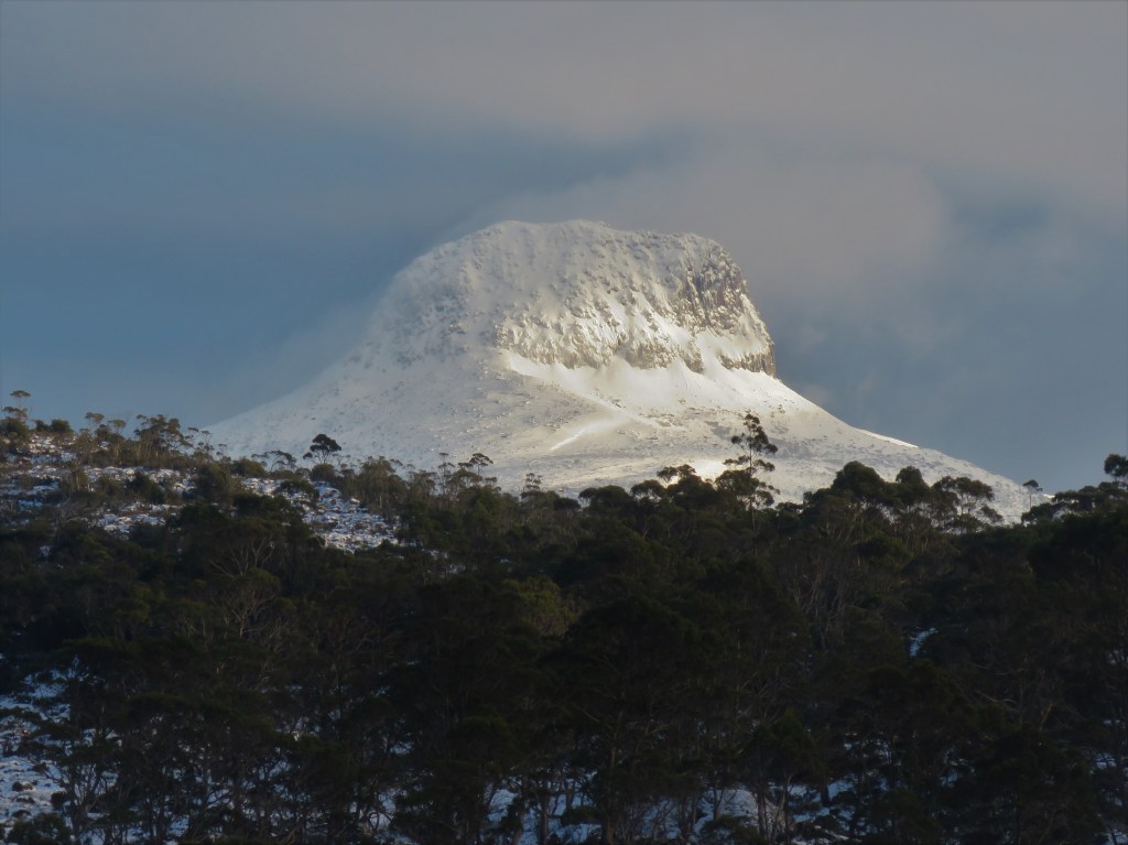
I woke a “bluebird” morning at Pelion Hut and was delighted to see the snow-covered slopes of Barn Bluff in the distance, a photographers delight, in the early morning light.
Barn Bluff from Pelion Hut.
This was to be my biggest day walking on the track as I was double hutting to 22.3kms to Waterfall Valley Hut. The first part of the day was easy skirting the flat terrain skirting Pelion Plains before descending to the lowest part of the track at Frog Flats. Mt Ossa was in full view from Frog Flats and I was pleased to see Tasmania’s highest peak. The ascent out of Frog Flats was not a particularly nice part of the walk and was a nix of mud, boulders, puddles and roots although there was a break from snow for this low-lying part of the track.
Mt Ossa from Frog Flats.
The track then ascends from the myrtle rainforest and once again I was walking through snow and I realised that today was going to be hard going. To my right was the dolerite columns of Mt Pelion West sharp in the early morning sunlight.
Mt Pelion West.

A welcome break from the walking was provided by the River Forth Lookout which provides superlative views over the Lemonthyme Forest, a forest fortunately saved from logging by protesters in 1986.
The track then passes over exposed Pine Forest Moor and again I appreciated how gnarly this part of the track would had been had it not been for the clear conditions. Melted snow on the track had formed dangerous ice for much of the way and I was aware that a fall in this isolated place would have disastrous.
Pine Forest Moor and the icy track.
The track passes next through rainforest and once again I found the track hard to follow in the deep snow although the going became easier on the approach to Windermere Hut. The plan was to have a warm cup of tea at the hut, but I had foolishly put my lighter in my pocket for the mornings walk, thinking that in the dry conditions it would remain dry. I had not considered the snow-covered branches and the lighter would not work. It was essential that I keep my strength up for the afternoons walk so I mixed some condensed milk and sugar into cold water and drank that.
There seemed little point to hang around without proper sustenance so I set off for Waterfall Valley Hut. The track skirts beautiful Lake Windermere leaving the hut before climbing steeply and with my current chest condition I found this hard going although at the top the view back over Lake Windermere and beyond was impressive.
Lake Windermere.
As I passed the side trip to Lake Will conditions deteriorated and it started to snow. I had been informed by my Danish friend at Pelion Hut that he was meeting a friend at Windermere Hut so it was not unexpected when I saw a figure walking towards me through the snow. After brief conversation I was pleased to have footprints in the snow to use for the remainder of the afternoon especially as exhaustion was setting in.
The last part of the afternoon was still hard going despite making use of the tracks in the snow and I had to keep the panic from rising in me regarding the absence of Waterfall Valley Hut and the falling temperatures. As light started to fail I finally sighted the hut and there were figures in high visibility clothing clearly doing exercises in the snow a short distance from the hut.
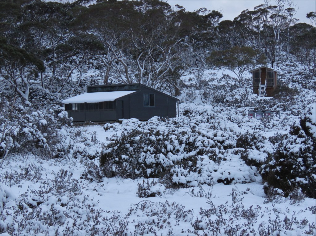
When I opened the door of the hut it was warm with the heater on, I was exhilarated to have warmth and not to have the worry of another substandard heater as at Kia Ora Hut. I unpacked and found my lighter was now working so quickly made a warm cup of tea. My company for the night were three cheery SES volunteers and after my dinner I was very kindly invited to share in Tim Tams. That evening I had great conversation as I enquired about their experiences and this was without doubt the best evening of the walk despite my deteriorating chest condition.
At last Waterfall Valley Hut appears in the distance!
Sunday 20th August – Day 6 – Waterfall Valley Hut to Cradle Mountain
Despite coughing for a good part of the night I awoke eager and ready to finish the Overland Track. I was pleased that my hut companions had been to exhausted after their exercises to have been disturbed by my coughing and wheezing, either that or they were too polite to say!
The guys were being picked up by helicopter that morning to be choppered back to Cradle Mountain and boy was I tempted to hitch a lift. The last part of the track to Cradle Mountain involved a steep climb to Cradle Cirque the highest part of the Overland Track before traversing the slopes of Cradle Mountain then descending to Cradle Valley.
I said my goodbyes to the wonderful SES guys then started the hard climb, part of the way up I stopped to wave the helicopter as it passed over me. In my mind I had built the climb into something it wasn’t and while it was hard going before long I reached the junction with the Barn Bluff side trip.
If I thought I was home and dry I was deeply mistaken the snow on this very exposed section of the track was deep. I had a back-up plan in that I would use the Lake Rodway Track that passes behind Cradle Mountain and is therefore more sheltered if conditions got too tough, and if I hadn’t been able to use the footprints of the guy from the previous day they would have been.
That said, the beauty of the landscape up here was not lost on me even if the visibility was down to 100m. The going was slow however especially as I was keen to finish the walk. Finally signs of civilisation as a I passed an extremely chipper day walker in snow skis and snow glasses both of which I deeply coveted especially the glasses as I was beginning to get snow blindness from the persistent glare of the snow. This guy was extremely happy with the snowy conditions and I wished I could have shared his enthusiasm but damn was I sick of snow.
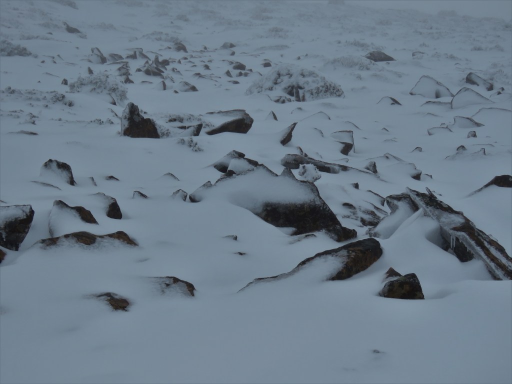
Snow-covered landscape traversing Cradle Mountain.
Even though the trek was coming to an end the dangers were not over as my foot went through the snow into a creek and I came very close to twisting my ankle. Fortunately, after a couple of steps I realised the damage was not as great as first thought and soon I came across Kitchen Hut deep in snowdrifts.
Kitchen Hut.

After a short break and my final cup of tea on the track I descended towards Marion’s Lookout. The walking was easier with the plenitude of day walkers tracks and I started to encounter people. At Marion’s Lookout I had my photo taken and then started the steep and dangerous descent past Crater Lake and out of the snow line.
Marion’s Lookout.

Crater Lake.

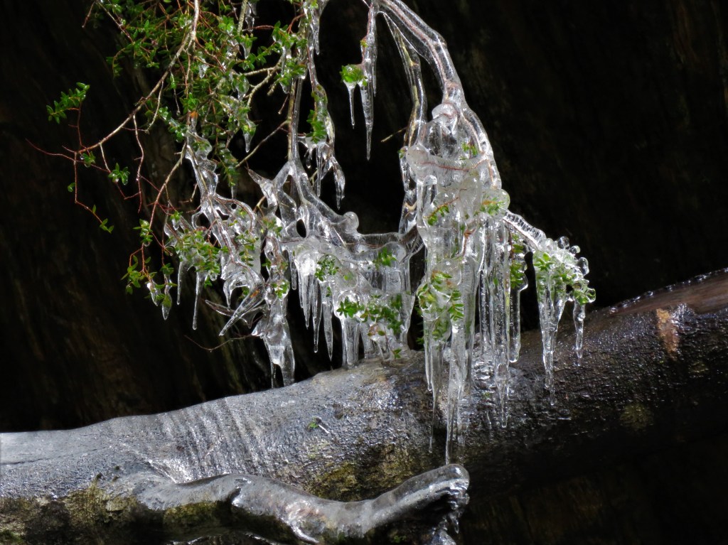
Icicles on a waterfall.
The last few kilometres of the walk passed quickly and before long I had reached the other end of the Overland Track. The plan was to head straight for accommodation, but damn it the cloud had cleared and so I felt obliged to get the free bus up to Dove Lake to photograph Cradle Mountain.
Relieved to finish at Ronny Creek.

I made my way to Ringtail Cottage at Cradle Mountain Highlander Cottages, fabulous accommodation that I was far too ill to enjoy. My condition deteriorated further and I was very weak and breathless and unable to tolerate the cold air, so I was confined to my cabin where I suffered incredible sweats for three days until such time as I could catch the twice weekly bus to Launceston. It still amazes me that despite the high tourist numbers as possibly Tasmania’s most well-known icon there are no medical facilities, not even a nursing post. I could have activated my EPIRB and been taken to hospital but this was my only option and one I was not prepared to undertake.
Cradle Mountain Highlanders Cottages (cradlehighlander.com.au)
Reaching Launceston, I finally saw a doctor and was diagnosed with a lower-lung infection, but at last I was able to access antibiotics I desperately needed, and slowly recovered.
Here is a trip documenting Rafting the awesome Franklin River :-
Rafting the Franklin River – Tasmania – Rafting by Nature.
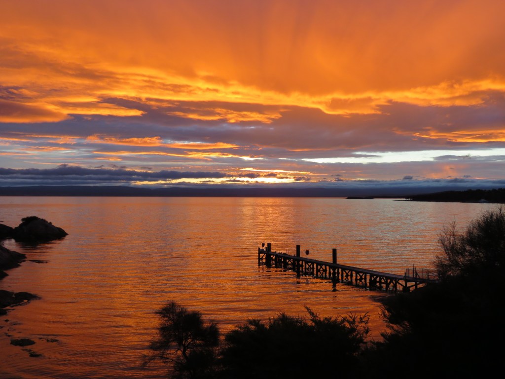
The final part of my holiday was the beautiful Coles Bay / Freycinet NP but I was still really too ill to really appreciate it fully.
Sunset Coles Bay.
In conclusion would I do the Overland Track again in Winter? Well I did get the isolation that I wanted and there is no doubt that this was fantastic and enhanced the experience but I found that also the people I met were a big part of the experience too. There are relatively large numbers of people walking the track in season but I think apart from the huts / campsites that this would not be much of a problem and wouldn’t diminish the experience, especially as outside of winter more people are able to do side trips that would dilute the walkers anyway, (most of the side trips were not a possibility for a walker as inexperienced as myself in harsh conditions.)
See also walking the Bibbulmun Track and Cape to Cape Track in my home state of Western Australia :-
Bibbulmun Track Part 1 – Kalamunda – Darling Scarp – Dwellingup – Reptiles and Jarrah (211.1kms)
Trekking Western Australia’s Cape to Cape Track – 31st Oct – 5th Nov 2015 – Reptiles and Beaches.
The wildlife on the track at this time of the year was limited to mostly Pademelons, Bennett’s Wallaby and Wombats so the species that I really wanted to see such as Quolls and Devils didn’t materialise.
My experience would undoubtedly have been better had I not been ill, do I regret it, absolutely not! In fact, I am already planning my return to the Overland Track in Summer to compare the experience. The Overland Track in three words – imposing, wild, achievable.
#QuollingAround

hi mate, if you did it in August again, would you take snow shoes ??
LikeLike
Hey Craig. If I did it again in the conditions I encountered snow shoes would have been a great asset. It’s all luck of the draw as to who’s around. I forged a path through the snow for a few days while a guy behind me used my footsteps for those days. Snow was thigh deep on Pelion Gap and Cradle Mountain. Jimmy
LikeLike