
Whadjuk, Pinjarup Country
Reminiscing over my Cape to Cape Track photo album months after the event, when sore feet had been forgotten, I became nostalgic about that walk and cherished the memories and sense of achievement and purpose I had gained from the experience.
Trekking Western Australia’s Cape to Cape Track – 31st Oct – 5th Nov 2015 – Reptiles and Beaches.
I knew it was time to undertake another project and with the 1005km Bibbulmun Track on my doorstep it was an obvious choice. Ideally I would have liked to have walked the whole track in one go, but this would involve taking eight weeks off work, so was not a possibility. Instead by default I walked the track sequentially from North to South.
Day 1. Kalamunda to Mundaring 8th May 2016 – 22.2km
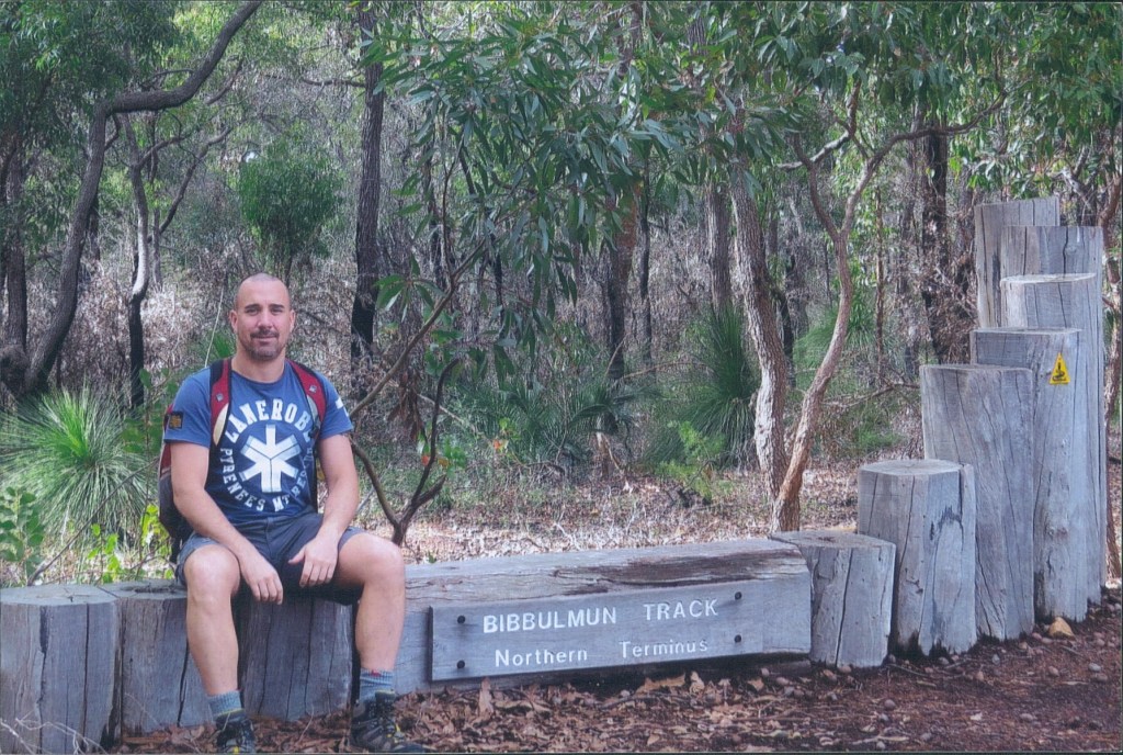
It was a partly cloudy 17C day when I set out for my first day on the Bibbulmun to get a feel for the track. I parked the car in Mundaring at the Perth Hills Centre and my partner Lorenz drove me to Kalamunda, a lovely town in the Perth Hills, and the Northern Terminus for the Bibbulmun Track.
I had walked the Bibbulmun out to the first campsite (Hewett’s Hill) and back with a friend a couple of years previously so I had vague memories of some of the walk ahead that day. After obligatory photos at the Northern Terminus I set off.
Preparation for walking involved buying the eight guide books for the track, each covering a section between Kalamunda and Albany. I didn’t buy the accompanying maps for the sections because of the associated extra cost. I hoped the guide books and the track markers would keep me on course.
The track starts out heading into a small patch of bush then surprisingly returns to a road, before once again heading into the bush proper. There were lovely stands of Parrot Bush flowering at the side of the track.
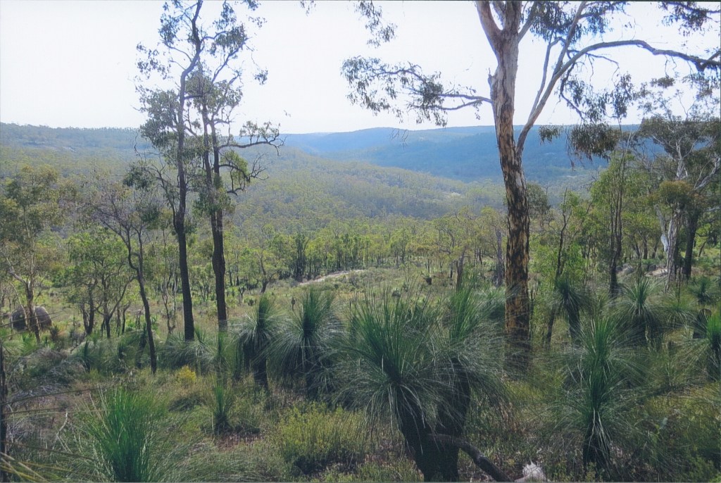
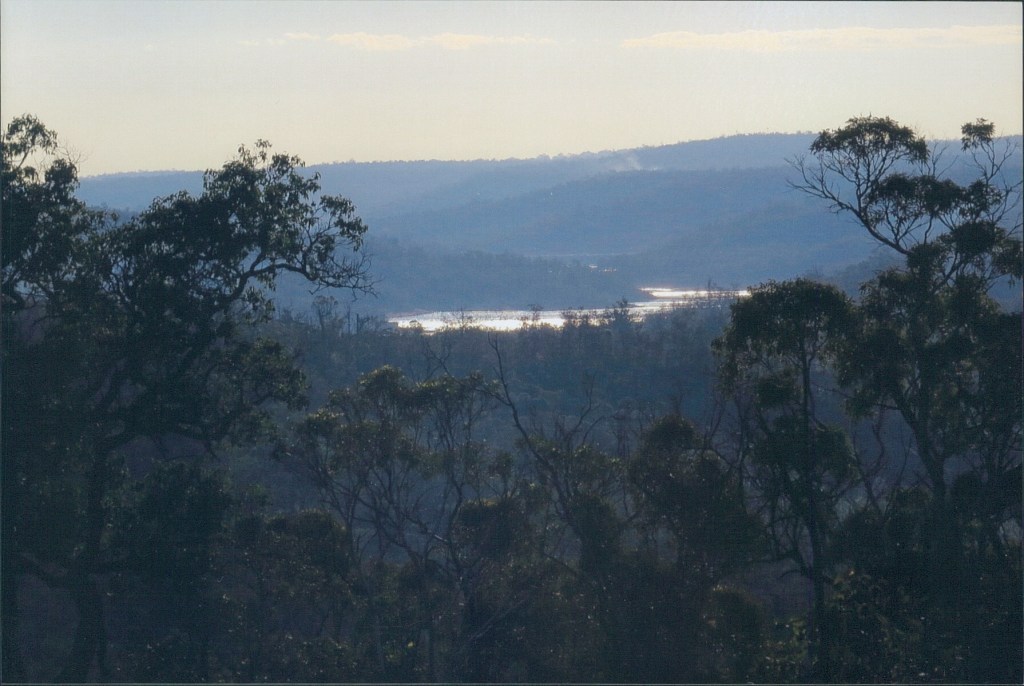
The track climbs through Jarrah Forest before coming out on a hill with spectacular views over Piesse Brook Valley and Kalamunda National Park, it is then a steep descent down into the valley.
The next ascent is through lovely Wandoo Woodland to the top of a gully.
As I left Kalamunda National Park and passed the junction with the Kalamunda Walk Trail I saw the first mammals on the walk grazing in nearby bush, a pair of Western Grey Kangaroos.

Despite it being late Autumn there were a number of plants flowering on the walk, with some of note being Dwarf She-oak, Pin Heath, and Common Pin Heath. It was also good to be able to refer to the guide book to identify some of the trees unfamiliar to me. This became one of the many joys of walking the track.
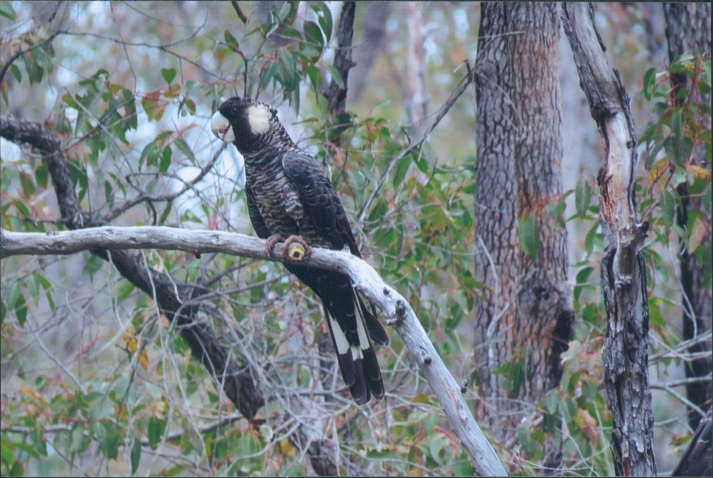
I passed the Calamunnda Camel Farm and then noticed my first birds on the track. There were Red-tailed Black Cockatoos feeding on Marri nuts, then more excitingly I came across a Western Spinebill feeding in Parrot Bush. I took this as a good omen for the walk as one of the reasons for doing the walk was to increase my chances of photographing wildlife, this bird being one of my targets.
I took the opportunity when passing Hewett’s Hill Campsite to take a break and enjoy fruit and a Cote d’Or Bouchee chocolate, snacks that were to become a regular feature of future walks on the Bibbulmun.
The walk then follows an old vehicle track on the Southern rim of the Helena Valley with extensive views North and before long the Mundaring Weir Wall comes into sight.
The track then descends and crosses the Mundaring Weir Wall
coming out in the visitor area on the North side of the weir wall. Here I got hopelessly lost and quite frustrated trying reconcile the directions in the guide book with what was in front of me. This was a to become a familiar problem when walking through track towns!
Once I had regained the track I ascended up to the Perth Hills National Parks Centre where my car was parked and as a last treat for the day there was a beautiful Pin Cushion Hakea flowering near the car park.
Day 2 and 3. Mundaring to Brookton Highway 18th 19th June 2016 – 51.6kms
Six weeks later I was back on the track. This walk was going to be my first overnight on the track because of the lack of vehicle access between Mundaring and Brookton Highway.
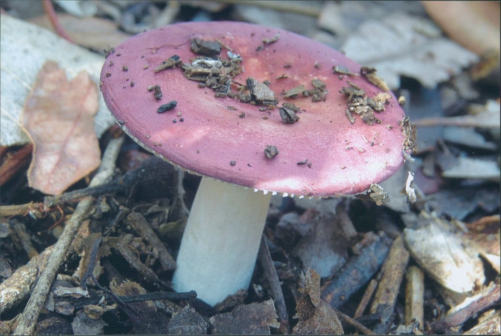
The first part of the walk was to Ball Creek Campsite 3kms away. It was a cold morning but the sun was shining. An immediate difference from the previous walk in May was increased Fungi in the bush.
After Ball Creek Campsite I passed through Mann’s Gully, a noticeably damper area than the surrounding woodland, with both Ferns and Yarri prevalent also there was water in the creek itself when I passed through.
Despite being so early in the season there were wildflowers starting to appear. Hibbertia was already prolific in places and both Hairy Jug Flower and Prickly Hovea were also flowering.
Helena Campsite was set into a steep hillside with magnificent views. It was a beautiful winter sky, there was no wind, and fluffy white clouds stretched to the horizon, appearing to decrease in size as they did so. It was so peaceful. While I drank a much needed cup of tea, a Scarlet Robin considered me from a nearby tree.
The next leg of the walk was one I will remember for some big hills. Leaving Helena Campsite, the track descends the side of Chinaman Gully. It then crosses the gully and ascends steeply, a hill etched into my memory. Descending I then crossed the Helena River before a further steep ascent through Wandoo and Powderbark Woodland.
I passed numerous other walkers on this section of the track and it was clear that if I was to stay at Waalegh Campsite that night I was going to have lots of company, so I made the decision to push on past dark to Beraking Campsite.
Prior to passing Waalegh there were amazing views West over Lake C. Y. O’Connor as far as the Mundaring Weir Wall. Despite the pressing need to push on with daylight coming to a close, I stopped to appreciate the glint of late afternoon sun off the water for a while.
The day had one last delight in store before sunset when I disturbed a Red-capped Parrot and it flew into a nearby tree enabling good views. As the sun set below the horizon I traversed a rocky outcrop and joined an old vehicle track.
This vehicle track was my companion as I walked through the dark. This was not as scary as I thought it would be because the Waugal markers are extremely reflective and are therefore easy to follow at night. The track was mostly level and straight and the only thing I remember is there being large numbers of Parrot Bush lining the track.
When I eventually reached Beraking Campsite the sole occupant of the hut was asleep so I quietly unpacked my things and got into my sleeping bag. It was hard to drift off with so much adrenaline coursing through my body after the copious exercise of the day, but after much tossing and turning I eventually fell asleep.
The following morning when I talked to my sleeping companion from the previous night we laughed as we realised we had both been awake but not game to get up and disturb the other party during the night.
Beraking Campsite is in a fabulous location and there was mist in the valley as the sun rose. I ate breakfast, packed and then with an afternoon deadline at the Brookton Highway I set off for the day.
It was a cold misty morning as I descended Ruen Rd (the vehicle track I had been following the previous night.) There were high numbers of Western Brush Wallabies in the surrounding bush, these as usual were far to skittish to photograph. The track then crossed the Darkan River passing large numbers of pine plantations with steep ascents.
Approaching Mt Dale there were good stands of both Grass Trees (Xanthorhoea preissii and Kingia australis) and good numbers of flowers present with all of Candle Cranberry, Prickly Bitterpea, Kangaroo Thorn Dryandra, Kick Bush and Scented Banjine present.
The imposing form of Mt Dale loomed overhead as I skirted the base of the mountain and descended to Mt Dale Campsite for a well-earned cup of tea and rest.
The last part of the walk to the Brookton Highway was my least favourite part of the Bibbulmun to this point. It was a low lying part of the track with no views and nothing flowering at the time of year I passed, there was evidence of fires in parts and no doubt the dark low cloud threatening rain didn’t do anything to improve the experience.
I did however delight in coming across flowering Swamp Banksia and a rather colourful Fungus just before Brookton Campsite.
Day 4. Brookton Highway to Sullivan Rock 2nd July 2016 – 32.3kms
The Bibbulmun Track had its claws firmly into me by now and it was a mere two weeks before I was back on the track for the day walk from Brookton Highway to Sullivan’s Rock.
The beginning of the day was uninspiring as I passed through more bushfire affected terrain for a good number of kilometres. The first highlight on a day of many highlights was Abyssinia Rock, a large granite outcrop with lots of Red Ink Sundews.
The next highlight was the Swampy Flats (dry at this time) with impressive Swamp Banksia and Swamp Paperbark before Canning Campsite.
After a short break and refreshed with tea and Bouchee chocolate I continued walking and noticed the forest looking much healthier than previously. There were Red-tailed black Cockatoos in the tree tops and healthy specimens of Snottygobble in the understory.
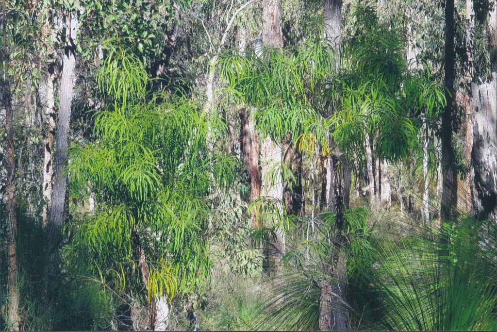
I was charmed to next walk through my first (small) patch of Virgin Jarrah Forest with impressive giant trees towering above. I truly had no idea that this is how Jarrah Forest looked prior to European settlement. Breathtaking! There was not only Virgin Jarrah but also huge Marri in this unlogged section and descending gently I passed good stands of She-oak.
I lunched on a granite outcrop just next to the Canning River before ascending to Monadnocks Campsite. I brewed up and chatted to two fellow walkers staying the night before heading off for the last part of the walk and another highlight, the first peaks of Monadnocks Conservation Park.
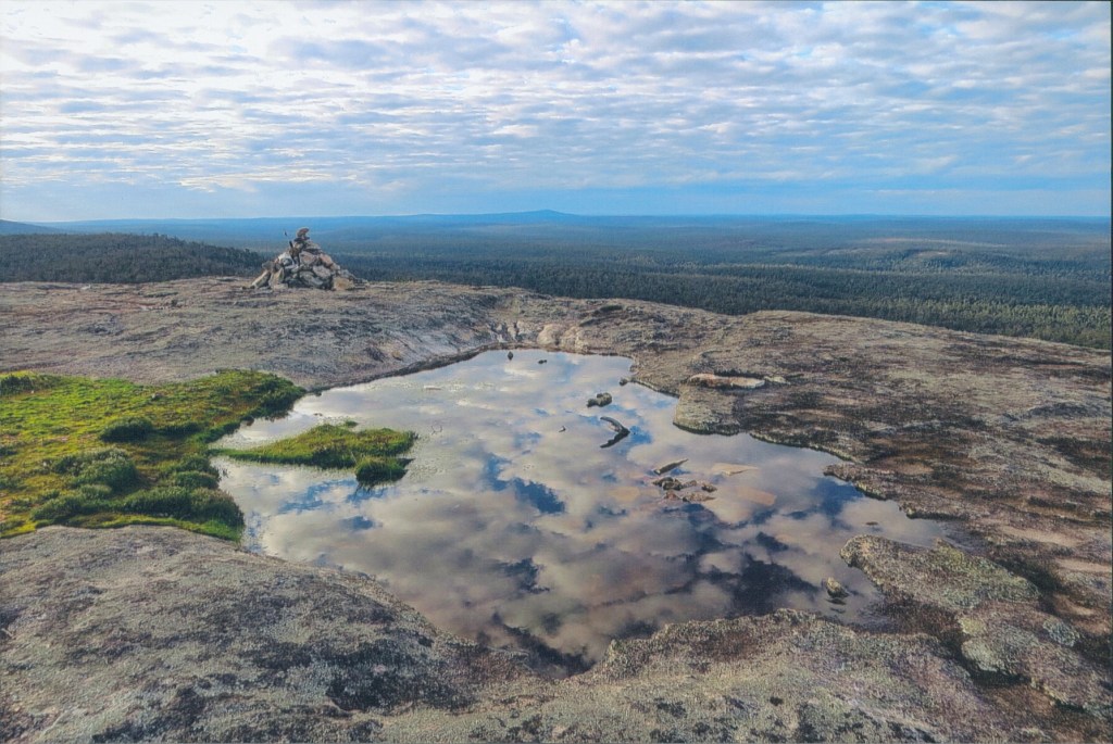
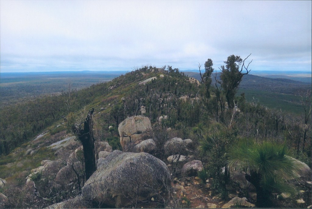
The track from Monadnocks Campsite passes through a lovely grove of She-Oak before reaching the start of the ascent of Mt Cuthbert and a fantastic stand of Darling Ghost Gum. At the summit views are superlative with the other peaks of the Darling Range clearly visible including Mt Vincent, Mt Cooke and looking North Mt Dale. As I traversed the summit there were freshwater pools in the granite reflecting the cloudy sky.
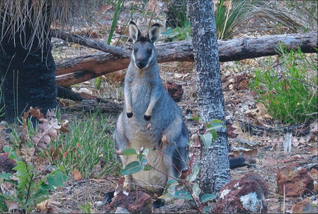
Descending Mt Cuthbert there are views South to Mt Vincent and further South to Mt Cooke. I crossed the saddle between Mounts Cuthbert and Vincent and disturbed a Brush Wallaby that as usual fled into the bush before I could reach for my camera. Then when I came across a second Brush Wallaby this one did not flee.
I had been trying for years to get a decent photo of a Brush Wallaby, without success, and I couldn’t believe my luck as I was able to take picture after picture of this normally shy species at close range. It was moments like these that made walking the Bibbulmun such a special experience.
After the final ascent of Mt Vincent the sky put on a spectacular show as it was illuminated by the setting sun. Mt Vincent also had impressive views from the peak.
It was almost dark when I reached Sullivan Rock Car Park on the Albany Highway the rendez-vouz point for my lift home. As I waited for my lift I pondered what a fantastic day it had been, a day full of highlights and
Day 5. Sullivan Rock to Albany Hwy 28th Aug 2016 – 39.45km
My next day on the track was a cold winter day in late August. I first climbed Sullivan’s Rock to connect with the track before heading South in the direction of Mt Cooke. This part of the track leading up to Mt Cooke was flat and the creeks were in full flow after the recent Winter rains.
These same rains had kick started the wildflower season. Around Mt Cooke Campsite was a Fuchsia Grevillea with its distinctive bright red flowers.
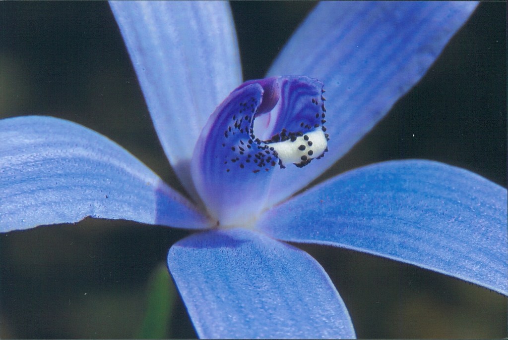
Ascending Mt Cooke I found my first Orchids of the season as the track passed around the natural amphitheatre lined with Darling Range Ghost Gum. These were Donkey Orchids, sheltering in the undergrowth next to the path, where they had access to light. Further along the track I passed White Myrtle and a zany, luminous green Drosera species!
Climbing Mt Cooke, it was necessary to take frequent breathers. When I did so I turned around to appreciate the great views of Mounts Vincent and Cuthbert to the North.
Reaching the summit of the mountain I was on the highest part of the Bibbulmun indeed the highest point of the Darling Range at 582m above sea level.
Flowering on the summit I came across my second Orchid of the season a Blue Beard Orchid, also there was Running Postman flowering.
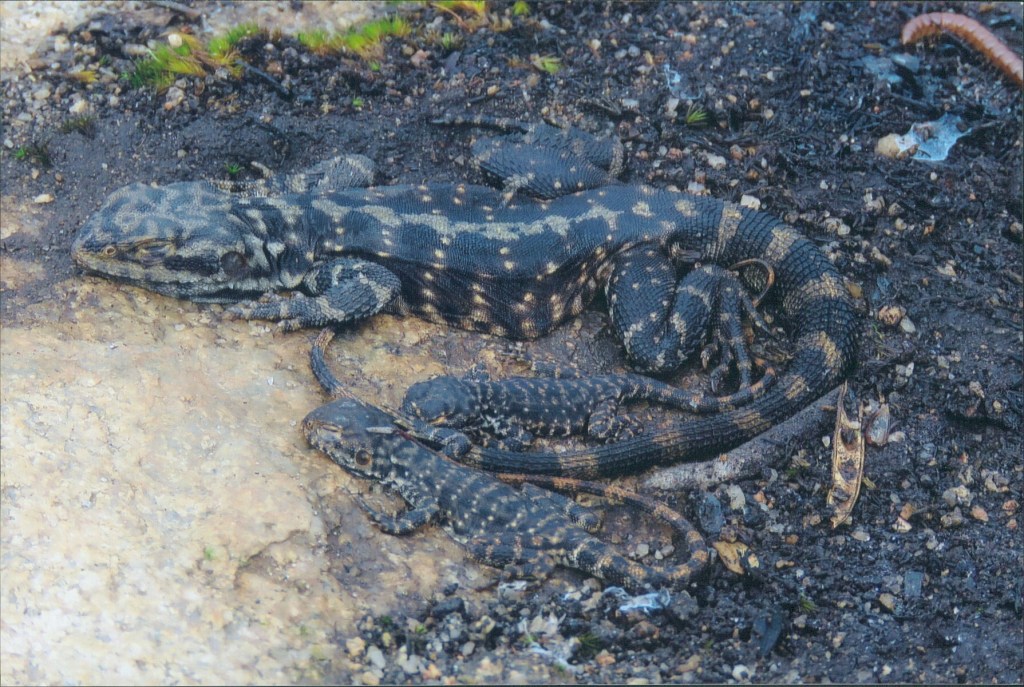
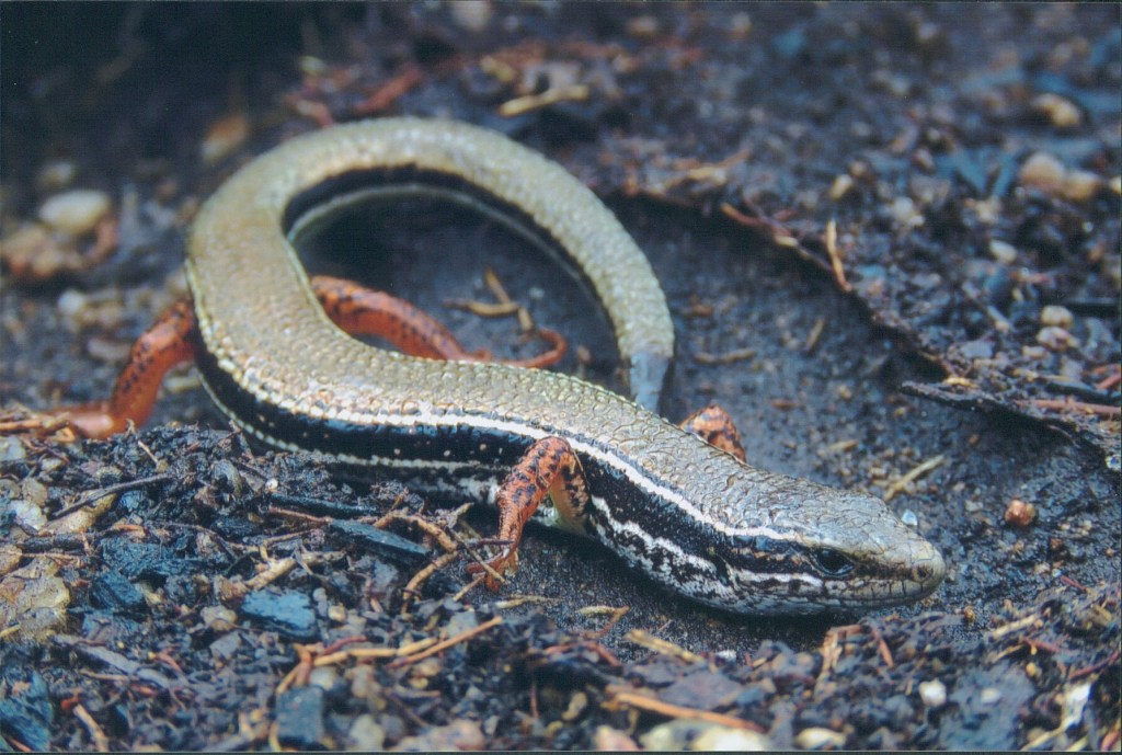
Old habits die hard and I couldn’t resist having a look for reptiles while I was in this great herping spot. A very successful herp it was with the below species found in quick succession beneath the many rocks at the summit.

I took particular care descending Mt Cooke as all the recent rain had made the granite surfaces of the rock ominously black and therefore slippery.
Pink Fairy Orchids were flowering on the last part of the descent of Mt Cooke into the woodland, but unfortunately after that the track took a turn for the worse once I had passed the power lines.
Once again a large area of the bush had been blackened by fire. It is such a terribly sad thing to walk through fire affected bush, and it doesn’t matter whether the fire was started deliberately, by lightening, or back burning, the end result is the same.
I was glad to reach Nerang Campsite where the bush was once again unburnt. After lunch and a lovely warm cuppa tea I continued on. Walking this part of the track I disturbed both Carnaby’s Cockatoos and Red-capped Parrots that were feeding on Marri seeds on the forest floor.
See also my post South West Reptiles – Western Australia – Devils and Dragons
The sky had been dark all day so it was no surprise when the heavens opened and the first of many heavy showers that were to be a regular feature of the afternoon came down. Not even the lovely Blue Squill flowers, that were everywhere, could cheer me up as I trudged along with water running down my neck.
I finally passed Gringer Creek Campsite. I usually like to check out the huts I pass but today there was only one thing on my mind, a hot shower! There was a group of people at the campsite with savage dogs caged in the back of a truck, I only hoped they hadn’t been hunting.
Approaching Albany Highway, I disturbed a couple of Brush Wallabies and as the roar of passing cars increased so did my step until finally I crossed the highway and reached my car. This was a journey where I was going to make the most of the heating and heated seats back to Perth!
Day 6 and 7. Albany Hwy to Dwellingup 10th 11th Sept 2016 – 66.3kms
Two weeks later I was back at the same car park on Albany Highway, just before North Bannister, to start the next leg of my Bibbulmun adventure.
My spirits were high and the sun was out as I walked down the vehicle track to Boonerring Hill, I passed a blue gum plantation and disturbed a mob of Kangaroos as I did. Rose Coneflowers lit up the bush with their pink flowers. At the broad rocky outcrop just before Boonerring Hill there were Ornate Crevice Dragons soaking up the morning sun and Silky Blue Orchids dotted the ground as I started my ascent.
The climb was a hard one with the big pack on my back but the view of the dome of Boonerring Hill from the saddle was worth all the hard work. The whole saddle was covered in flowering Parrot Bush and the calls of Western Wattlebirds filled the air.
The track skirts the dome of Boonerring Hill but I couldn’t resist making the climb up the spur to the top to check out the views, which were indeed worth the climb.
Back on the main track I saw my second Western Spinebill, despite great views of the bird I was once again unable to get the photo I so desired!
I descended to White Horse Hills Campsite where I had morning tea and company in the form of both an enthusiastic group of young walkers from Scotch College heading to Mt Wells, and the many mosquitos that were around the hut after the winter rains.
Climbing White Horse Hills through the jumbled boulders there were both Silky Blue and Donkey Orchids in good numbers as well as one of my favourite plants, Coral Vine.

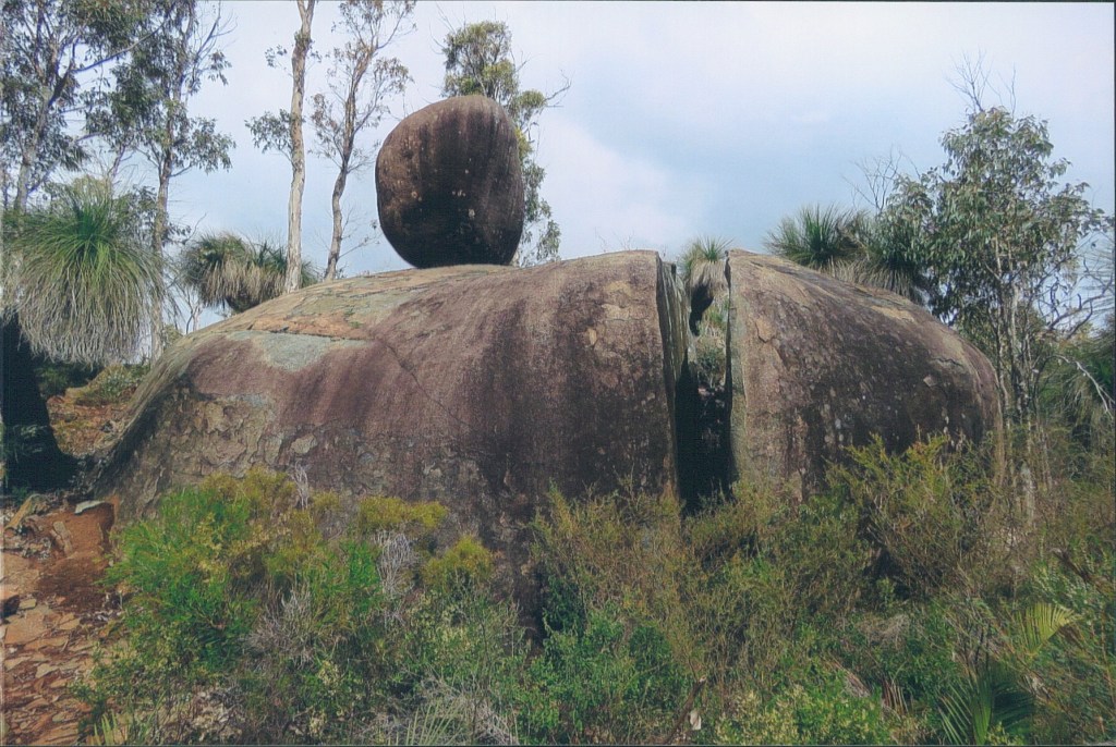
Further up the track I passed the balancing boulder on the split rock.
There were numerous Ornate Crevice Dragons active on the exposed granite and Napoleon Skinks were also around, soaking up the little sunshine there now was.
I planned to eat lunch enjoying the views from the peak of White Horse Hills but there were cold winds blowing across the exposed peak, and in the distance, I could make out heavy showers. It was not a day to linger.
I was lucky not to have a soaking as I managed to dodge showers walking the flat terrain of the South Dandalup River Valley, but my luck could not last. I passed the old concrete water tank, and as expected, I got caught in the first of many heavy showers. I still had a few hours of daylight, so I sheltered under the slanting trunks of large trees to avoid the worst of the rain, before I made the last push for Mt Wells, between the showers.
The afternoon’s walking could best be described as miserable but I did pass my first Cowslip Orchids of the season before the long hard ascent of Mt Wells.
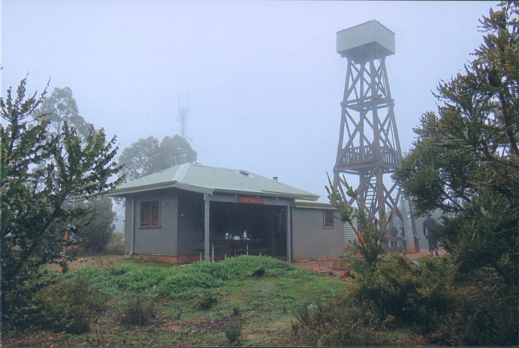
When I reached the hut, which was cloaked in low cloud, there was more bad news, the hut was packed to the rafters with other hikers.
Providentially, the Scotch College group were tenting it, but even then, as last in for the night I was on the cold concrete floor of the hut.
Sleep did not come easy that night especially as there were a number of snorers present (possibly including me during the brief sleep I had!)
Never have I been so glad to see daylight even if it was as miserable as the previous afternoon. Breakfast was a brief affair then I set off to cover the many kilometres to Dwellingup.
I descended Mt Wells and the Jarrah Forest was very still in the cold morning, other than a mob of Kangaroos. I had walked for about 90 minutes before I came across an old water tank. I was only thinking that I had I seen one very similar the previous day when it dawned upon me….
When I had neared the Mt Wells hut the previous night, in my mind I had seen the track continue, so when I started walking I headed back to where I had arrived the previous afternoon. The low cloud blocked out any sun so I was not able to orientate that way, and I can only think that exhaustion of the previous days walking coupled with lack of sleep played a part also, but I walked down the same track I had walked up the previous afternoon!
It didn’t help that there were no obvious features in the Jarrah Forest until I reached the water tank and the truth dawned on me.
I accept full responsibility for my mistake. However, I wrote to the Bibbulmun Foundation later that week to suggest that the first track markers either side of a campsite be marked N and S. This cheap solution would avoid what is commonly referred to by the foundation as a walker becoming “geographically embarrassed” leaving campsites. A great idea I thought.
Anyway there was nothing to do but turn around and head back the way I had come. I did briefly consider returning to the Albany Highway, but decided against it.
I was not pleased to ascend Mt Wells a second time and I was lucky I had set off so early because by now I had been walking three hours to get back to where I started at Mt Wells Hut.
I descended Mt Wells on the correct path the second time and was delighted with the bright white of Clematis (old man’s beard) cheering up the dull morning. Pink Fairy Orchids and Tree Hovea were other flowers I passed. The walk to Chadoora Campsite was flat and one by one I passed my companions from the previous night, before a much needed break at the campsite.
After Chadoora I was pleased the terrain remained flat as I was exhausted and blisters were causing pain with every step. The kilometres dropped away with not much to note until I passed the Hotham Valley Tourist Train, a reminder that civilisation was nearby.

I passed the Old Holyoake Township, destroyed in the 1961 Dwellingup fires, and reflected not for the first time how the Bibbulmun had connected me with the history of WA.
The last part of walk into Dwellingup took me past the timber mill and straight to the Blue Wren Café where I took no time in demolishing one of their delicious pies before my lift back to Perth.
I had covered some serious kilometres over the previous weekend including the 15.4kms spent going the wrong way, in fact a total of 81.7kms, a feat I hoped would never be repeated during my remaining time on the track. Continued in Part 2 – Dwellingup – Collie – Balingup – Donnelly River – Pythons and Scarecrows (274.3kms)
#QuollingAround

2 thoughts on “Bibbulmun Track Part 1 – Kalamunda – Darling Scarp – Dwellingup – Reptiles and Jarrah (211.1kms)”