
Arrernte Country
This three part blog is an account of thirteen days walking the 223 kilometre Larapinta Trail. It is split into a day by day account of the trek, and on each day I have added a short account of one aspect of the logistics of walking the trail for those planning to walk. I hope you enjoy reading about the trail as much as I enjoyed walking it…..
Continued from Part 1 :- The Larapinta Trail – Part 1 – Alice Springs to Brinkley Bluff.
Day 5 – Brinkley Bluff to Hugh Gorge – 22.9kms
The breeze on Brinkley Bluff had been relatively calm as I rugged up in the sleeping bag for the night, by 1am it had somewhat picked up, enough to briefly wake me. By dawn, it was strong enough for the lantern hanging from the tent roof to be swinging around like it was madly possessed.
Laying in the darkness I pondered how best to strike the tent without it being blown off the mountain. This feat was achieved with the use of a few well-placed rocks to hold the tent material down, while I did my utmost to cram it quickly in the backpack. Proper packing would have to wait until later in the morning at the next hut.
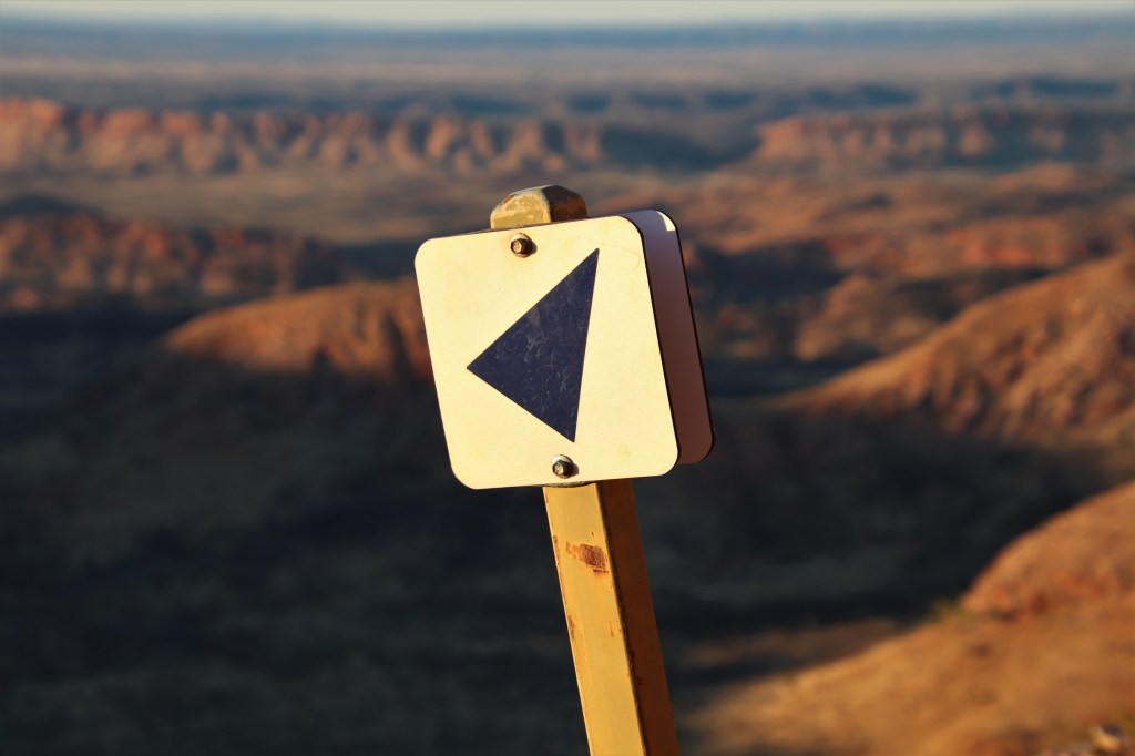
Day five was the day I was going to pay the price for an easy day four. Wrapped in layers I watched the sun climb over the eastern horizon. Breakfast would also have to wait until later that morning after the long descent from Brinkley Bluff.
Larapinta Trail Marker on the descent from Brinkley Bluff.
I punched out the eight kilometres to the hut at the Section 4/5 Junction in just two hours, helped by the flat terrain following the steep descent off Brinkley Bluff. The track at this early hour was pleasantly shaded in the shadow of the immense mountain.
At the hut at Section 4/5 Junction I ate a quick breakfast while rearranging the pack for the day ahead. Within thirty minutes I was back walking, without the time to check out nearby Birthday Waterhole. Time was no friend today.
Shortly after leaving the hut as the morning began to warm, there was a climb over a small saddle before the track descended to Spencer Gorge. Negotiation of the stony floor of Spencer Gorge required focus.
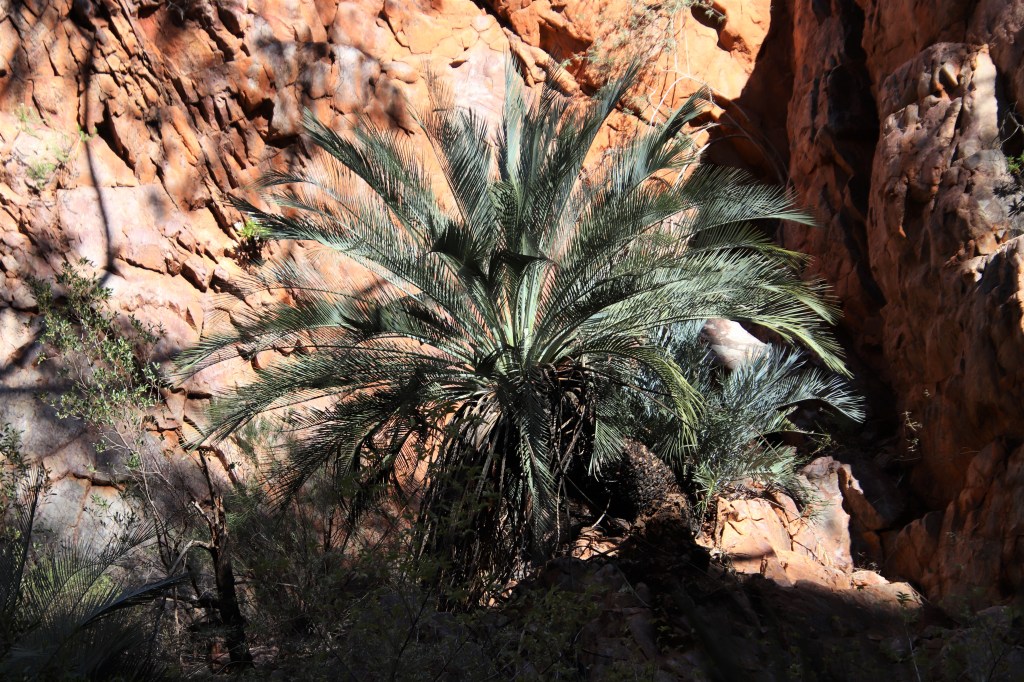
I regularly stopped to check out the beautiful surroundings of the gorge. There was an abundance of plants in the cool and shady confines, including the endemic and prehistoric looking MacDonnell Ranges Cycads. Birdsong echoed through the landscape and one bird in particular looked familiar. It was a Black-chinned Honeyeater almost identical to one of my favourite birds from Southwest Australia the White-naped Honeyeater.
MacDonnell Range Cycad (Macrozamia macdonnellii,) within the confines of Spencer Gorge.
The trail was hard going as it traversed the rocky floor of Spencer Gorge. It was necessary to regularly haul both the myself and pack over huge boulders. This however, was nothing compared to what was to come as the trail swung west to ascend a steep gully.
It was late morning and the small gully was in full sun with very little, if any shade, and it was steep, very steep. I slogged ever upwards, hot and truly bothered. It was requisite every few minutes to stop and catch my breath and I was getting nowhere fast. I found this short section the hardest of the entire Larapinta.
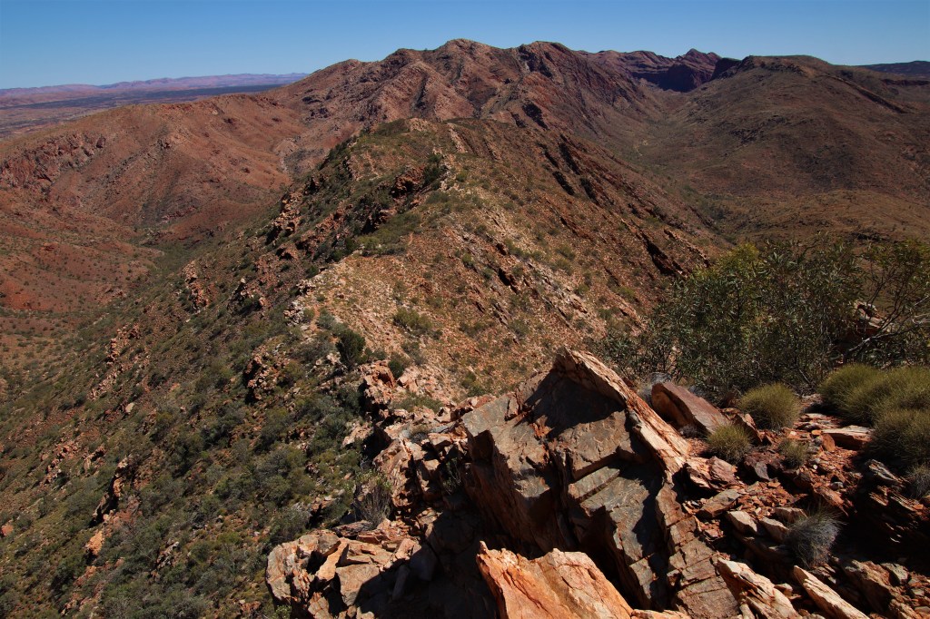
I was relieved to finally reach the dizzying heights of Windy Saddle and find a stiff breeze under which to cool down. Stretched out before me was one of the Larapinta Trail’s most famous icons, intimidating Razorback Ridge.
The initial descent onto the ridge was gnarly, a definite case of chose your own adventure. Then as the crest of the ridge widened the walking became easier. Traversing this high country in the middle of the day, as the sun beat down mercilessly from overhead with absolutely no shade anywhere was less than ideal.
Intimidating Razorback Ridge.
The trail descended from the ridge after a couple of kilometres, by which time I was frazzled. Time pressure had been on all day to reach Hugh Gorge Hut by nightfall. I desperately needed a break.
Fortunately, a few hundred metres south of the track at this point was Fringe Lily Pool. I stripped off and immersed myself in the frigid waters. It was just what was needed. As my core temperature plummeted I was able to focus on the remainder of the day
Refreshed, I tackled the 3.6 kilometres over Rocky Saddle to Hugh Gorge. I was too tired for the side trip to the pool, and sat in the shade of the River Red Gums dwarfed by the immense walls of Hugh Gorge. The gum trees harboured Budgies also seeking relief from the hot sun, their calls echoing up and down the dry creekbed.
I must have lay there an hour before I was ready to take on the challenge of the remaining walk, south through the confines of Hugh Gorge. The going was slow over the rocky habitat of the creekbed, and I relished any shade I could find. A Gilbert’s Water Dragon watched on pitifully as I stumbled by.
Eventually I reached the Hugh Gorge Shelter, to find it was the nicest hut on the trail thus far. The north facing outlook into Hugh Gorge and the Chewings Range was beautiful as the late afternoon shadows danced along the range.
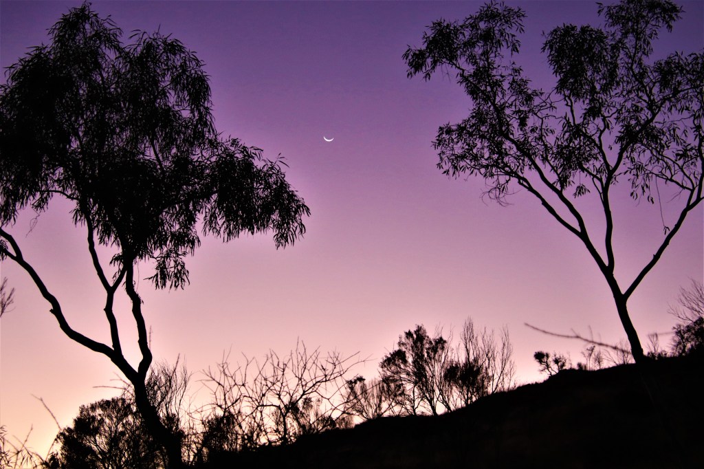
The evening remained warm long after the sun had set. When I finally summoned the strength to cook dinner, a crescent moon hung low in the sky amongst the eucalypts lining the hills around the shelter.
There were four people at the hut that night, while myself and Matty B put up our tents in the shelter, a mother and daughter from Tasmania camped nearby in one of the tent sites circling the hut. They were taking 35 days to walk the trail. I envied them.
Crescent moon hanging low in the sky as dusk envelopes Hugh Gorge.
What was the most and least useful equipment I carried on the Larapinta Trail?
Aside from essentials such as the tent and sleeping bag, it was the fly net that was the winner. The walk would have been unbearable at this time of year without it. Hut shoes are also a godsend at the end of a day!
I carried a pack of wet wipes, and while these are the devils spawn environmentally, they are bloody useful on a trail. Each night I cleaned the dust from my feet to keep the sleeping bag clean, and to save precious tank water used them for a bedbath. Wet wipes are also useful to clean the last remnants of food from crockery and cutlery.
The dumbest item I’m ashamed to say was a rubber mallet for tent pegs. I mean I was walking a rocky trail with millions of rocks, each perfectly capable of performing the task of hammering tent pegs into the ground, what was I thinking! At least when I told Emily from LTTS after being picked up from Mount Sonder it provided her with a good laugh.
Day 6 – Hugh Gorge to Ellery Creek South – 31.2kms
Each shelter contains an information board with a trail description and height profile for the section either side of that shelter. The profile for section six was flat, on the map it looked like a breeze compared to the dizzy high points of sections four and five. It wasn’t. This was my least favourite day walking the trail.
I started walking at 7.30am, reaching Ghost Gum Flat two hours later. There was a raised platform set amongst the Ironwoods, Ghost Gums and in the direct shade of a beautiful Corkwood. It was the best camping spot in all of section six, so I unpacked the jetboil and enjoyed a coffee at this lovely spot.
The trail was constantly ascending and descending over small hillocks for the duration of the morning. There were no views from these small hillocks and I couldn’t understand why the trail needed to go over the top of every one.
The campsite at Rocky Gully, approximately halfway to Ellery Creek, was 300m south of the trail down a sandy creek bed. It was hardly worth the effort to get there. It had no shelter, or even platforms and definitely no shade other than the pitiful shade provided by the water tank.
I loaded up on water, drinking 1.5 litres while I briefly rested. I was already feeling tired, so despite the hot conditions, I chose foolishly not to carry full capacity drinking water for the remainder of the day.
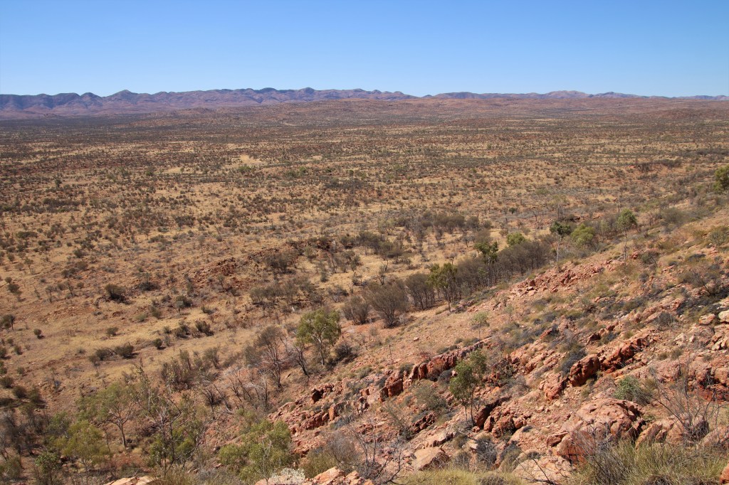
Another 300m back up the sandy creek bed, before the trail crested more hillocks. At least further west of Rocky Gully the landscape started to flatten. Once again, there was very little shade in the afternoon as the day reached the forecast high of 30C.
The seemingly flat terrain of Alice Valley from Hugh Gorge to Ellery Creek.
There are two campsites at Ellery Creek, positioned at either end of a deep swimming hole a mere few hundred metres apart. Ellery Creek North is 28.9kms from Hugh Gorge, while Ellery Creek South is 31.2kms from Hugh Gorge.
The food drop location is at Ellery Creek South, and so it was necessary to cover the extra 2.3kms. The 2.3kms included a steep climb over a saddle in the Heavitree Range, of which I hadn’t taken account of when filling up with water at Rocky Gully.
Summoning the remainder of my strength sitting in the shade of a large boulder, I chugged 500ml of water before pushing up and over the saddle in the Heavitree Range. Water was now down to a meagre 250ml, and while the trail was clear, I had left myself in a dangerous situation should a wrong turn be taken.
I was relieved when after cresting a large hill, the Ellery Creek South Campsite came into view. I committed to never get so low on water again. It was 2.30pm and I had covered 31.2kms in seven hours.
I hobbled down to the swimming hole and slumped on the sand in the shade of a tree. I must have looked forlorn because a guide from one of the Larapinta Trek Companies came over and asked did I want the leftovers from their picnic lunch?
I tried to look as casual as possible when I mentioned I could take it off their hands, trying to hide the saliva that had started to run from the corners of my mouth at the sight of vegetable wraps.
I was overheated from the days walking so to swim at this time would have been foolish and so I waited. When I finally entered the water, it was for approximately thirty seconds, it was freezing, I mean really freezing. Had it not been for the throng of tourists milling around, I would have let out a high-pitched scream. It hit the spot through, cooling me down instantly.
Afterwards, I picked up the supplies from the LTTS box drop then set up camp between the day-use area and dry creekbed. I was under the impression that there were camping fees at Ellery Creek, but when I asked a ranger he assured me that the camping fees didn’t apply to Larapinta walkers not utilising the official campsite.
https://northernterritory.com/alice-springs-and-surrounds/see-and-do/ellery-creek-big-hole
Ellery Big Hole.
Once the sun had set, swarms of mosquitoes appeared. This was one of only two places on the trail I encountered this problem, and I was thankful for the repellant I had packed.
I ate dinner at one of the day-use shelters in the company of a jolly bunch of seven walkers from Adelaide I dubbed the Adelaide Seven. The recent wine they had retrieved from the food drop no doubt contributed to their ebullience!
One of the walkers was kind enough to give a much appeciated lesson on star constellations. Despite spending so much time out bush after dark my knowledge of the night sky is somewhat lacking. As a result of this impromptu lesson I can now identify the constellations of Taurus and the Seven Sisters that sit next to Orion the Hunter in the cosmic chandelier.
Back at the tent away from the hungry mosquitoes, sleep came quickly to the sound of a pair of calling Boobook Owls in the River Red Gums above on what was another warm night.
How much water to carry on the Larapinta Trail?
The million dollar question, and probably the most important decision to make before setting out on the trail.
There are many things to consider. What is the longest distance between water tanks? What time of the day, and what time of year will you be walking? Will you be camping at the shelters next to water sources, or out on the highlights of the trail?
I myself carried 4.75 litres, spilt between two 2L platypus water bladders stored in the backpack and a 750ml pump bottle to hand, these were sufficient for my needs during September (provided I kept them topped up!)
I think the golden rule of water is to err on the side of caution, it’s a pretty shitty end dying of thirst thinking if only I’d carried that extra litre…..
Day 7 – Ellery Creek South to Serpentine Gorge – 12.3kms
I was on the trail before sunrise on day seven. This was both the shortest and easiest day on the Larapinta thus far, and was gratefully received after what had been two very tough days.
The trail started off winding over spinifex-covered hills before arriving at a trig point where there was phone reception. All of the Adelaide Seven from the previous night were on their phones, I was happy to leave mine off.
There is a short part of section seven that negotiates extremely sharp rocks. I sustained more boot damage on this section than at any other on the trail. It is wise to walk the Larapinta with new or reasonably new boots, the trail is rough in parts and to manage disintegrating boots on the walk would have been a real pain in the ass.
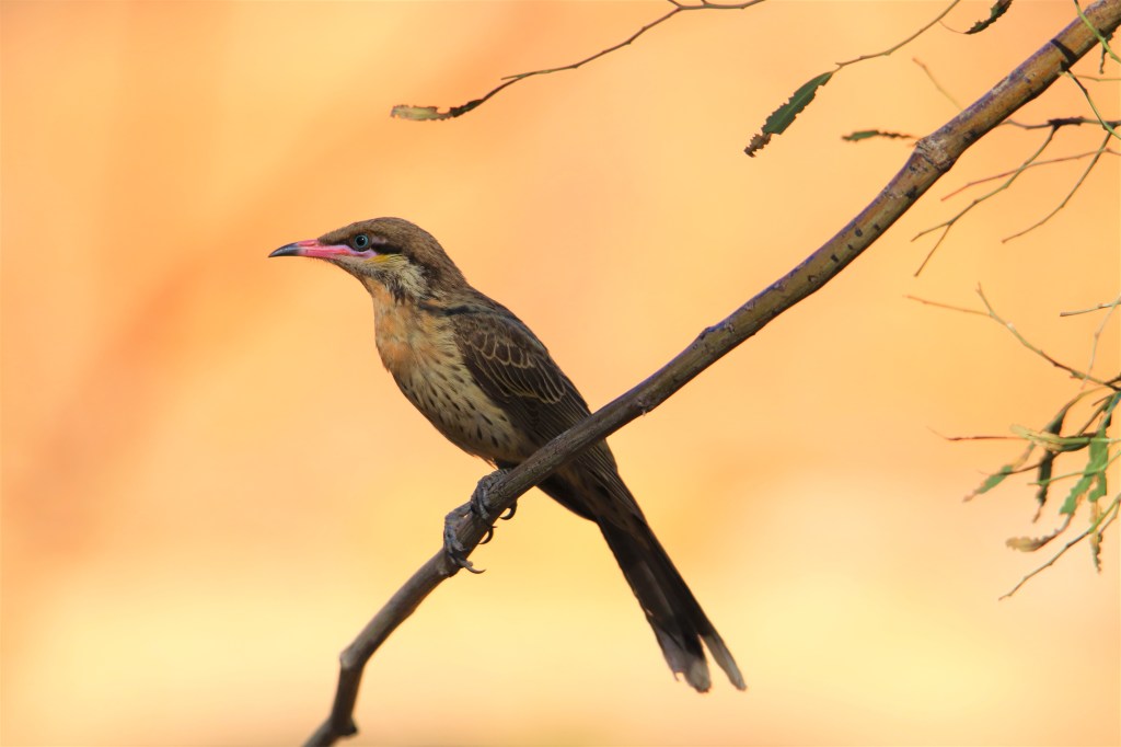
The last 2.6kms from West Junction to Serpentine Gorge Campsite was easy on this easiest of days. I reached Serpentine Gorge by 11am, the first walker to arrive. The hut was set in Riverine Woodland and the surrounding trees contained an abundance of birds, with Grey-headed and Spiny-cheeked Honeyeaters in profusion.
Spiny-cheeked Honeyeater.
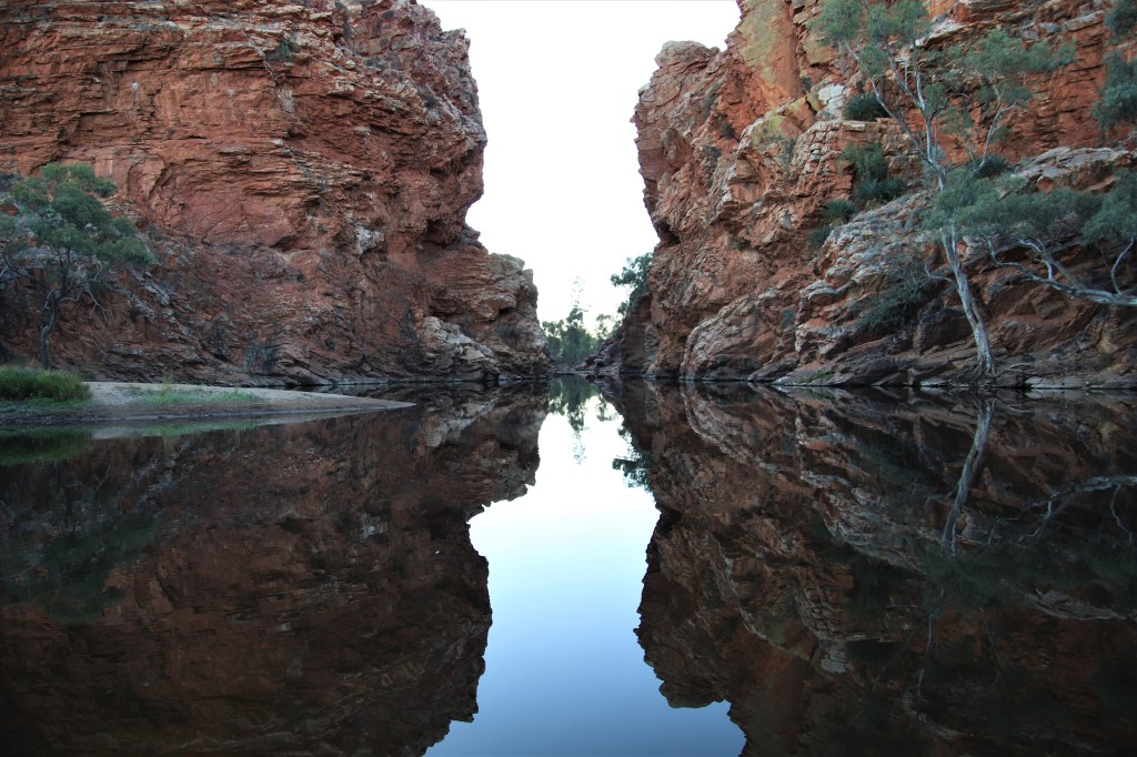
The day was already hot, and it was shrewd to visit the Serpentine Gorge Lookout before temperatures increased further. It was quite the ascent to a lookout via a series of switchbacks, but the view of this immense gorge from the viewing platform was worth the climb. The heat radiating off the rocks was intense and so I quickly retreated to the relative cool of the shelter, in time for the arrival of the other walkers.
Serpentine Gorge.

The Adelaide Seven had already arrived, and a little later Matty B took the number of walkers to nine, the highest number at any hut on the trail. Everyone stashed their gear and snoozed during the hot afternoon, but by night the hut was empty as everybody elected to enjoy the warm night in a tent.
The earlier internet access at Trig Point had proved useful, for it was discovered that temperatures were going to peak at a dangerous 35C over consecutive days later that week. Plans were hurredly discussed and rearranged in the light of this new information, with four of the Adelaide Seven calling off the trek there and then.
Late afternoon I escaped the heat, sitting in shade provided by the gorge walls, next to a permanent pool at the southern entrance to the gorge. It was well patronised by the local birds coming into to quench their thirst.
Dinner was a social affair at the hut before everyone retired to their tents. Another warm night on the trail had brought out a Gecko in close proximity to the tent. Falling asleep to the soft clicks of this nocturnal lizard calling was magical!
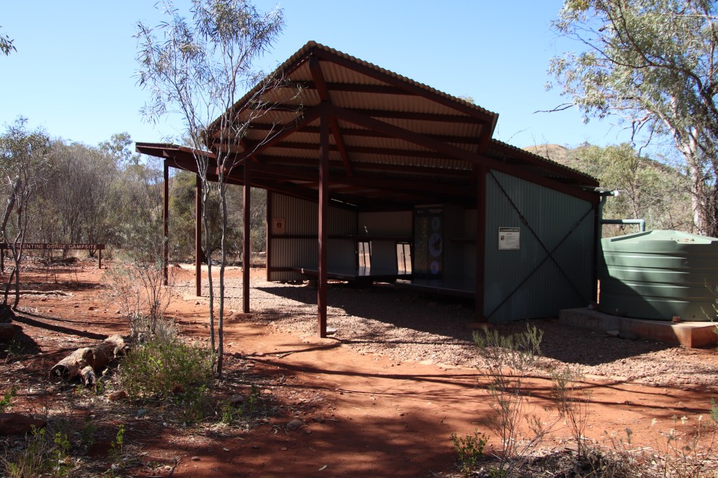
Larapinta Trail Shelters.
Not built for luxury, the shelters on the Larapinta Trail are however functional. They consist of two sleeping platforms that can each comfortably sleep four people. Shelving above sleeping platforms provides additonal space for gear.
Each shelter contains a cupboard (not particularly secure against mice,) and it is within these cupboards that the solar powered charging stations are found. Below the sleeping platforms in some huts, (but not the one pictured below,) are meshed drawers providing food storage away from rodents. Hanging food from sticks jammed between the rafter and corrugated roof of the huts is a good method to protect food from menacing rodents.
Some shelters contain a picnic table, most don’t. Every shelter however, does contain two water tanks. These are monitored remotely and there was always water available at every tank on the track.
Numerous tent sites surround each hut, and it was great to have the option to sleep in the open. Apart from the first few nights on the trail when temps were frigid, I removed the fly sheet so I could drift off under the moon and stars.
Typical Shelter at Serpentine Gorge.
Day 8 – Serpentine Gorge to Serpentine Chalet Dam – 13kms
It was a very early start for the Adelaide Seven that had become the much diminished Adelaide Three, who were on the track for 4.30am. They had a big day because they were striking out for Waterfall Gorge to try and knock out some kilometres before the heat kicked in later in the week.
I had a leisurely breakfast with the remaining four members of the Adelaide Seven who were being picked up from Serpentine Gorge Carpark later that morning.
Once the bag was packed I myself was on the track by 7.30am, because even though section eight was a relatively short walking day, the track in this section, contained one of the absolute highlights, Counts Point, and I wanted to be sure the sun was in a good position for photography.
The trail passes through Serpentine Gorge Carpark where there were a couple of informative boards, one of which explained the reason Serpentine Gorge is so special. The the pool of water at the south entrance to the gorge, where I had escaped the heat the previous afternoon, prevents predators such as Dingoes, Foxes and Cats accessing the gorge, making it the haven for wildlife it is.
Post carpark, the trail ascends a steep flank of the Heavitree Range all the way to the top, it was a hard climb but fortunately not too lengthy. Up on the ridge, the most difficult part of the day was behind and the walking easier.
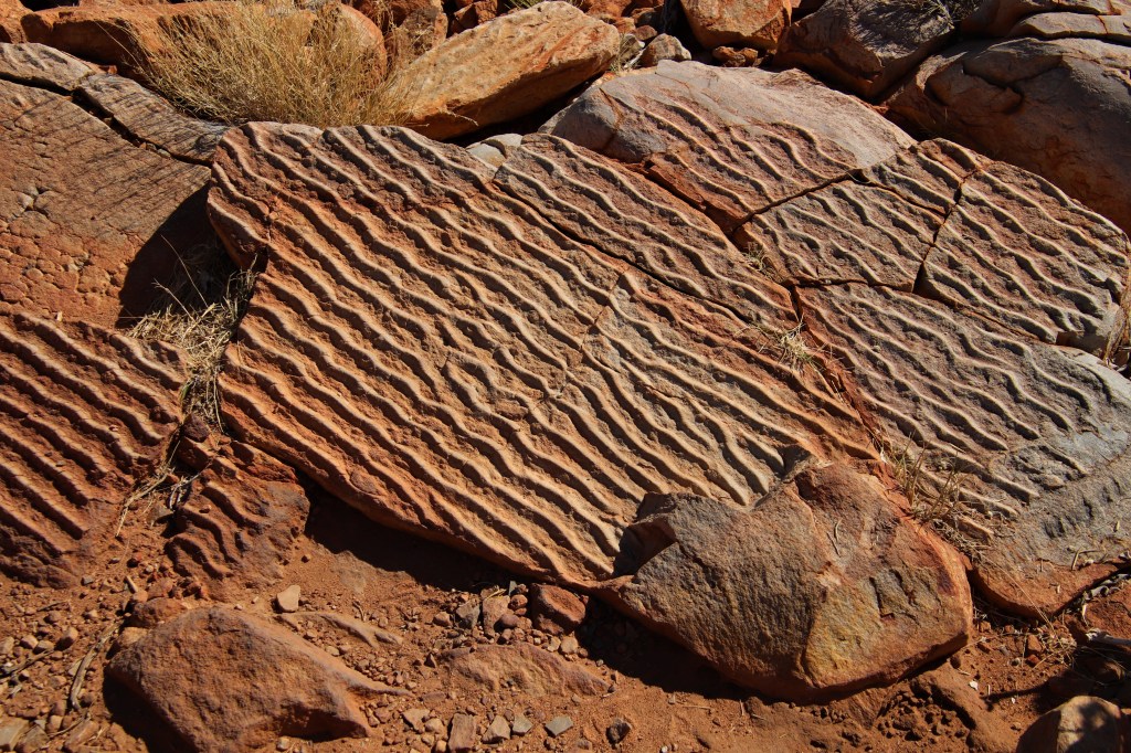
The trail was littered with rocks, some of which were quartzite outcrop indented with perfectly formed ripple marks. Evidence that this very rock high on a mountain range in the middle of Australia was once either in a river bed or or the tidal zone of a sea!
Ripple marks on Quartzite Rock indicates these rocks were once submerged.
After three and half kilometres of epic 360 views, the trail heads back down the south side of the range, but a spur track that heads directly west for 700m to Counts Point is not to be missed.
At 1140m this is one of the highest points on the Heavitree Range, and gracefully arching valleys spanned out across the desert towards the ultimate destination, for there through the heat haze four days walking hence, was a distant Mt Sonder, the western terminus of the Larapinta Trail. Matty B caught up with me at Counts Point, and I was glad for the company in which to appreciate this most remarkable of views.
The view was stunning, incredible, breathtaking and a whole lot of other adjectives. There was even a bench thoughtfully placed to enjoy the vistas.
Counts Point.
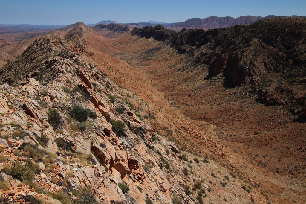
I stayed for an hour, lapping up possibly the best view on the entire Australian continent (big call!) I was two thirds through the trail, could it get any better? and yet it did.
Continued in Part 3 :- Larapinta Trail – Part 3 – Counts Point to Mount Sonder.
The Boring Stuff, Food and Gear on the Larapinta.
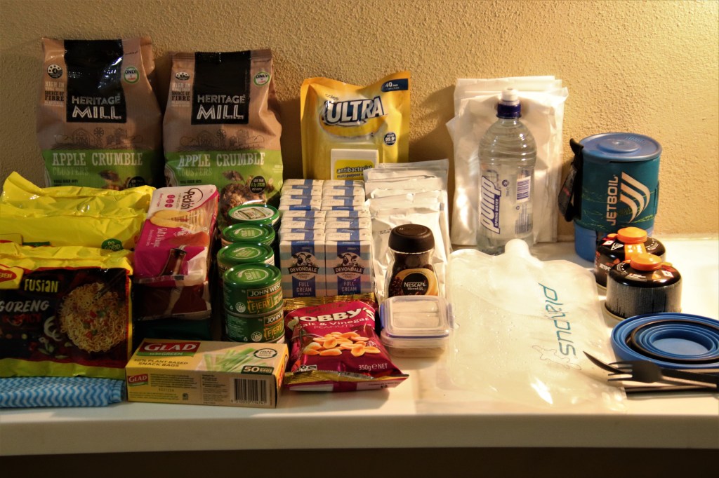
The Food
My diet on the Larapinta Trail can best be described as uncomplicated. Breakfast consisted of coffee and muesli with carton milk (I would have used powdered milk had it not been for the food drops.) Lunch was a packet soup or a handful of nuts. Dinner a can of tuna and a packet of noodles. It’s amazing now that noodles and tuna come in a variety of flavours how many different combinations are possible, I never tired of this evening meal.
The only treat I put in each drop box was a packet of rice crackers. Unsurprisingly I lost five kilos over the course of the trek and I was rarely if ever hungry. Trekking always underscores just how much food I consume in my daily life that I just don’t need. I guess the constant advertising does work?
I’m thinking of marketing this diet as the “Larapinta Diet.” Consume 1000 calories a day then burn 6000 calories walking over mountains for 13 days. Guaranteed weight loss, or your money back!!!!
The Gear
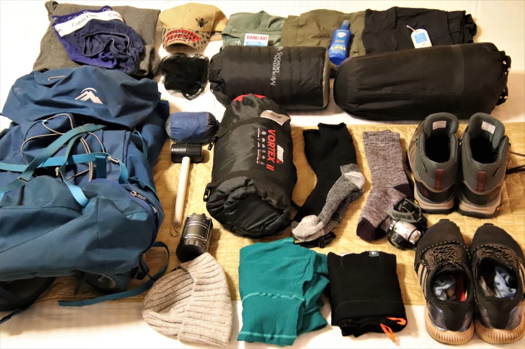
The photo below is fairly self-explanatory. I carried a 4kg Vortex II tent from Anaconda in place of my super lightweight 2kg hiking tent, the larger space allowed the pack to fit in the tent away from the rodents.
Because the tent was freestanding in the absence of other walkers I could erect it within the shelters. Alternatively when camping in the sites surrounding a shelter it could be relocated to find the most comfortable site, this was more than worth the extra 2kgs.
Air mattress, inflatable pillow, sleeping bag, repellant, sunscreen, water bladders, hut shoes, flynet, headtorch, lantern, bandaids, all essential. Walking in September there was a large tempertaure differental, and it was necessary to carry both cold and hot weather gear. The coldest night was 3C the hottest day 35C.
Gear for the Larapinta.
#QuollingAround

3 thoughts on “The Larapinta Trail – Part 2 – Brinkley Bluff to Counts Point.”